Suggested Searches

1 min read

Tropical Storm Earl

Instruments:
2004-08-15 00:00:00
August 15, 2004

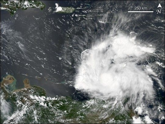
The MODIS instrument aboard NASA's Aqua satellite captured this true-color image of Tropical Storm Earl on August 15, 2004 at 17:50 UTC. At the time this image was taken Earl had maximum sustained winds of 45 mph with slightly higher gusts. Earl was moving towards the west at a brisk 28 mph. Soon after this image was acquired, Earl began dissipating and was declared a tropical wave on August 16 at 15:00 UTC.

References & Resources

Image courtesy Jesse Allen, NASA's Earth Observatory .

You may also be interested in:

Stay up-to-date with the latest content from NASA as we explore the universe and discover more about our home planet.

Imelda and Humberto Crowd the Atlantic
3 min read

The tropical cyclones are close enough in proximity that they may influence one another.

Article
Hurricane Erin Roils in the Atlantic
3 min read

The major hurricane steered clear of land but delivered tropical storm conditions to coastal areas along its path.

Article
Hail Scars Alberta Farmland
3 min read

A powerful supercell storm left a trail of damage spanning hundreds of kilometers southeast of Calgary, Canada.

Article