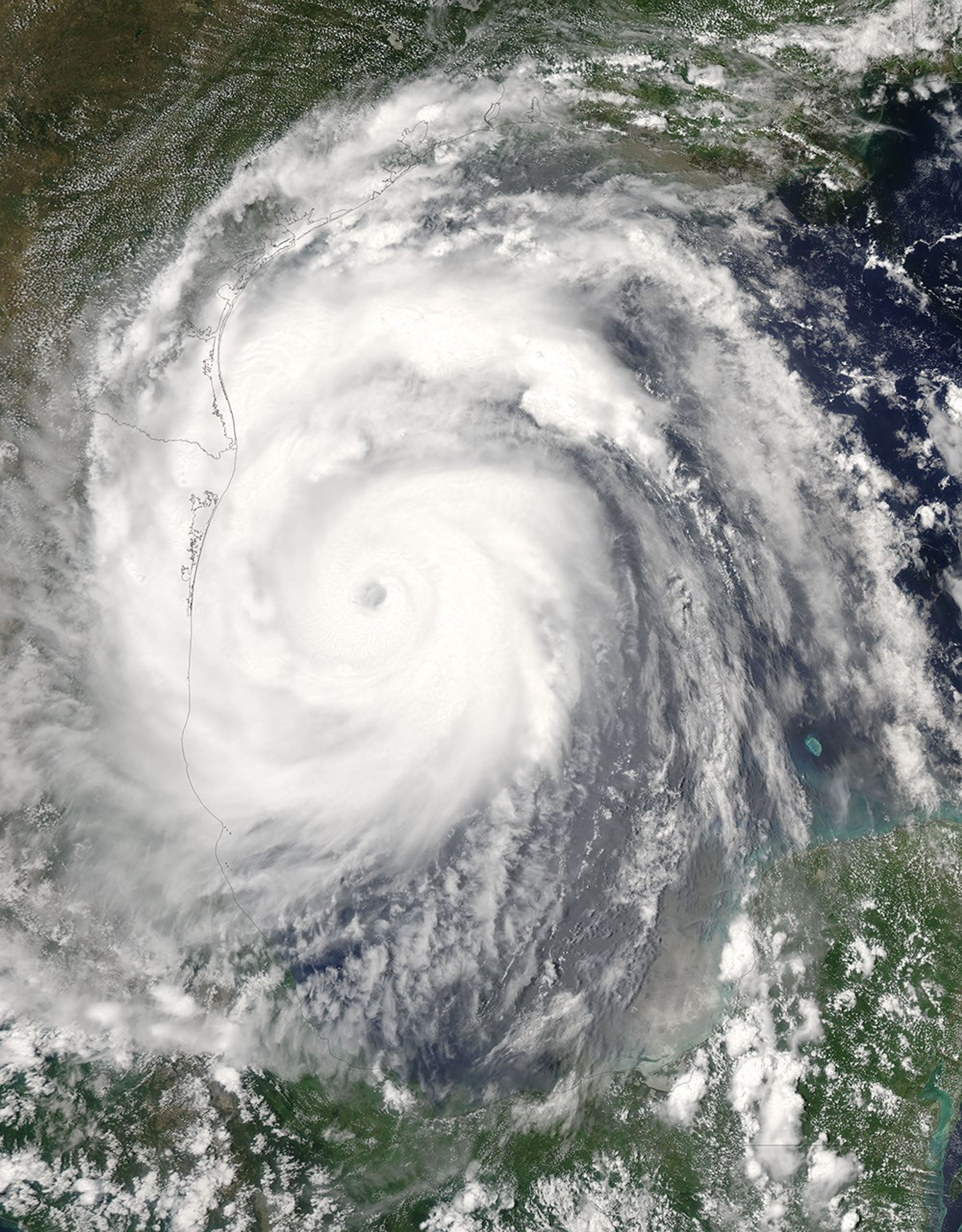

























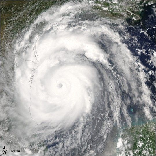
Hurricane Emily was re-intensifying over the Gulf of Mexico on July 19, 2005, when the Moderate Resolution Imaging Spectroradiometer (MODIS) on NASA’s Aqua satellite captured this image. The image shows the storm at 14:20 p.m. local time in Cancun, Mexico, roughly one day after Emily returned to open waters. At this time, the storm was a Category 1 storm with winds of 150 kilometers per hour (85 knots), slightly stronger than when it first moved off the Yucatan Peninsula the day before. It left a wide swath of damage behind it, but with no reported casualities attributed to the storm.
Emily is a record-setting storm for many reasons. When it formed on July 11, Emily became the earliest fifth named storm on record. As it moved through the Caribbean, Emily intensified into a powerful Category 4 storm with winds over 250 km/hr (150 mph) and gusts as high as 300 km/hr (184 mph), making it the most powerful storm to form before August. The previous record was set by Hurricane Dennis, which ripped through the Caribbean during the first week of July 2005. Emily’s Category 4 status also made 2005 the only year to produce two Category 4 storms before the end of July.
References & Resources
NASA image provided courtesy of Jeff Schmaltz, MODIS Rapid Response team.