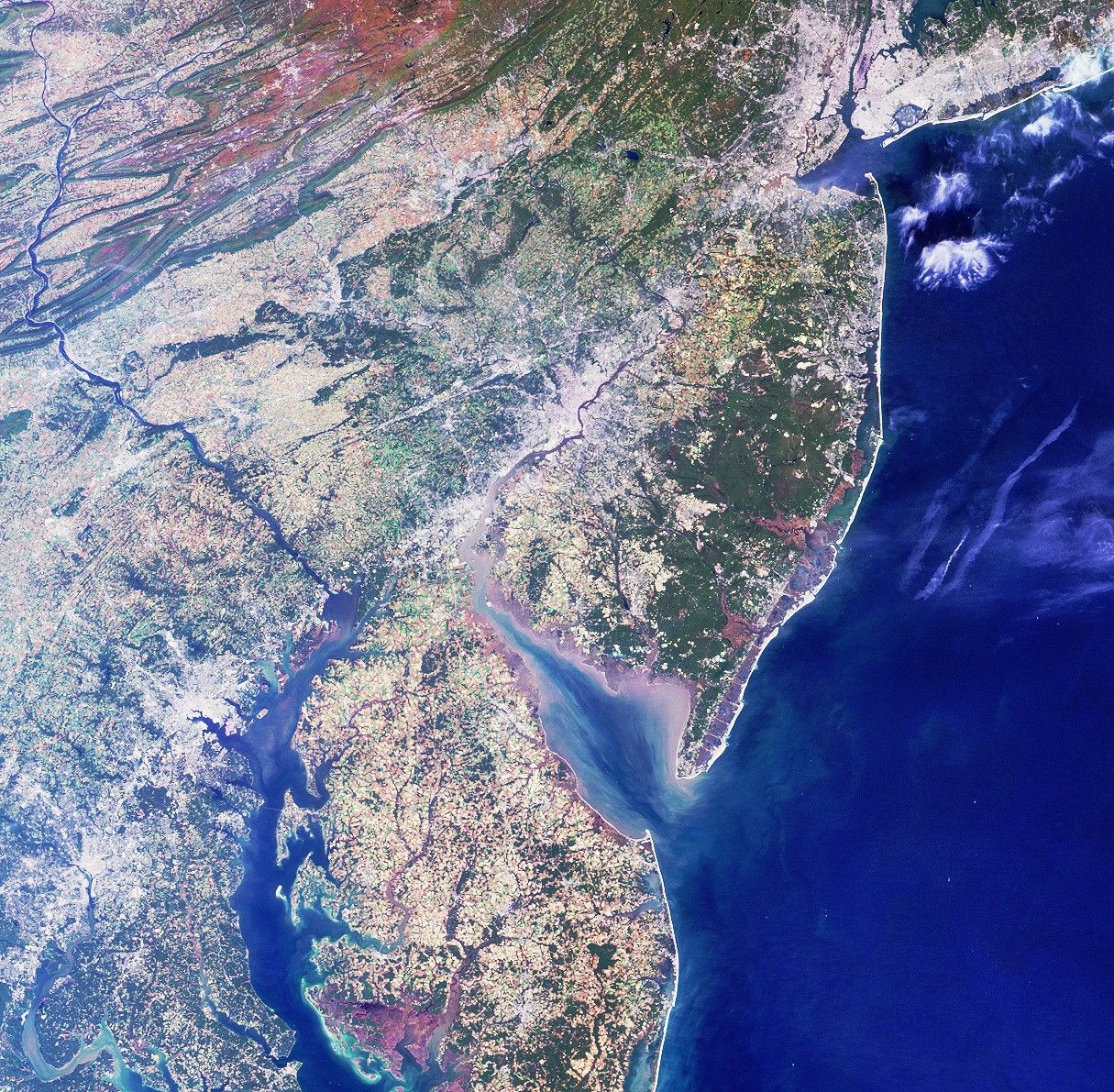
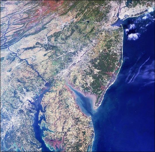
Philadelphia, where the Declaration of Independence was signed225 years ago on July 4, 1776, lies in the center of this imagefrom NASA's Multi-angle Imaging SpectroRadiometer (MISR). Thistrue-color view of the northeastern United States, taken from theinstrument's nadir, or downward-looking, camera includes afitting display of the reddish colors of soils, grayish-whites ofurban areas and clouds, and blue hues of water.
Larger cities, including New York, Newark, Philadelphia,Wilmington, Baltimore and Washington D.C., are visible from upperright to lower left. The bright sands of the New Jersey shorelineand a pattern of highly reflective roads and bridges extendnorthward along the coast from Delaware Bay. A popular touristdestination for those wanting to avoid the crowds and main roadsis the Coastal Heritage Trail, a 440-kilometer collection ofhistoric and other points of interest developed by the NationalPark Service and the state of New Jersey.
A portion of Pennsylvania's Appalachian Mountains are captured inthe upper left corner. The effects of folding and erosion onthese ancient, mostly sedimentary deposits are visible, and thereddish colors indicate ironstone and iron-rich sandstone. Thesoutheast-flowing Susquehanna River cuts transversely acrossthese folded formations toward the Chesapeake Bay in Havre deGrace, Maryland, where it provides 50 percent of all thefreshwater entering the great estuary. The waters of theSusquehanna originate at Otsego Lake in New York and meanderalong 700 kilometers until reaching Chesapeake Bay and the sea.
This image was acquired on October 11, 2000. It covers an area334 kilometers x 328 kilometers. North isat the top.
References & Resources
Image NASA/GSFC/LaRC/JPL, MISR Team.