Although the extraction of mineral wealth has been the major influence in thehistory of Johannesburg and the surrounding Witwatersrand regions (with about45% of all gold ever mined coming from there), the discovery of now-famoushominid fossils at the Sterkfontein Caves and the convening of theworld’s largest-ever conference on environment and development aresetting a new stage for the future. The United Nations began the secondDevelopment and Environment Conference in Johannesburg on August 26, 2002. Thismeeting addresses the implementation of international goals to fight poverty andprotect the global environment that were established at the first suchconference held in Rio de Janeiro in 1992. The Johannesburg summit involvesabout 40,000 participants and roughly 100 world leaders. One of severalofficial opening ceremonies for the conference was held at the SterkfonteinCaves to recognize the outstanding universal value of the paleo-anthropologicalfossils found there.
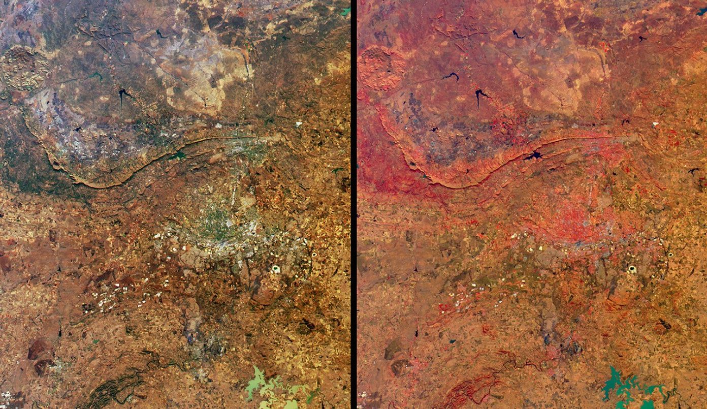
These views from the Multi-angle Imaging SpectroRadiometer (MISR) highlight anumber of the land use, vegetation, and geological features found within GautengProvince (including the urban center of Johannesburg and the capital cityPretoria) and parts of the North West and Free State Provinces. The image on theright displays vegetation in red hues and is a false-color view utilizing datafrom MISR’s near-infrared, red, and blue bands. Both the natural-color view(left) and the false-color version were acquired by MISR’s nadir camera onJune 16, 2002. The urban areas appear as gray-colored pixels in thenatural-color view and exhibit colors corresponding with the relative abundanceof vegetation found in the urban parts of this arid region.
The mountains trending east-west near the center of the images extend fromPretoria in the east to Rustenberg in the west. These ranges, the Magaliesbergand Witwatersberg, separate the low-lying, hotter bushveld to the north from thecooler highveld to the south. The large round feature near the northwest cornerindicates an ancient volcanic crater in the Pilanesberg National Park. Manybright, buff-colored rectangular patches around Johannesburg are associated withmining activities, and at least two of these areas (situated 40 kilometerssoutheast of the city) hold large amounts of water. The Sterkfontein Caves (nowincluded within the recently created “Cradle of Humankind” World Heritage Site)are located about 35 kilometers northwest of Johannesburg. In the southernportion of the images, a section of the Vredefort Hills are apparent to thewest, and to the east the Vaal River, a large water body contained by theVaal Dam delineate the border between the Gauteng and Free State provinces.
The Multi-angle Imaging SpectroRadiometer observes the daylit Earthcontinuously from pole to pole and views almost the entire globe every 9 days.This image covers an area of about 190 kilometers by 221 kilometers.
References & Resources
Image courtesy NASA/GSFC/LaRC/JPL, MISR Team.