


![Request for Information – Potential [Placeholder for Prize]](https://assets.science.nasa.gov/dynamicimage/assets/science/missions/a-step/FFR_Earth_Background_20251120%20.png?w=1024)


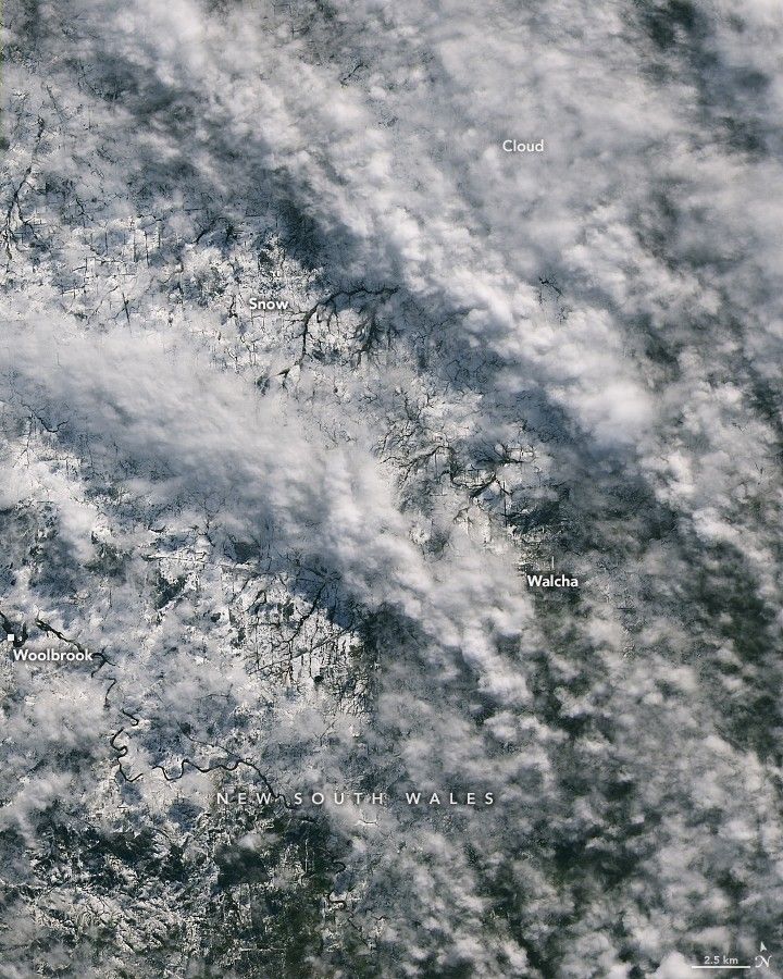
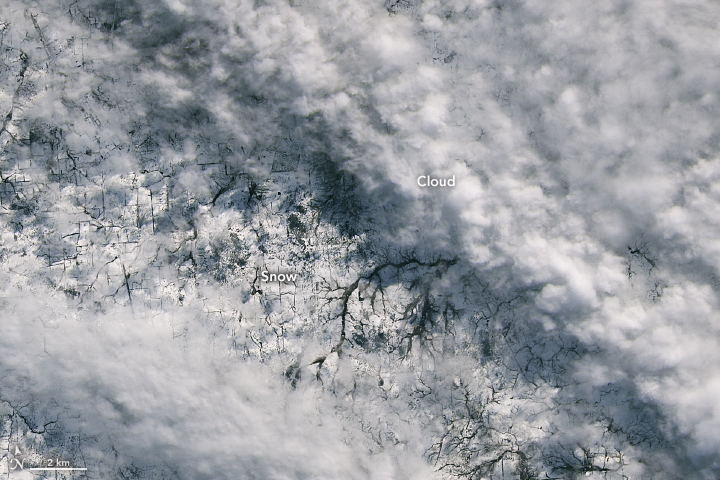
The Northern Tablelands in New South Wales, Australia, transformed into a winter wonderland on August 2, 2025. As much as 40 centimeters (16 inches) of snow piled up on the broad plateau that day—the most some areas have seen since the mid-1980s, according to news reports.
The next morning at about 9:45 a.m. local time, breaks in the clouds allowed the OLI (Operational Land Imager) on Landsat 8 to capture these images of the snow-covered ground. The images show the landscape near the town of Walcha, located on the southeastern edge of the Northern Tablelands and about 300 kilometers (190 miles) north of Sydney. The Walcha district is known for pasturelands that provide grazing for tens of thousands of cattle and hundreds of thousands of Merino sheep.
In contrast to its serene, ethereal appearance in satellite and ground-based images, the fresh snow posed hazards to an area that seldom sees such conditions. Vehicles became stuck on snowy roads, and officials closed several sections of highway, including the Oxley Highway running west out of Walcha, according to news reports. Tree branches and carports that succumbed to the weight of the snow were reported across the region.
The weather was caused by a low-pressure system sitting off the coast and pushing moisture inland, according to Australia’s Bureau of Meteorology. While precipitation fell as snow in the highlands, rainfall was widespread at lower elevations, the agency reported, with some locations receiving more than 100 millimeters (4 inches) in 24 hours. Several flood watches and warnings were issued as river levels rose; the State Emergency Service received thousands of calls for assistance and responded to dozens of flood rescues. Winds brought significant swell to the New South Wales coast, where gusts over 100 kilometers (60 miles) per hour were observed.
References & Resources
- ABC News (2025, August 2) Wild weather in NSW triggers hundreds of SES calls as parts of state see deepest snow in 20 years. Accessed August 6, 2025.
- Australia Bureau of Meteorology, via Facebook (2025, August 2) On Saturday, wet, windy, wintery weather impacted parts of New South Wales. Accessed August 6, 2025.
- Australia Bureau of Meteorology, via YouTube (2025, August 2) Severe Weather Update 2 August 2025: Heavy rain, strong winds, large waves for NSW. Accessed August 6, 2025.
- The Guardian (2025, August 4) Residents warned of potential ‘major flooding’ and damaging surf in NSW after wild weekend weather. Accessed August 6, 2025.
- New England Times (2025, August 3) Thousands without power, trees down, events cancelled due to snow. Accessed August 6, 2025.
- NSW State Emergency Service (2025, August 4) NSW SES Operational Update Monday 4 August 2025. Accessed August 6, 2025.
NASA Earth Observatory images by Lauren Dauphin, using Landsat data from the U.S. Geological Survey . Story by Lindsey Doermann .


