


Earth Science Research News
Earth News and Information
Filters

Drifting sea ice fragments near Alaska’s Saint Lawrence and Nunivak islands and colorful water around the Yukon Delta heralded the approach of the summer solstice.

The Nebraska Sandhills—the largest system of sand dunes in the Western Hemisphere—stretch across about one-quarter of the state.
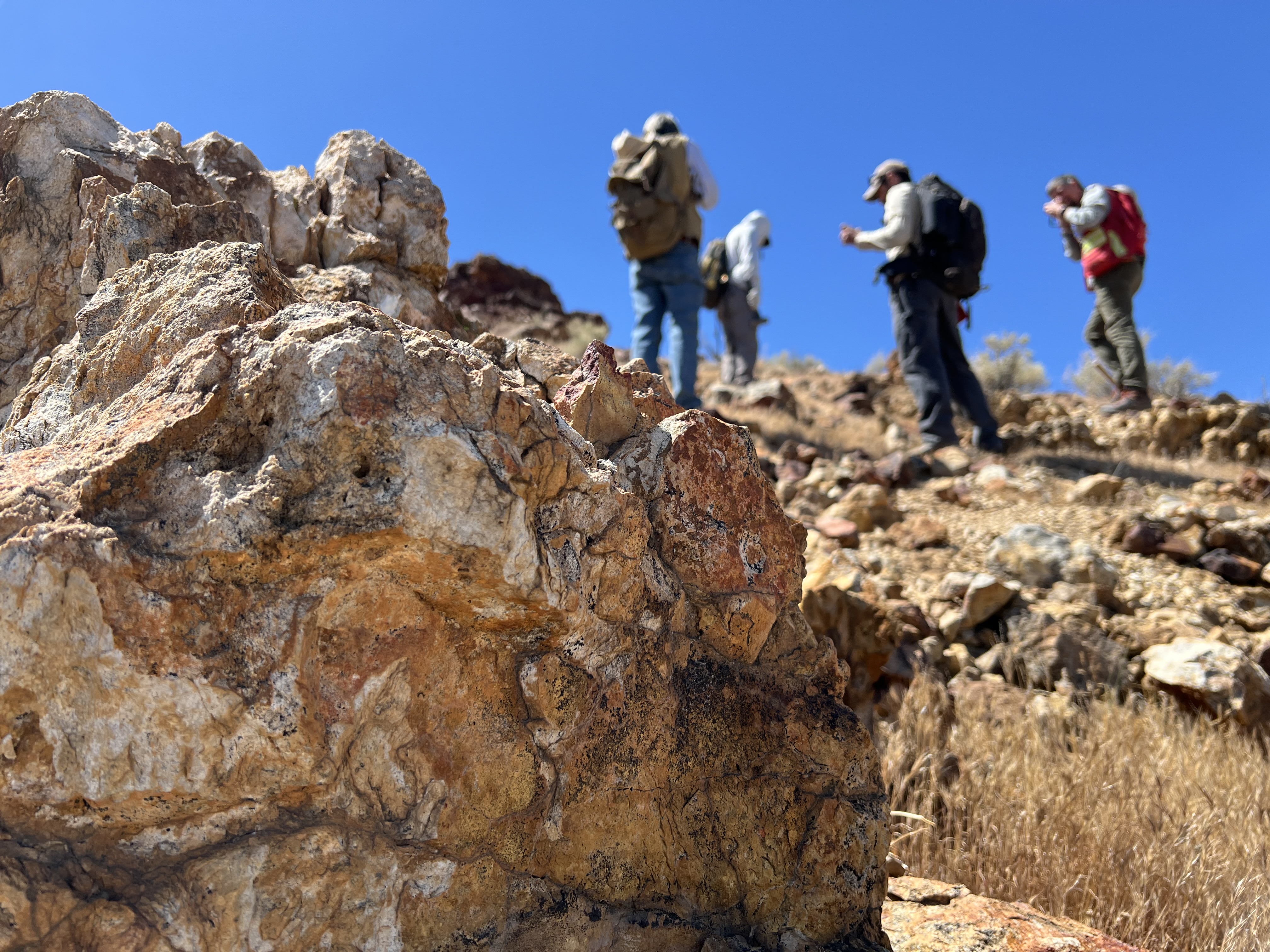
Equipped with rock picks and hand lenses, a team of geoscientists deployed to the Mojave Desert recently to investigate a tantalizing “fingerprint” detected by a NASA sensor. Their target: a cache of topaz hiding in plain sight. The geologists weren’t…

Abstracts are now being accepted for the session, which will take place at the 2027 AMS Annual Meeting.

Ice splintered off the southern Patagonia glacier and drifted across a growing glacial lake.

Urban development, green spaces, and maritime activity converge in this Northern California city.
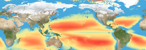
Editor’s note: This article was updated on June 5. A new study combining NASA satellite observations, ocean surveys, and genetic testing on marine microorganisms found evidence that warming ocean waters may be limiting nutrient availability across much of the global…

Radar data from an agricultural area in South Africa, shown in a vivid color palette, reveal crop types and how they changed during the Southern Hemisphere's growing season.

Wild disturbances are on the rise, while land disturbed by human activity has been decreasing.
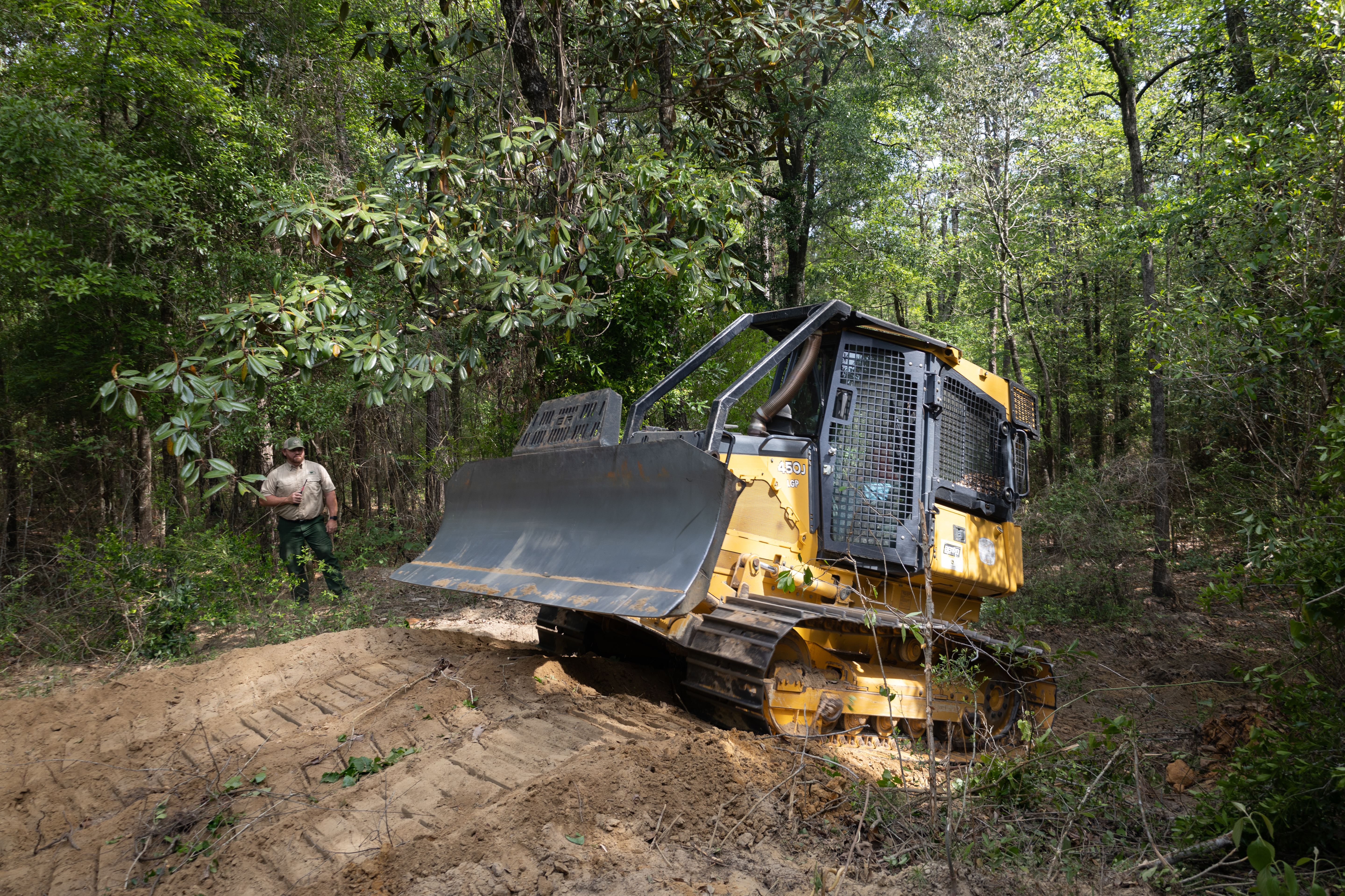
With peak wildfire season approaching, scientists with NASA’s FireSense project have created low-cost thermal sensors to install on fire bulldozers that will alert firefighters when heat from a nearby fire reaches a dangerous level. The sensors also provide researchers with…