


Freshwater
From sustaining agriculture and energy to shaping landscapes and communities, freshwater is essential. NASA’s Earth science data helps the nation manage this vital resource, prepare for droughts and floods, and support long-term water resilience.
Where Does NASA Fit?
NASA Earth Science provides a global view of water in motion. Satellites measure changes in lakes, rivers, and underground reserves, while tracking soil moisture, snow, and ice that feed vital water supplies. Airborne missions and on-the-ground campaigns add crucial detail. Scientists transform this data into forecasts, giving farmers, water managers, and policymakers the tools to help the nation adapt to shifting needs and plan for challenges ahead.
What is Earth's Water Budget?
NASA has a fleet of satellites to help us bring Earth’s water budget into focus, including missions like SWOT. Watch to discover how Earth's water budget works and why tracking it matters.
More DetailWhere's the Water

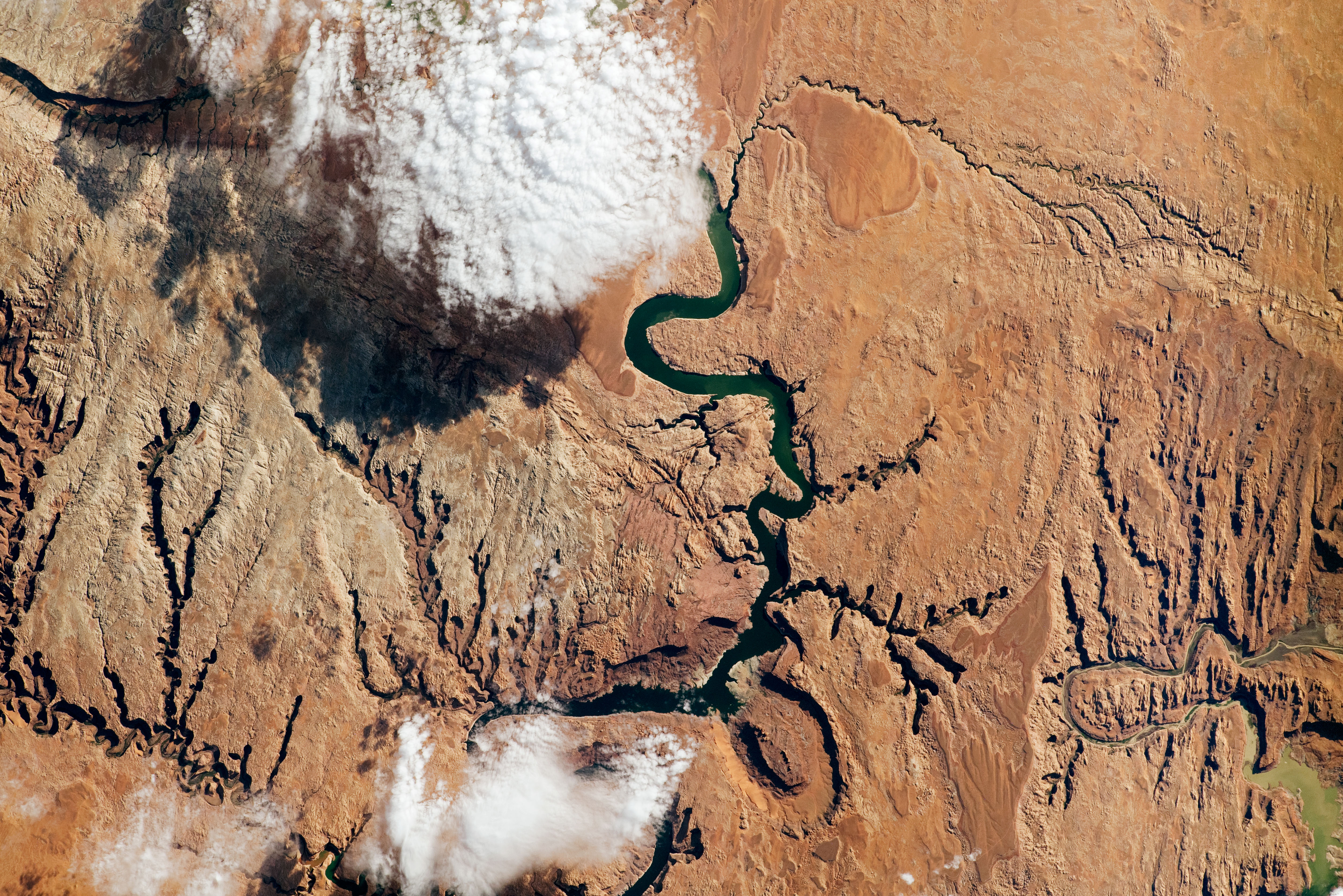
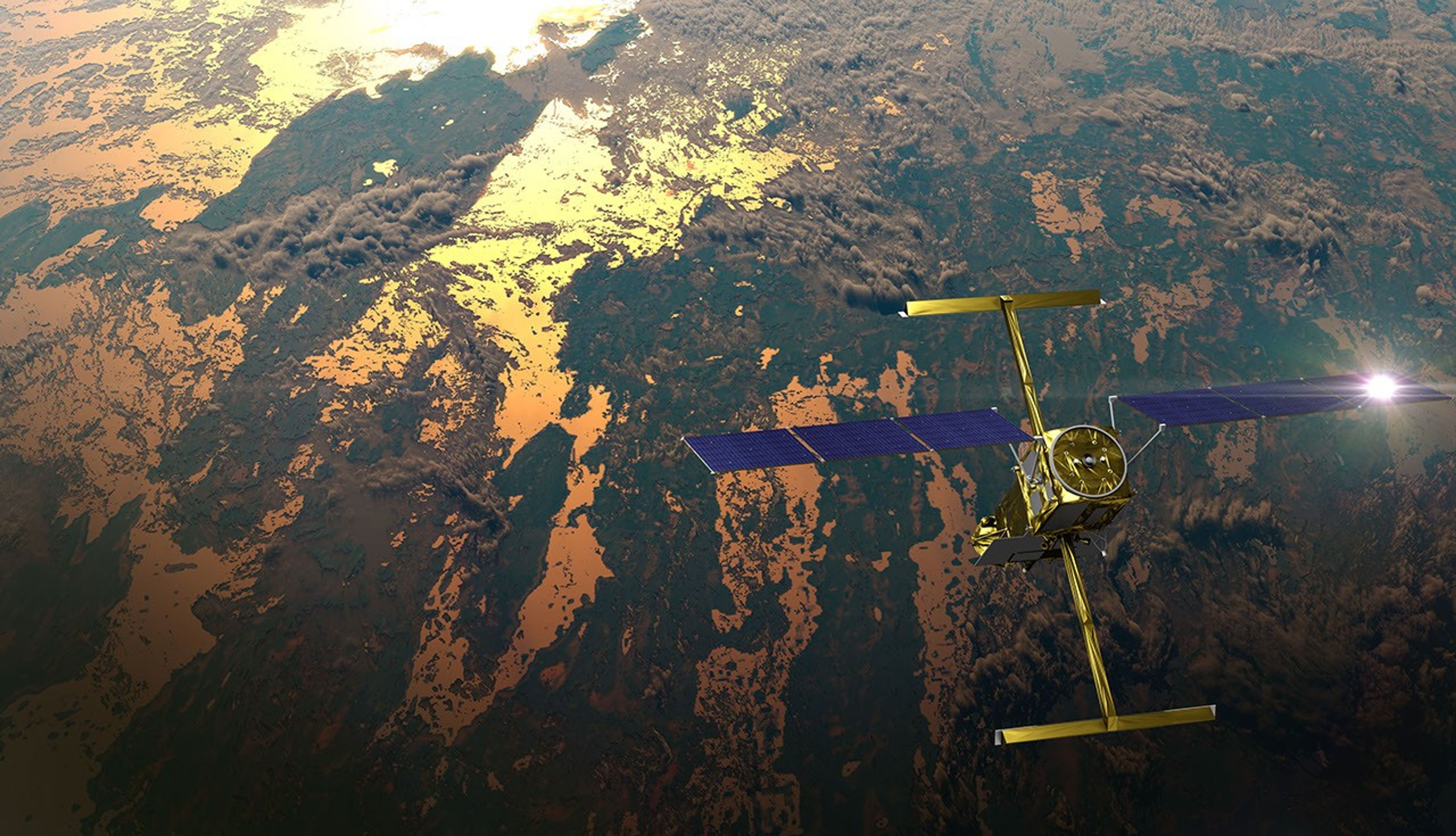
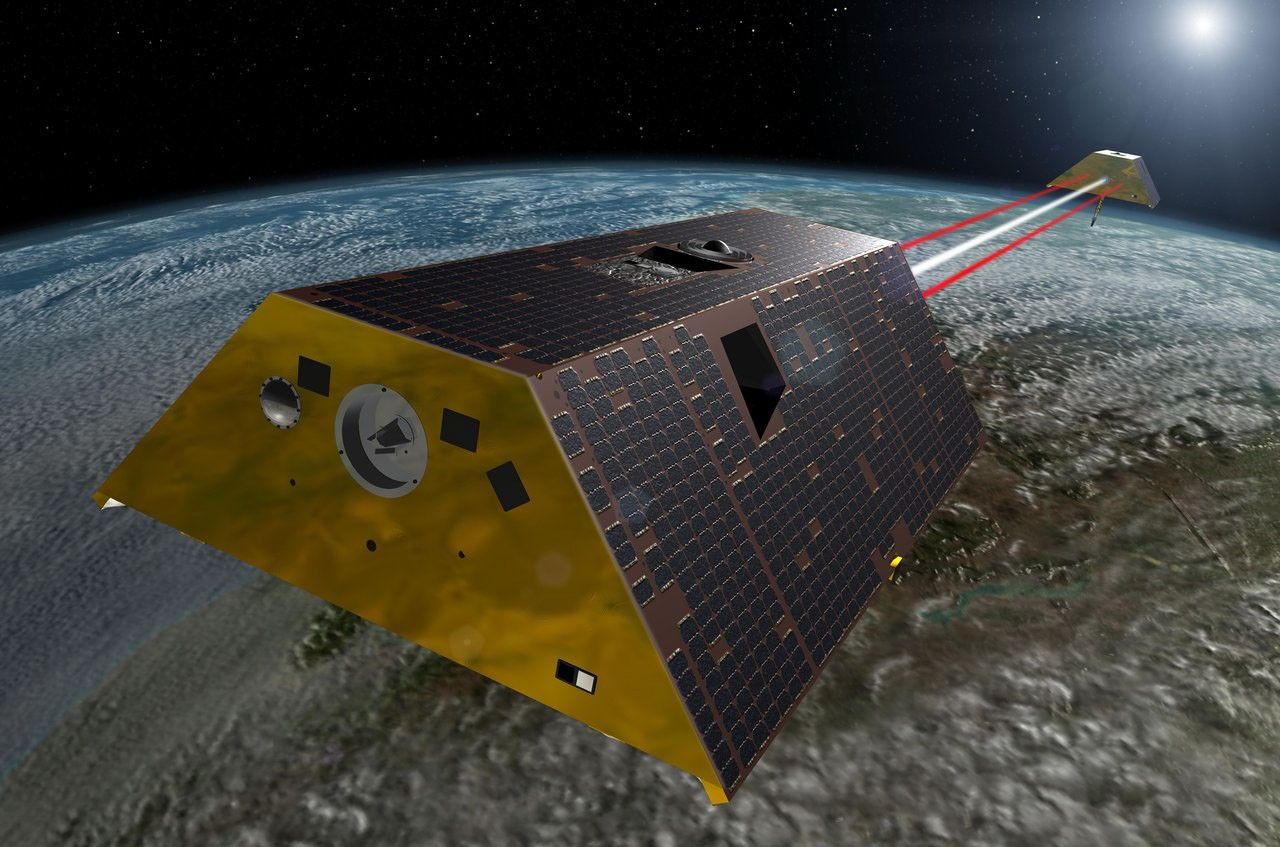
Featured Mission: SWOT
The Surface Water and Ocean Topography (SWOT) mission is transforming how we measure Earth’s freshwater, providing the first global survey of the planet’s rivers, lakes, and other freshwater bodies from space. SWOT data helps U.S. businesses, farmers, water managers, scientists, and policymakers track floods, droughts, and water supplies — supporting agriculture, energy production, infrastructure planning, and more. By improving forecasts and water management strategies, SWOT helps protect economies and ensures reliable water resources for communities.
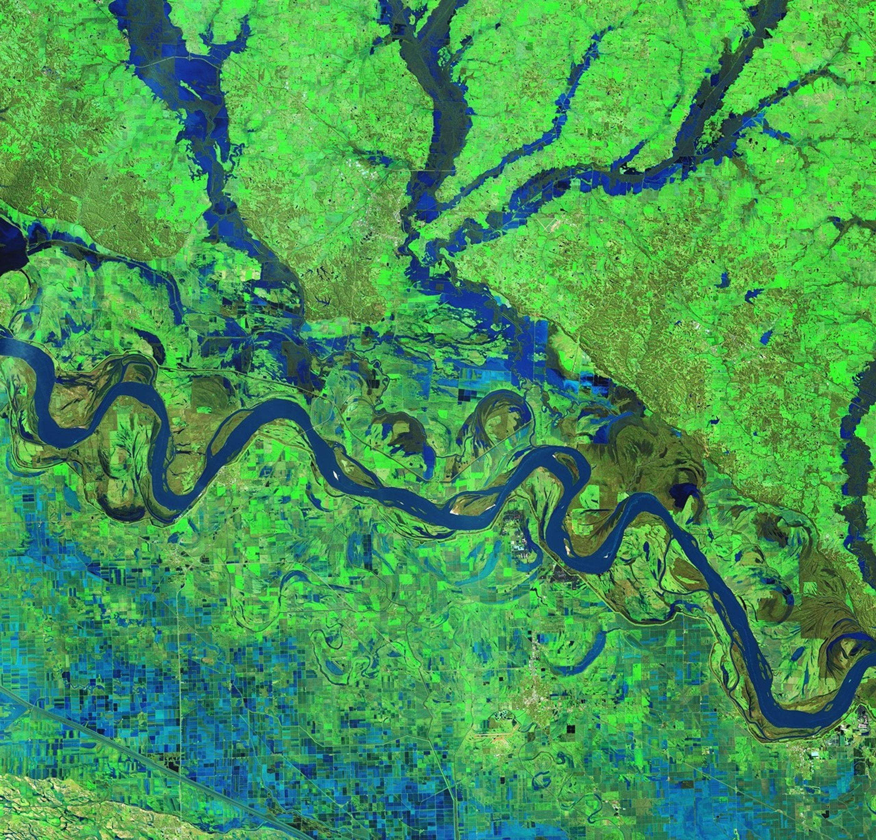
International SWOT Mission Can Improve Flood Prediction
NASA-Led Study Provides New Global Accounting of Earth’s Rivers
Measuring Water From Space
How do we make sure SWOT’s space-based water measurements are accurate? Hydrology lead Tamlin Pavelsky explains the global validation effort.
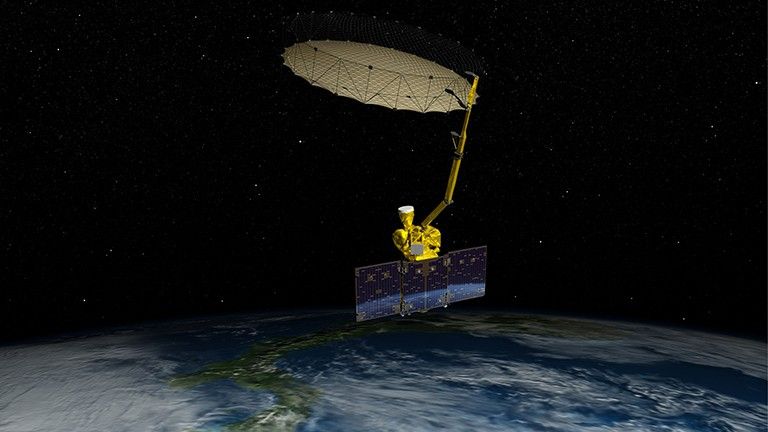
Featured Mission: GRACE
The Gravity Recovery and Climate Experiment (GRACE) satellites measure fluctuations in Earth’s gravity each month. Developed by NASA and its partners, these twin satellites detect tiny shifts in mass on and beneath Earth's surface, helping scientists track underground water, glaciers, and the amount of water in large lakes.
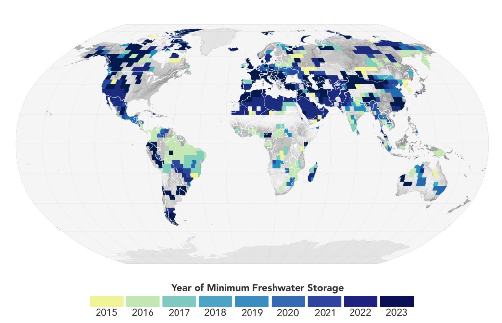
NASA Satellites Reveal Abrupt Drop in Global Freshwater Levels
How GRACE Is Used For Groundwater Management
The GRACE satellites track groundwater changes, helping manage water supplies, prevent depletion, and support sustainable use.
15 Years of GRACE Earth Observations
From 2002 to 2017, the original GRACE satellites unlocked mysteries of how water moves around our planet. Watch how this groundbreaking mission changed our understanding.
Featured Mission: SMAP
The Soil Moisture Active Passive (SMAP) mission provides critical data on soil moisture, helping scientists track how water moves between the land, atmosphere, and plants. By measuring moisture levels in the top layer of soil, SMAP improves drought monitoring, flood forecasting, and agricultural planning.
Exploring Earth’s Soil with SMAP
The SMAP mission teams up with the GLOBE Program to engage students in soil moisture science — connecting space-based data with hands-on learning.
NASA Soil Moisture Data Advance Crop Forecasts
Data from the first NASA satellite mission dedicated to measuring the water content of soils is now being used by the USDA to monitor global croplands and make commodity forecasts.
Explore the VegScape
The USDA's VegScape is a web-based tool for monitoring U.S. crop conditions. It allows users to access, visualize, and analyze crop soil moisture data products derived from NASA’s SMAP satellite.
How NASA Helps
-
Predicting Floods & Droughts
Working with farmers, local water utilities, national agencies, and more, NASA’s Water Resources Program translates the agency’s scientific observations into practical tools for managing water.
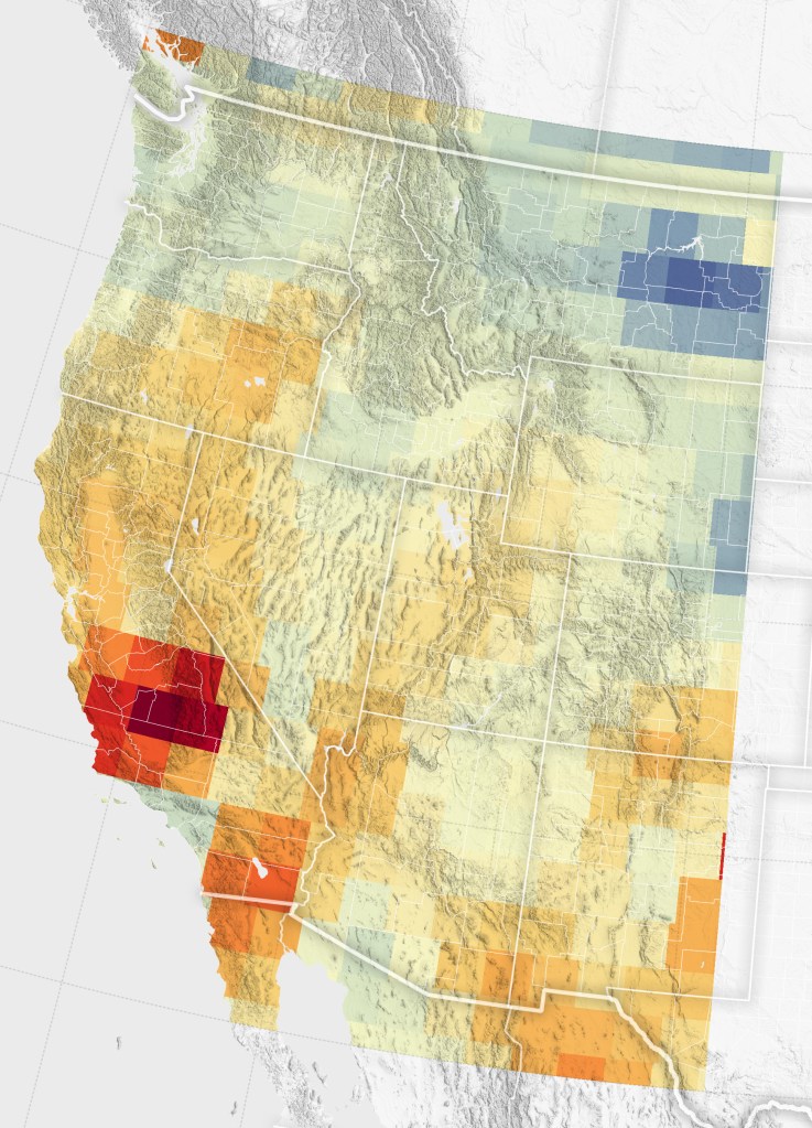
For instance, by funding research and providing satellite data, the program helps improve the U.S. Drought Monitor, a weekly map that shows drought conditions across the country. Dry conditions parched all but two states in October 2024 and worsened as the month progressed.NASA Earth Observatory/ Michala Garrison
 -
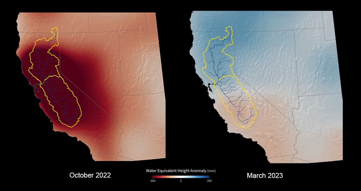
Measuring Water Underground
VIRGO, a tool from NASA’s Western Water Applications Office, helps scientists track groundwater levels over time. It combines data from multiple sources, including measurements from wells and GPS stations on the ground, as well as satellite data that detects changes in gravity and land movement. By bringing all this information together, VIRGO makes it easier to see long-term groundwater trends and understand how water supplies are changing.
 The VIRGO online mapping tool helps water managers to visualize and understand groundwater changes across California using satellite and ground-based data.Xavier Mascareñas/California Department of Water Resources
 -
Supporting Farmers, Ranchers, and Water Managers
NASA provides crucial data to help farmers, ranchers, and water managers make informed decisions about water use, ensuring sustainable agriculture and resource management.
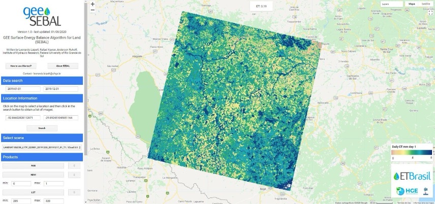
OpenET, supported in part by NASA, uses satellite data to estimate evapotranspiration (ET)—water evaporating from soil and transpiring from plants. By providing water-use data, OpenET helps farmers, water managers, and policymakers make informed decisions on irrigation, conservation, and drought response.
Powered by Landsat, ECOSTRESS, and other Earth-observing satellites and sensors, OpenET delivers field-level water use estimates across the western U.S. This helps improve agricultural water efficiency and supports local and state water planning for sustainable resource use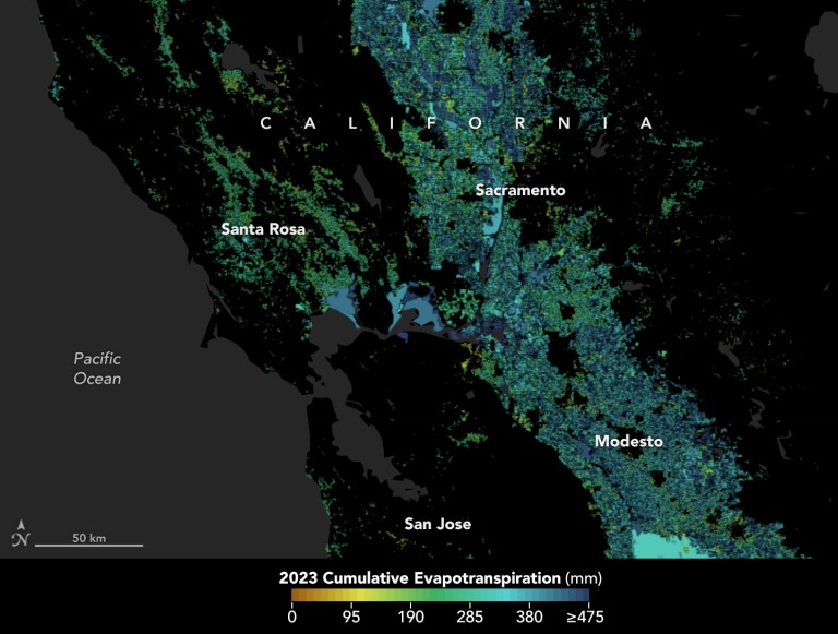 A moisture measurement tool known as OpenET is improving the way farmers, ranchers, and water resource managers steward one of Earth’s most precious resources. View the full storyNASA Earth Observatory using openetdata.org
Freshwater News

International SWOT Satellite Spots Planet-Rumbling Greenland Tsunami

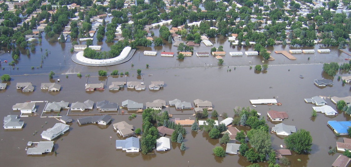
Floods Swamp Tennessee
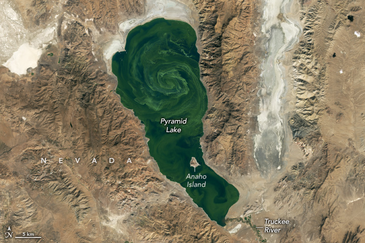
Pyramid Lake in Bloom
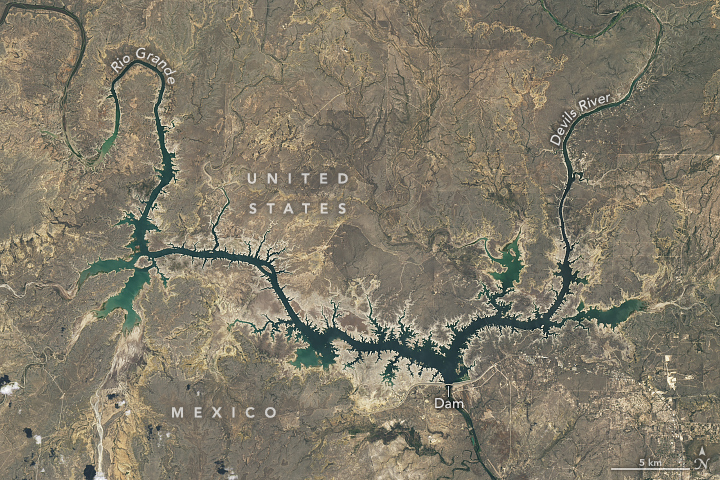
Dry in the Rio Grande Basin
Show Me the Data
Current Research


Additional Information

NASA ARSET
NASA offers in-person and online trainings on using satellite data to monitor water resources and , covering topics like rainfall, groundwater, evapotranspiration, and lake levels. Designed for policymakers, researchers, and applied science professionals, these trainings teach participants how to access, interpret, and apply NASA’s water data and tools.
Earth Observatory: Water
The Earth Observatory’s Water page showcases satellite imagery and stories that explore the many ways water shapes our planet — from droughts and floods to glaciers and ocean currents. It serves as a visual and educational gateway to understanding Earth's dynamic water systems through NASA’s eyes in space.


