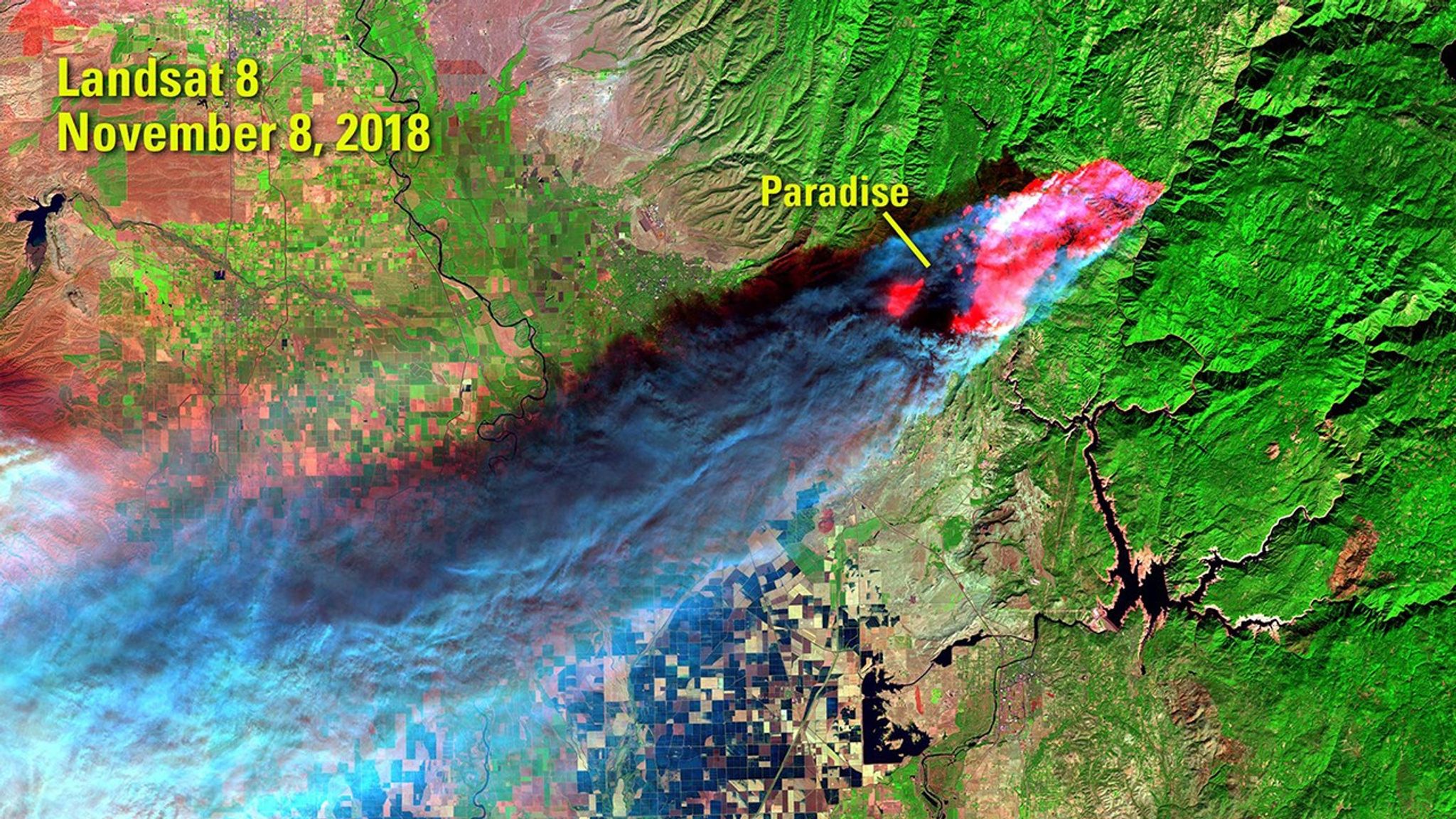
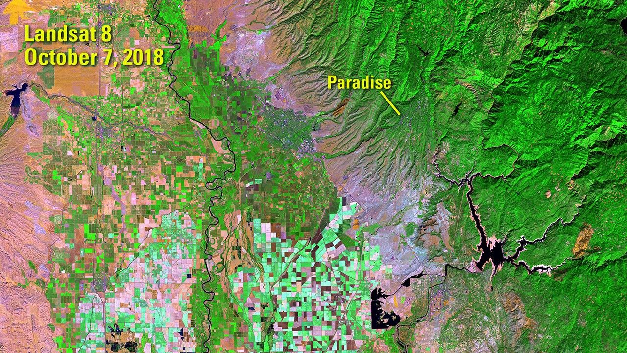
Due to the lapse in federal government funding, NASA is not updating this website.

Suggested Searches

1 min read

Camp Fire, Northern California

before
after
The Camp Fire burned more than 153,000 acres of Butte County, California, in November 2018. The California Department of Forestry and Fire Protection (CAL FIRE) reported that it was California’s deadliest and most destructive wildfire, responsible for 85 deaths and the loss of nearly 19,000 structures, including almost 14,000 residences. Fire appears red and smoke appears blue in the false-color image acquired in November, hours after it started. See also the Woolsey, Mendocino Complex, County, Thomas, and Wine Country fires.   Images taken by Landsat 8. Source: U.S. Geological Survey’s National Land Imaging Image Collections

Before and After

Camp Fire, Northern California

Oct. 7, 2018 - Nov. 8, 2018

The Camp Fire burned more than 153,000 acres of Butte County, California, in November 2018. The California Department of Forestry and Fire Protection (CAL FIRE) reported that it was California’s deadliest and most destructive wildfire, responsible for 85 deaths and the loss of nearly 19,000 structures, including almost 14,000 residences. Fire appears red and smoke appears blue in the false-color image acquired in November, hours after it started. See also the WoolseyMendocino ComplexCountyThomas, and Wine Country fires. Images taken by Landsat 8. Source: U.S. Geological Survey’s National Land Imaging Image Collections

Downloads

Image 1

JPEG

(2 MB)

Image 2

JPEG

(2 MB)