


Wildfires
Communities use Landsat data to intervene before, during, and after a wildfire to protect their land and maintain healthy forest ecosystems.
Landsat’s Role in Managing Wildland Fires
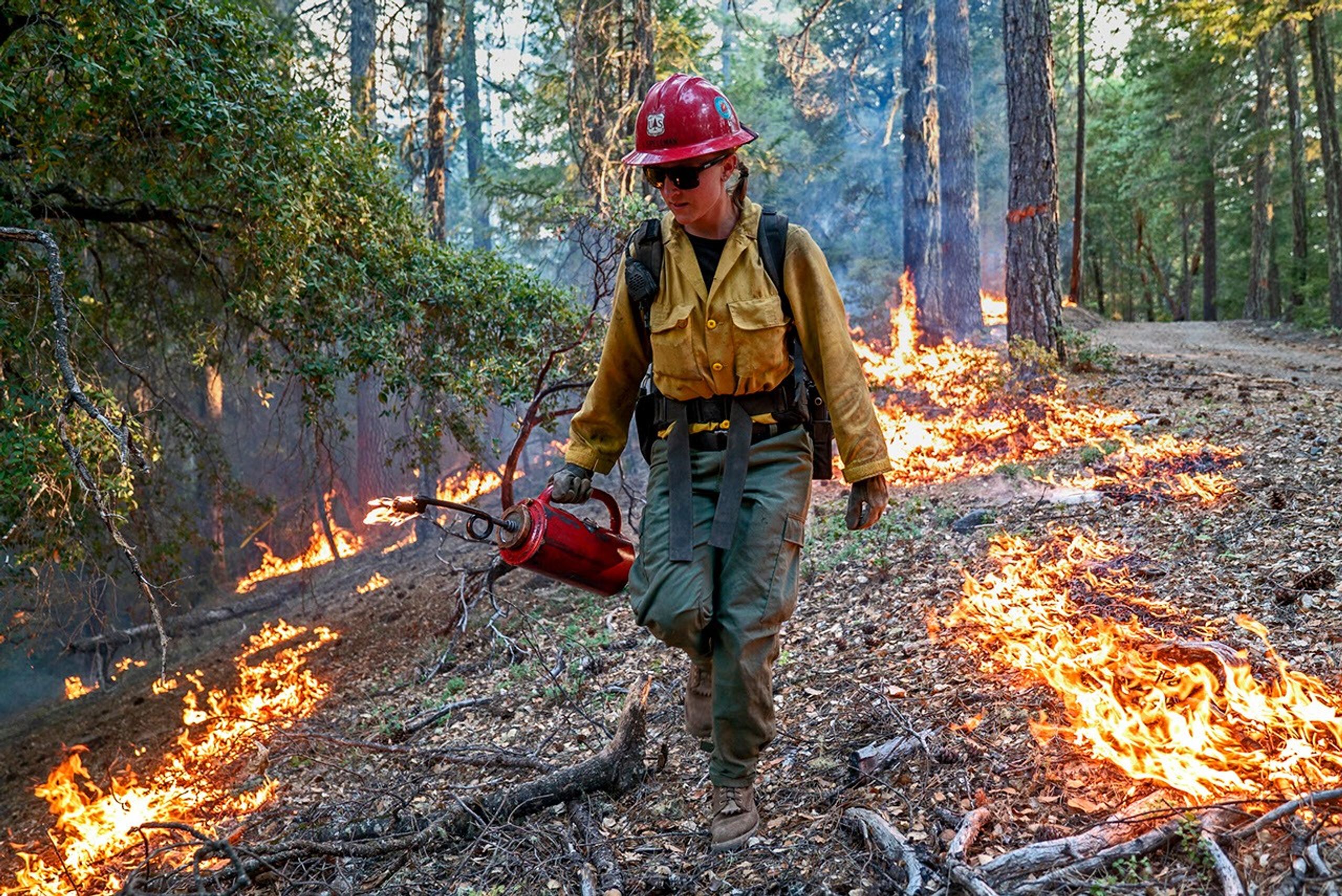
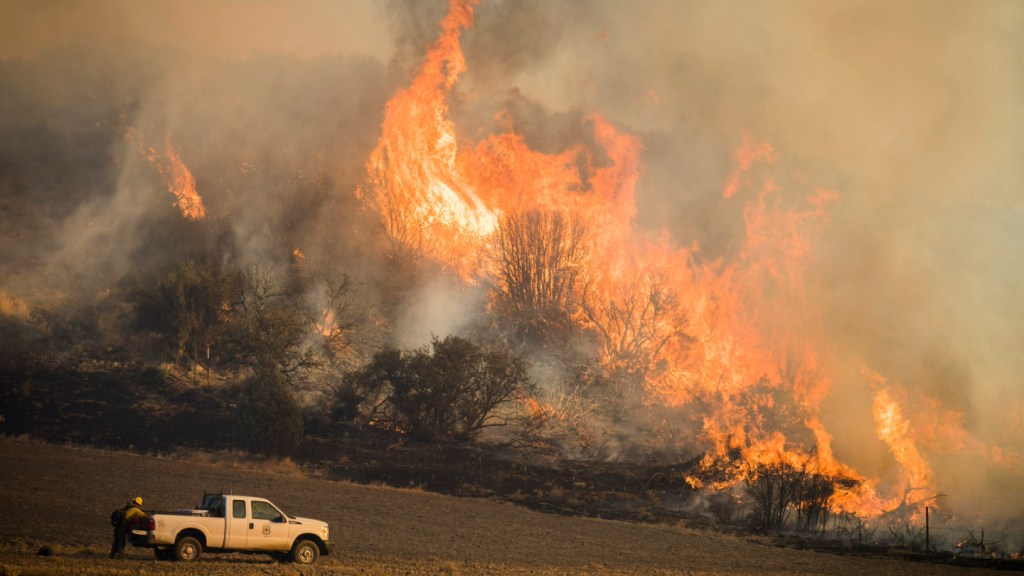
Worldwide, fire plays a critical role in maintaining healthy forests, but fire can also be damaging. Homes are destroyed and the effects on air quality can be felt for miles. Forest fires are occurring more often and with greater intensity than in years past, and Landsat plays a critical role in understanding the impact. Landsat data enables land managers and scientists to assess the severity and extent of large fires as they plan recovery efforts; to improve safety and prevent damage to life, property and natural resources; to estimate how much pollution burning releases into the air; and to monitor the post-fire recovery of burned areas.
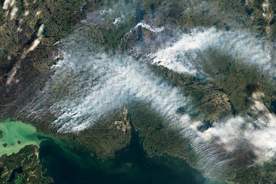
Landsat satellites have been collecting information about forest fires since the 1970s. Landsat plays an important role in assessing the impact of fires on forest ecosystems and human society. Landsat satellites document the location and extent of burned areas, how severely fires burn, and the subsequent regrowth of the land after a forest fire. All this information helps land managers better manage our forests and other natural resources in the context of fire.
Landsat Data for Local and Global Decision-making
- Assessing the severity and extent of damage
- Improving safety and preventing further damage to life, property, and natural resources
- Estimating how much pollution burning releases into the air monitoring burn areas and regrowth
- Assessing susceptibility to wildfire
Assessing the Severity and Extent of Damage When an Area Burns
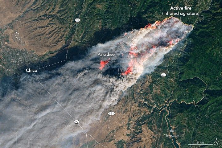
Landsat offers an inexpensive way to gauge the extent of large fires. Landsat’s imaging capabilities allow land managers to estimate the percentage of shrubs, grasses, and trees that were damaged or killed by a fire and to determine areas where soils burned. Land managers at the US Forest Service use this Landsat-based assessment of burn severity and extent to prioritize recovery efforts and guide decisions on where replanting and erosion control are needed.
Improving Safety and Preventing Further Damage
Intense fires increase the potential for flooding and erosion in two ways. Fires may remove all plant material from the forest floor, leaving soil unanchored. Fires can make some soils water repellent resulting in increased runoff after precipitation events. By using Landsat images to identify burned areas on steep slopes and the location of those areas within the watershed, US Forest Service’s Burned Area Emergency Response (BAER) assesses potential hazards and determines a response plan.
Estimating Air Quality and Carbon Emissions
Detailed maps of the extent and severity of forest fires from Landsat can be combined with air quality measurements to estimate the amount of carbon released into the atmosphere. This helps improve models that estimate smoke emissions, forecast air quality, and monitor carbon storage and flux on forested lands.
Monitoring Burned Areas and Regrowth
With fifty years of data, Landsat offers a unique historical record of forest fire activity and forest regrowth and succession. Fires are a critical component of the ecological succession of forests. Fires clear out underbrush and allow new trees and plants to take root. After the Great Yellowstone Fire in 1988, foresters and biologists observed the growth of grasses and shrubs by using Landsat data. These observations helped scientist gain a greater understanding of forest succession after a significant fire.
Related Resources
Latest News
Discover how Landsat data supports wildfire management, from spotting early fire risks to watching nature's recovery.
From the vantage point of space, NASA’s fleet of Earth-observing satellites joins with those of partner interagency and international agencies…
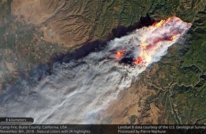
As 2018 closed, Discover Magazine blogger Tom Yulsman posted to his ImaGeo blog about the most gripping image he’d seen during the year. The…