Agriculture & Food Security
Landsat data empower land managers to optimize crop health and maximize food security, benefiting farmers and consumers worldwide.
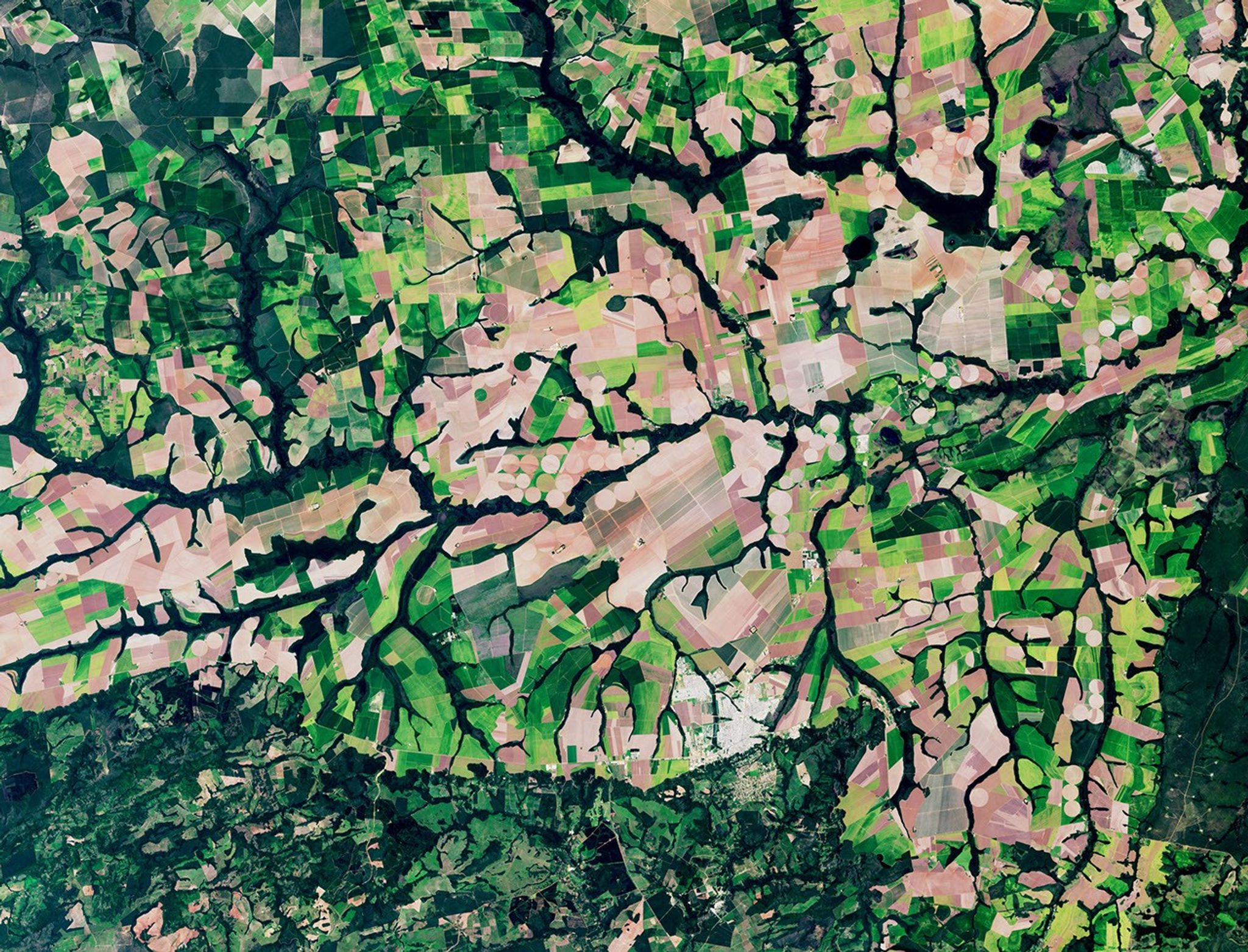
Food and farming organizations worldwide rely on unbiased, accurate, and timely information from Landsat satellites to feed a growing global population. These data help crop health analysis throughout the growing season, determine field-specific needs for fertilizer and irrigation, verify acreage for production forecasting and fraud prevention, measure irrigation water usage, and assess drought impacts. Landsat data serves as the foundation for invaluable agricultural resources, including the National Land Cover Database and the Cropland Data Layer, which provide standardized information for decision-makers across the agricultural sector.
NASA Harvest and NASA Acres are two key programs that connect NASA data to farmers. Both partner with private companies to provide timely insights about water availability, extreme weather, agricultural insurance, and more. Acres focuses its efforts on U.S. farms, while Harvest operates worldwide.
Landsat's Role in Agriculture & Food Security
-
Forecasting Crop Production
The Cropland Data Layer, produced annually by the U.S. Department of Agriculture, uses Landsat data and ground truth data to provide crop type and land cover information across the continental U.S. The Agricultural Statistics Board uses the CDL to estimate acreage for the nation’s crop commodities. In addition to supporting the agricultural economy with more accurate acreage estimates, the CDL enables researchers to assess croplands affected by natural disasters, plan crop rotations, and more.
![The U.S. Department of Agriculture tracks how many acres and the annual yield for every crop produced. One method used to estimate crop acreage and yield is remote-sensing data from the NASA-USGS Landsat satellite program. The program started in 1997,with North Dakota, and by 2008 covered the entire lower 48 states and the District of Columbia. Music: "Downloading Landscapes" by Andrew Michael Britton [PRS] and David Stephen Goldsmith [PRS]. Published by Atmosphere Music Ltd [PRS].Complete transcript available.Watch this video on the NASA Goddard YouTube channel.](https://assets.science.nasa.gov/dynamicimage/assets/science/cds/svs/a010000/a013400/a013417/13417_Landsat_Croplands_print.jpg?w=1920&h=1080&fit=clip&crop=faces%2Cfocalpoint) The U.S. Department of Agriculture tracks how many acres and the annual yield for every crop produced. One method used to estimate crop acreage and yield is remote-sensing data from the NASA-USGS Landsat satellite program. The program started in 1997,with North Dakota, and by 2008 covered the entire lower 48 states and the District of Columbia.
The U.S. Department of Agriculture tracks how many acres and the annual yield for every crop produced. One method used to estimate crop acreage and yield is remote-sensing data from the NASA-USGS Landsat satellite program. The program started in 1997,with North Dakota, and by 2008 covered the entire lower 48 states and the District of Columbia. -
Measuring Water Supplies and Use
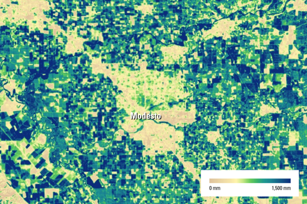
When tracking agricultural water use, it's imperative to quantify evapotranspiration, or the movement of water from land to atmosphere through evaporation and plant transpiration. The open-source OpenET platform uses thermal-infrared Landsat data to determine field-level rates of evapotranspiration, enabling farmers and water managers across the contiguous U.S. to quantify water consumption and increase irrigation efficiency.
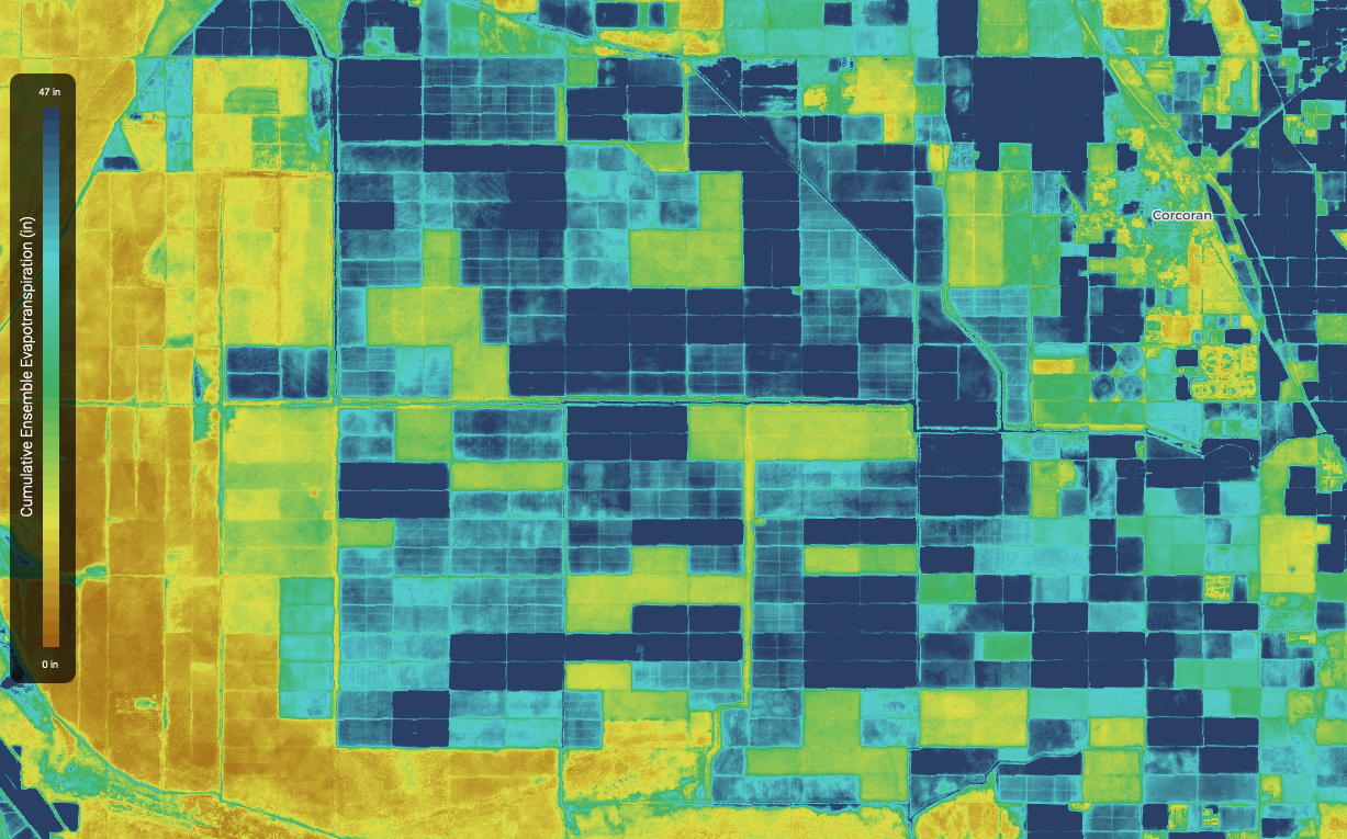 2022 ET estimate for fields around Corcoran, CA.
 -
Monitoring the Crop Impacts of Natural Disasters
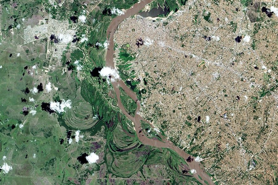
Droughts, wildfires, landslides, and flooding damage and destroy crops, impacting food supply and farmers’ livelihoods. Landsat data helps farmers and agricultural policymakers monitor vegetation stress due to drought, assess damage after a storm, and map flooding trends over time.
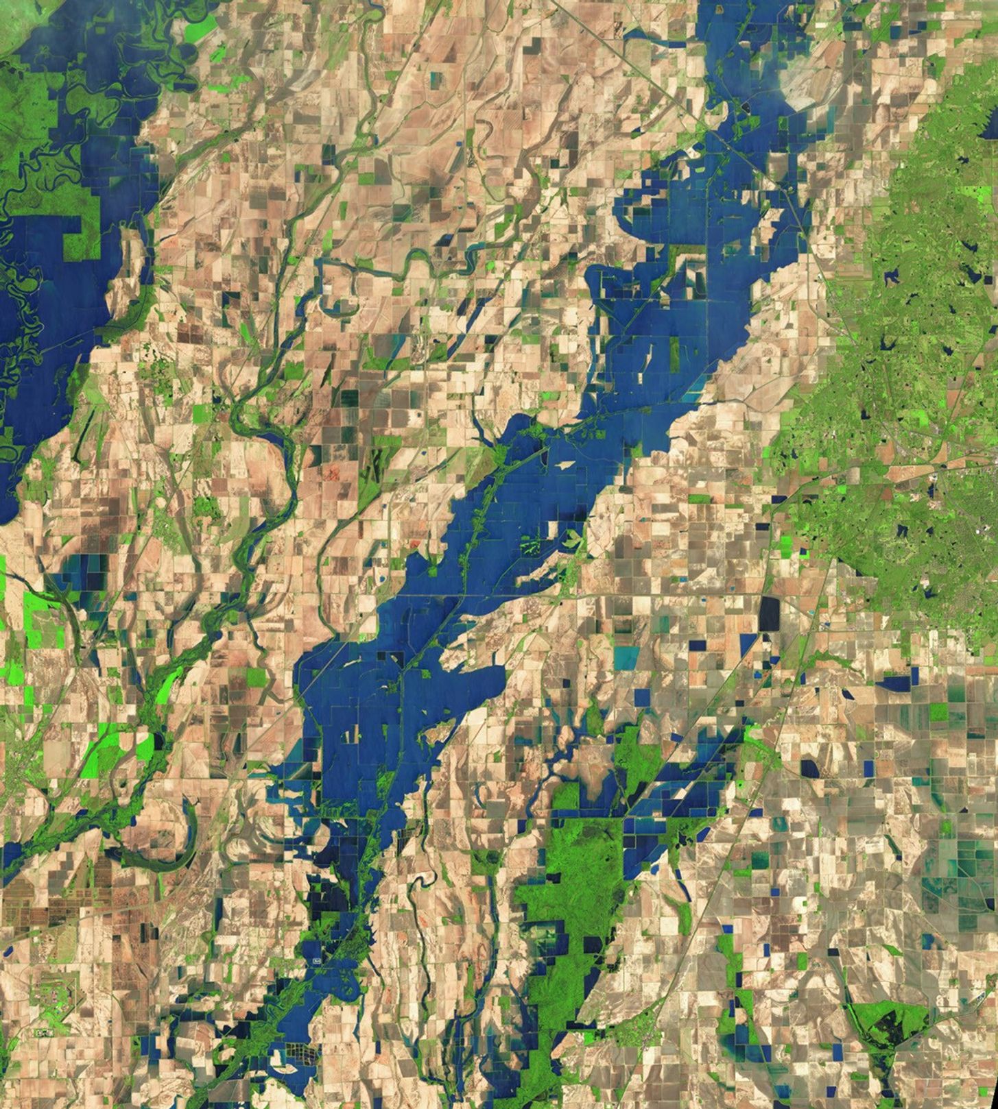 Many growers have been forced to replant as a prolonged flood killed off crops in the Arkansas Delta.NASA's Earth Observatory/Wanmei Liang
Vine by Vine - Conserving Water With Landsat
How do you measure exactly how much water every vine needs across thousands of acres? For E. & J. Gallo Winery, the answer came from 438 miles up — Landsat's thermal sensors measure surface temperature, revealing how much water crops are actually using. That data powered GRAPEX, a Gallo–USDA partnership that mapped water use vine row by vine row, and helped lay the groundwork for OpenET, a free platform now serving water data across all 48 contiguous states.
ExploreLatest News
Stay up-to-date with the latest stories about Landsat's critical role in agriculture and food security.

The Landsat satellite program, with its unparalleled 53-year historic record, can reveal changes through the Annual National Land Cover Database…
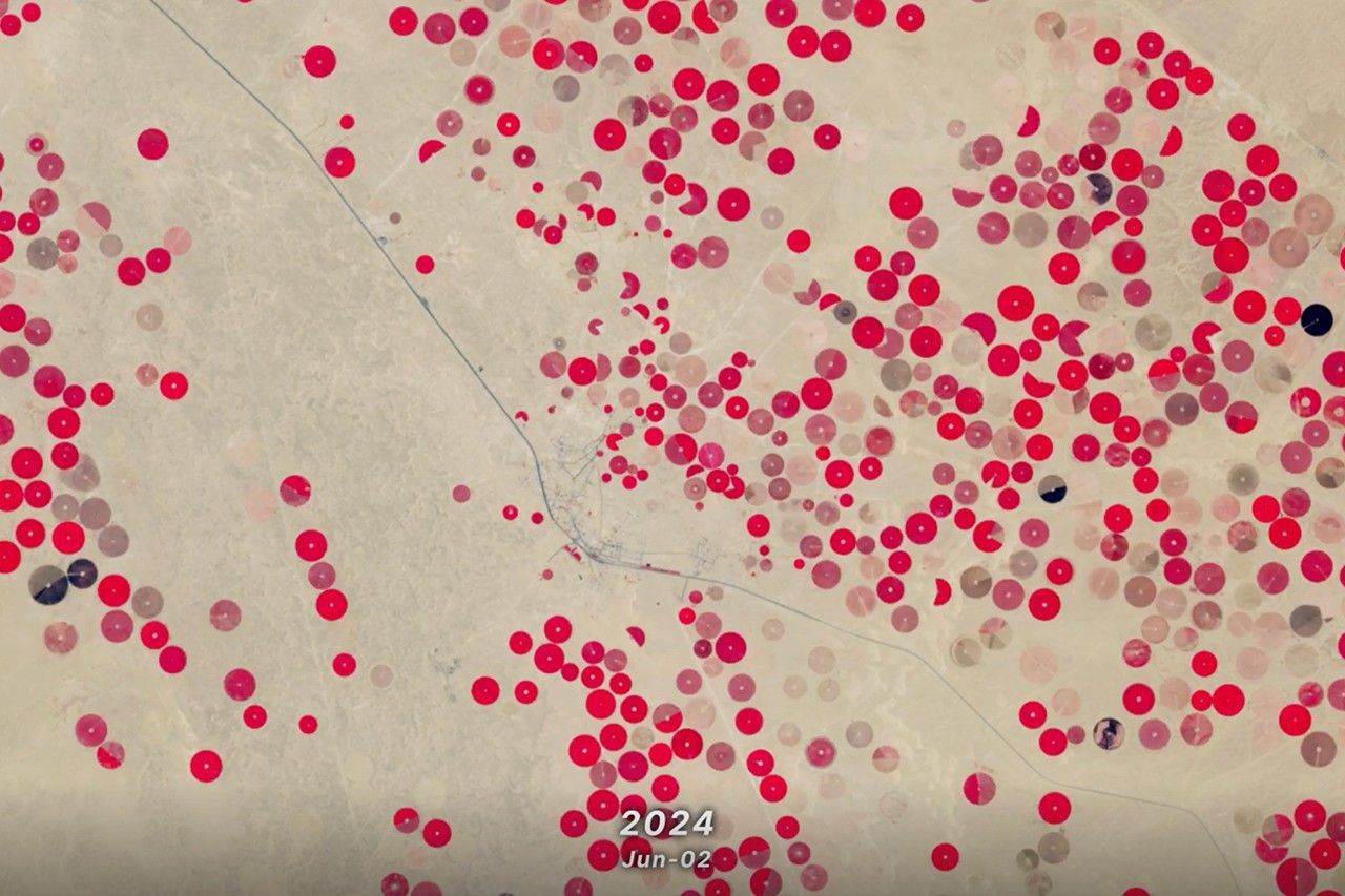
In this animation of 2024 and January 2025, crop fields in Saudi Arabia cycle through their growing seasons.
Using Landsat’s thermal imagery, researchers at Gallo Winery have been able to better understand vineyard water needs and optimize irrigation.
Time Series
Saudi Arabia’s Desert Agriculture
In this animation, crop fields in Saudi Arabia cycle through their growing seasons. Corn, barley, sorghum, and wheat—Saudi Arabia’s four main crops—all follow different crop calendars, but the bulk of the harvesting occurs in late spring and early summer. The time series spans 2024 and January 2025. In this false-color band combination, which combines near-infrared, red, and green wavelengths of light, bright red represents healthy plants, whereas black or grey represents stressed vegetation or fallow fields.
Explore