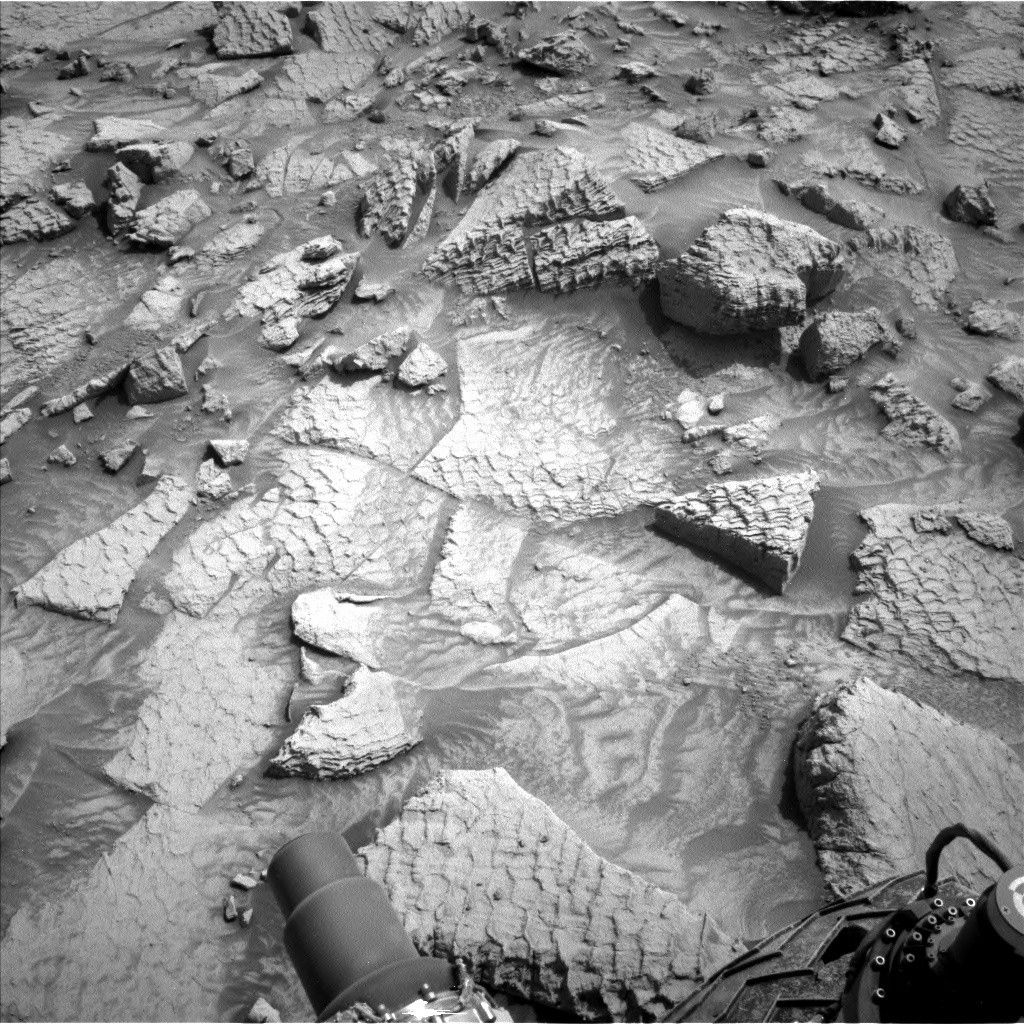


Earth planning date: Friday, June 14, 2024
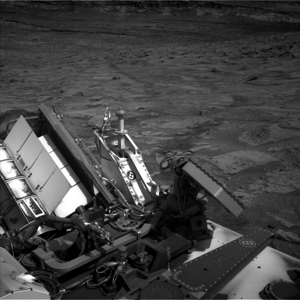
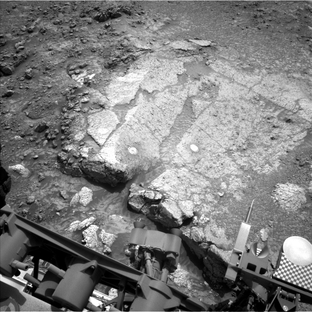
At the start of this week, we did a preload test on the target “Mammoth Lakes,” the rightmost bright ellipse (DRT ellipse, so less dusty) on the workspace image above. The preload test shows the stability of the rock, making sure it doesn’t move and that it doesn’t look like it will fracture under pressure from the drill. This is obviously a very important test! For example, if the rock fractured, the arm might slip down unexpectedly, so we really want to get that confirmation before we commit to drilling here. We also want to ensure the arm can adequately control the orientation of the drill as it makes progress into the rock. Unfortunately, as Conor reported on Wednesday, the preload test didn’t give us the information that we wanted to go ahead with full drill. However, this workspace (“Whitebark Pass”) is very intriguing, so the RPs found us a second spot (“Mammoth Lakes 2”), about 2.4 inches (6 centimeters) away from the original “Mammoth Lakes” to do a preload test.
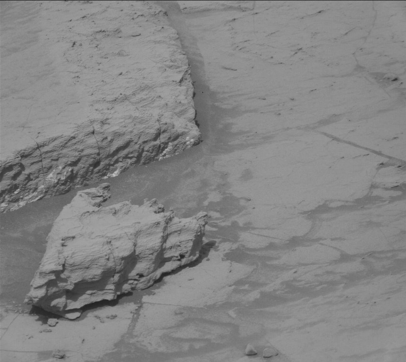
The GEO (Geology and Mineralogy) theme group took advantage of the extra time to further document the color variations and lithological types in this workspace. Mammoth Lakes is centered on the main slab, but the rim of the slab is darker in color. APXS and MAHLI will analyze along this rim at “Loch Leven” for comparison to the center of the slab (e.g., Mammoth Lakes, analyzed by APXS and ChemCam, and imaged by Mastcam and MAHLI on sol 4212) and the whiter, pitted float rocks along the edge of the slab (e.g., “Snow Lakes”, analyzed by APXS and ChemCam, and imaged by Mastcam and MAHLI on sol 4202).
ChemCam will analyze the darker material, using LIBS on “Split Lake,” about 15.8 inches (40 centimeters) away from the Loch Leven target, and the underlying bedrock farther away from the rover at “Big Five Lakes.” They will also use ChemCam passive to look at “Grass Lake” – you can see the bright DRT ellipse for this target in the center of the workspace image above, as it was an APXS and MAHLI target on sol 4209. Both LIBS targets will be imaged by Mastcam. ChemCam will also take an RMI (Remote Micro Imager) 10x1 mosaic image (i.e., one row of 10 images) of a collection of loose rocks in the distance.
The Mastcam team have a very busy plan. On the morning of the first sol (4217), Mastcam will take a large 19x5 mosaic of the Texoli butte, looking at the stratigraphy and erosional surfaces under morning illumination.
Then it is taking advantage of the stop here at Whitebark Pass, with two larger experiments that need to run over several sols (days). The first is a series of change-detection images on the targets “Walker Lake” and “Finch Lake,” taken at different times over multiple sols to look for movement of sand grains, etc. The second is a photometry experiment – this involves taking multiple sets of observations at specific times of day (sunset and sunrise) at the same location in order to study surface scattering properties.
Mastcam will also support the ENV (environmental) theme group today, taking a series of tau images to help constrain dust levels in the atmosphere. ENV have stuffed their section of the plan with dust devil scans and movies, and zenith (looking directly upwards) and suprahorizon (looking in a more horizontal direction) movies, in addition to regular DAN, RAD and REMS activities. APXS will also take an atmospheric measurement, overnight on the second sol, specifically to track seasonal argon changes.
Written by Catherine O'Connell-Cooper, Planetary Geologist at University of New Brunswick