


Surface Topography and Vegetation (STV)
Mapping Earth’s Changing Surface and Overlying Vegetation Structure
Overview
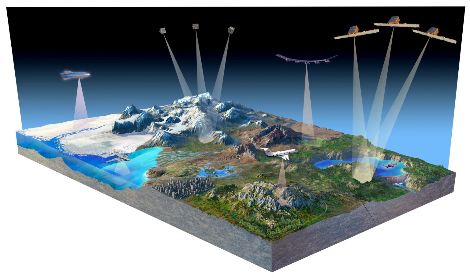
The 2017-2027 Decadal Survey recommended high-resolution global topography, including bare surface land topography, ice topography, vegetation structure, and shallow water bathymetry as a targeted observable (TO). Targeted observables address key priorities within and across disciplinary lines for a set of science objectives related to a common aspect of the Earth system. STV science goals call for exploring next-generation measurement approaches that could be ready for spaceborne implementation within the decade.
Key Questions
How does Earth’s changing surface structure inform us about natural hazards, vegetation, and water resources?
Solid Earth: How does Earth’s surface respond to tectonic and geomorphic processes and what are the implications for geologic hazards?
Vegetation Structure: How is the structure of Earth’s vegetation changing over time?
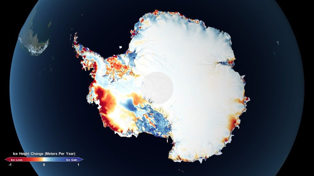
Cryosphere: How are Earth’s glaciers, ice sheets, and snow changing over time?
Hydromorphology: How does water interact with changing terrain and coastal topography?
Applications: How do changing topography and vegetation impact resources and infrastructure?
STV Content Pages


Participate in STV

STV Study Leads
 Lead Andrea Donnellan NASA/ JPL/ Caltech |  Tech Co-Lead Craig Glennie Univ. Houston | ||
| Science | Technology | Observing System | Partners & End Users |
 Solid Earth Paul Lundgren NASA/ JPL/ Caltech |  Radar Yunling Lou NASA/ JPL/ Caltech |  Architecture Mark Stephen NASA/ GSFC |  Collaborations Pietro Milillo Univ. Houston |
 Cryosphere Brooke Medley NASA/ GSFC |  Lidar Ben Smith U. Washington |  Architecture Joe Green NASA/ JPL/ Caltech |  Applications ApplicationsRob Zinke NASA/ JPL/ Caltech |
 Vegetation Structure Keith Krause Battelle/ NEON |  Stereoimaging Mel Rodgers Univ. South Florida |  Platforms Matt Fladeland NASA Ames | |
 Hydrology Marc Simard NASA/ JPL/ Caltech |  Data Fusion Data FusionDavid Shean U. Washington |  OSSEs Marco Lavalle NASA/ JPL/ Caltech | |
 Coastal Geomorphology Coastal GeomorphologyLori Magruder U. Texas, Austin |  Data Fusion Data FusionRobert Treuhaft NASA/ JPL/ Caltech |