


.png?w=1024)


Local land subsidence increases flood risk in San Francisco Bay
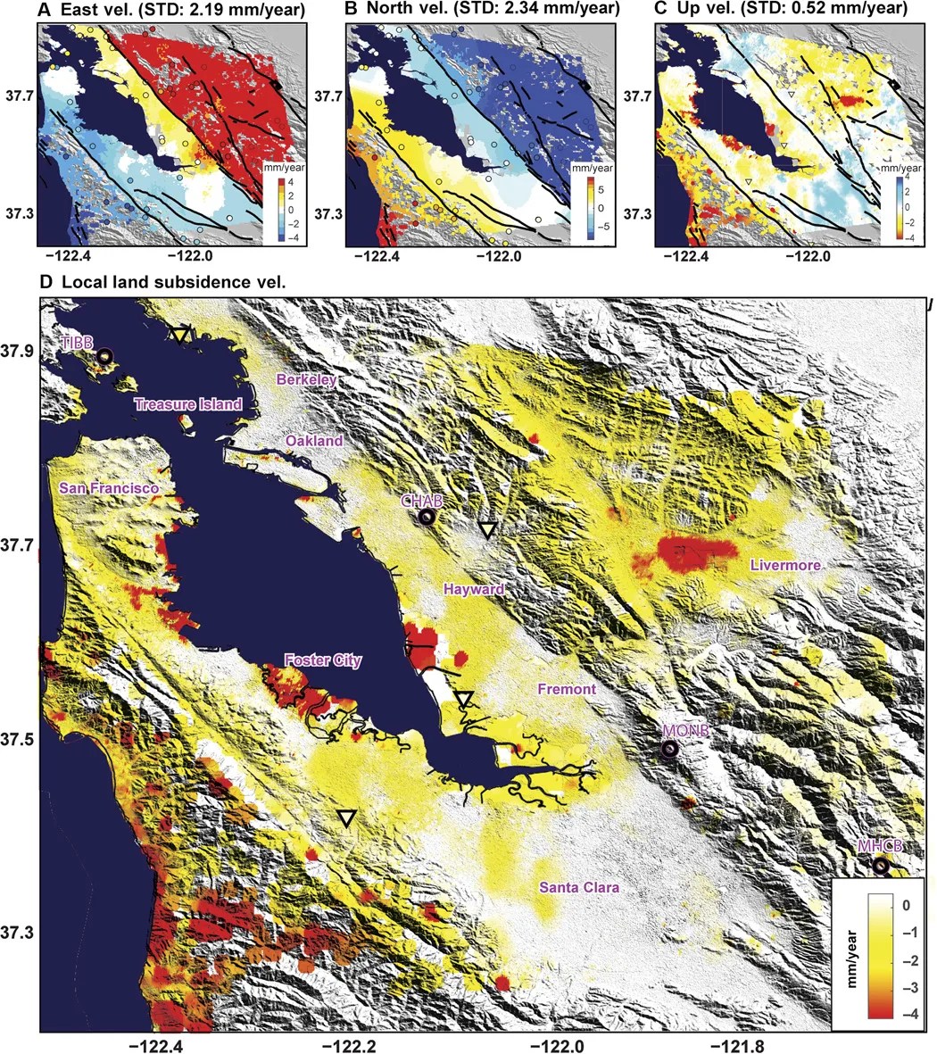
Scientists used a host of remote sensing tools to draw a new 100-year inundation map of the San Francisco Bay area. The revised map, considering both future sea level rise and spatially varying local land subsidence, revealed that inundation maps solely based on sea level rise underestimated the flood prone area of San Francisco Bay by 3.7 to 90.9%.
Data Sources: Environmental Satellite (Envisat) C-band and Advanced Land Observing Satellite (ALOS) L-band synthetic aperture radar (SAR), global navigation satellite system (GNSS) station data, and digital elevation model (DEM) from the Shuttle Radar Topography Mission (SRTM).
Publications
Shirzaei, M., and Burgmann, R., (2018), Global climate change and local land subsidence exacerbate inundation risk to the San Francisco Bay Area. Science Advances, Vol 4, No 3, doi: 10.1126/sciadv.aap9234
< Previous Discovery | Next Discovery >
< Back to: A Year in Review


