


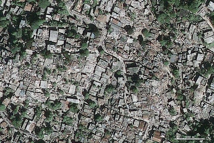
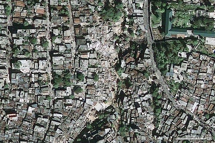
The GeoEye-1 satellite (a commercial satellite) captured these images of earthquake damage in the densely populated neighborhoods of Port-au-Prince, Haiti, on January 13, 2010. Geometric shapes define structures that appear undamaged from above, but this appearance may be deceptive. The buildings may be damaged under an intact roof. Other homes and other structures have clearly been destroyed entirely, a mass of rubble spilling in a tangled mass across broad sections of the image. According to the United Nations, at least 10 percent of homes in Port-au-Prince were destroyed when a massive 7.0 earthquake shook the city on January 12, 2010.
References & Resources
- Reuters – AlertNet. (2010, January 15). Snapshot: Haiti Earthquake ââ¬â 1720 GMT. Published on ReliefWeb. Accessed January 15, 2010.
© All Rights Reserved: Use of IKONOS, GeoEye, QuickBird and WorldView imagery must be coordinated with Maxar.
GeoEye imagery copyright GeoEye. Caption by Holli Riebeek. © All Rights Reserved: Use of IKONOS, GeoEye, QuickBird, WorldView, and Digital Globe imagery must be coordinated with Maxar .


