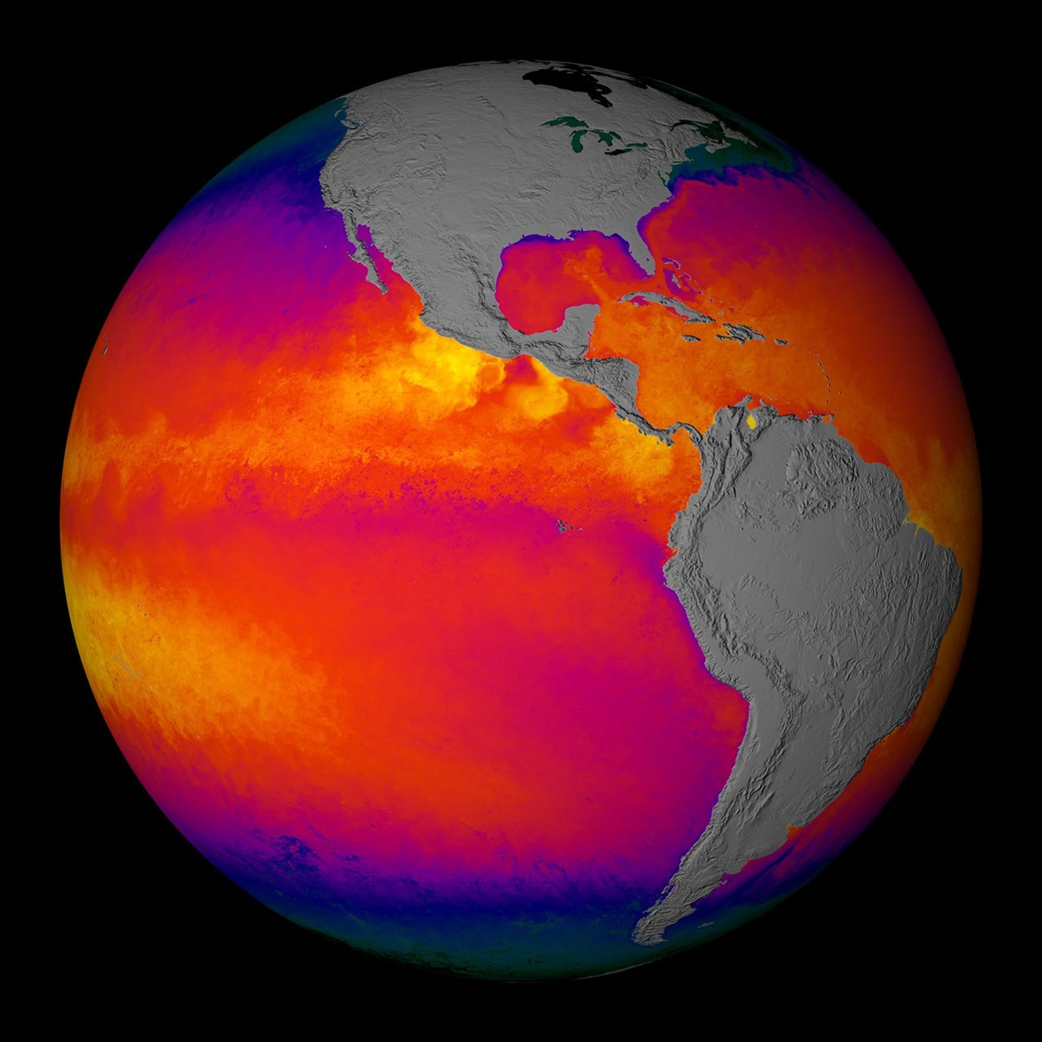
A new sensor orbiting the Earth aboard NASA’s satellite is nowcollecting the most detailed measurements ever made of the sea’s surfacetemperature every day all over the globe. Like a sophisticatedthermometer in space, the Moderate-resolution Imaging Spectroradiometer(MODIS) is helping Earth scientists advance studies of how our world’soceans and atmosphere interact in ways that drive weather patterns and,over the long term, define our climate.
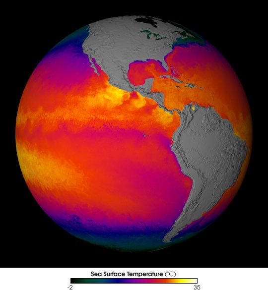
The image above shows cold water upwelling near the coast of Peru(purple) and joining the South Equatorial Current, which flows westwardacross the Pacific Ocean. This MODIS sea surface temperature image from January 1–8, 2001shows the ocean in normal conditions, but during an El Niño the watersoff Peru are much warmer. Cold waters are black and dark green. Blue,purple, red, yellow, and white represent progressively warmer water.
For more information, high-res images, and animations, see: Terra Measures Sea Surface Temperature with Unprecedented Detail.
References & Resources
Image by Jesse Allen, based on data provided by the MODIS OCEAN Team and the University of Miami Rosenstiel School of Marine and Atmospheric Science Remote Sensing Group