![Request for Information – Potential [Placeholder for Prize]](https://assets.science.nasa.gov/dynamicimage/assets/science/psd/solar/2023/09/s/solarsystem_0.jpg?w=1024)


December 31, 2017
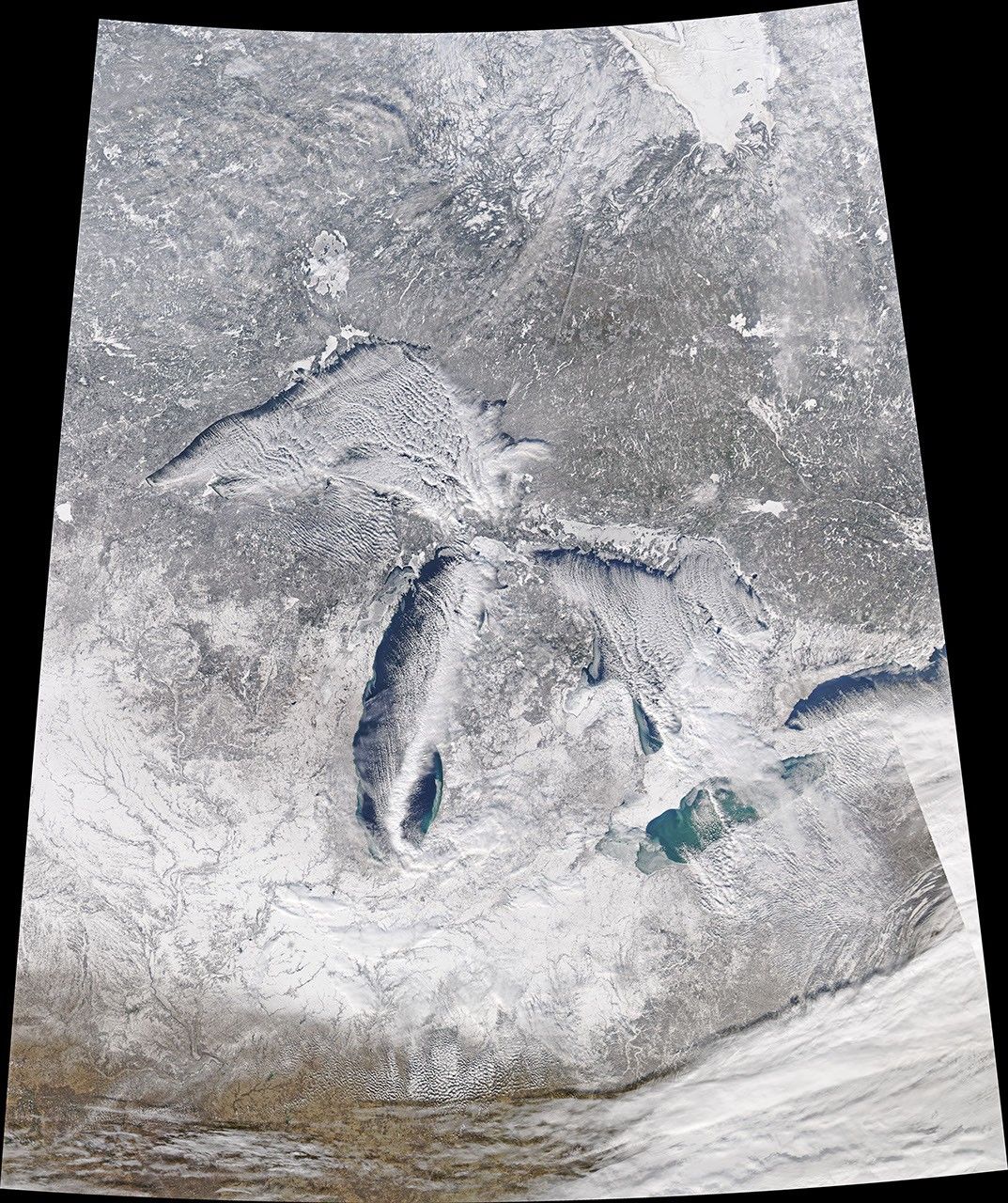
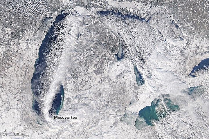
On December 31, 2017, the Moderate Resolution Imaging Spectroradiometer (MODIS) on NASA’s Aqua satellite captured this image of a strong band of lake-effect snow moving across Lake Michigan. The snow was amplified by the emergence of a mesovortex, a rotational feature that moved south over the length of the lake. This meteorological feature dropped more than a foot of snow in parts of Indiana.
References & Resources
- CIMSS Satellite Blog (2017, December 31) Lake Michigan Mesovortex. Accessed January 2, 2018.
- National Weather Service (2017, December 31) Heavy Lake Effect Snow December 31st, 2017. Accessed January 2, 2018.
- Forbes (December 31, 2017) Record-Shattering Lake Effect Snow In The Great Lakes Region. How Does It Form?
- Penn State Lake-Effect Snow. Accessed January 2, 2018.
- Grim, J. & Laird, N. (2004) Mesoscale Vortices Embedded within a Lake-Effect Shoreline Band. Monthly Weather Review.
NASA Earth Observatory image by Joshua Stevens, using MODIS data from LANCE/EOSDIS Rapid Response . Caption by Adam Voiland.