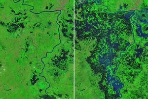
On October 29, 2024, a period of intense rainfall inundated Valencia province in eastern Spain. The extensive, deadly flooding destroyed infrastructure and spurred massive search and rescue efforts.
The downpours kept coming as a high-altitude, low-pressure weather system remained parked over the region. These systems, known as cut-off lows or locally by the Spanish acronym DANA, develop when cold fronts encounter warm, humid air masses and become isolated from the jet stream. In the days following the Valencia flash floods, rain continued to fall in Spain’s eastern coastal regions as well as its southwest, causing yet more flooding and disrupting transportation, classes, and other activities.
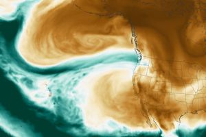
This map shows rainfall accumulation totals from October 29 through November 4, 2024. These data are remotely sensed estimates that come from IMERG (the Integrated Multi-Satellite Retrievals for GPM), a product of the GPM (Global Precipitation Measurement) mission, and may differ from ground-based measurements. For instance, IMERG data are averaged across each pixel, meaning that rain-gauge measurements within a given pixel can be significantly higher or lower than the average.
Ground-based measurements by Spain’s meteorological agency, AEMET, indicated that rainfall totals exceeded 300 millimeters (12 inches) in some areas of Valencia province on October 29 alone. A few days later, on November 1, Huelva province in southwest Spain saw torrential rains; 134 millimeters (5 inches) fell in the city of Cartaya in a 12-hour period. AEMET also issued warnings and reported strong storms along the Mediterranean coast on November 2 and 3.
Next, the heavy rains migrated north, and 150 millimeters (6 inches) fell in Barcelona by noon on November 4. Barcelona’s airport cancelled and diverted flights on that day due to flooding, and train services and schools were also suspended.
Cut-off low-pressure weather systems are typical in this region in autumn because intrusions of cold air from the Arctic encounter remaining surface heat from the Mediterranean summer. Storm systems of the same type drenched Spain and Greece in September 2023.
References & Resources
- AEMET (2024, November) Latest weather data, Spain. Accessed November 5, 2024.
- Associated Press (2024, November 4) Heavy rains in Barcelona disrupt rail service as troops search for more flood victims in Valencia. Accessed November 5, 2024.
- El País (2024, November 4) Barcelona on red alert for severe weather: Flights canceled and trains suspended. Accessed November 5, 2024.
- MeteoAlarm Spain. Accessed November 5, 2024.
- NASA Earthdata Floods. Accessed November 5, 2024.
- NASA Earth Observatory (2024, November 1) Valencia Floods. Accessed November 5, 2024.
- NASA Earth Science Applied Sciences Understanding Flood Exposure. Accessed November 5, 2024.
- The New York Times (2024, November 4) An Angry Spain, Still Reeling From Floods, Faces More Rain. Accessed November 5, 2024.
- World Meteorological Organization (2024, October 31) Devastating rainfall hits Spain in yet another flood-related disaster. Accessed November 5, 2024.
NASA Earth Observatory image by Michala Garrison, using IMERG data from the Global Precipitation Mission (GPM) at NASA/GSFC. Story by Lindsey Doermann .


