![Request for Information – Potential [Placeholder for Prize]](https://assets.science.nasa.gov/dynamicimage/assets/science/psd/solar/2023/09/s/solarsystem_0.jpg?w=1024)


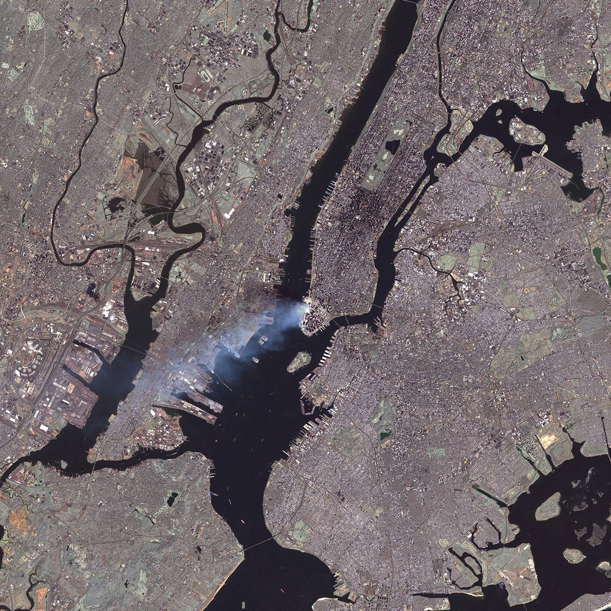
This true-color image was taken by the Enhanced Thematic Mapper Plus (ETM+) aboard the Landsat 7 satellite on September 12, 2001, at roughly 11:30 a.m. Eastern Daylight Savings Time.
<!-- LINK NO LONGER VALIDVisit the USGS Landsat 7 site for additional Landsat imagery,-->Visit the NASA home page for photos from the space station and MODIS, and GlobalSecurity.org for images from other satellites.
References & Resources
Image courtesy USGS Landsat 7 team, at the EROS Data Center.