


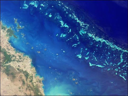
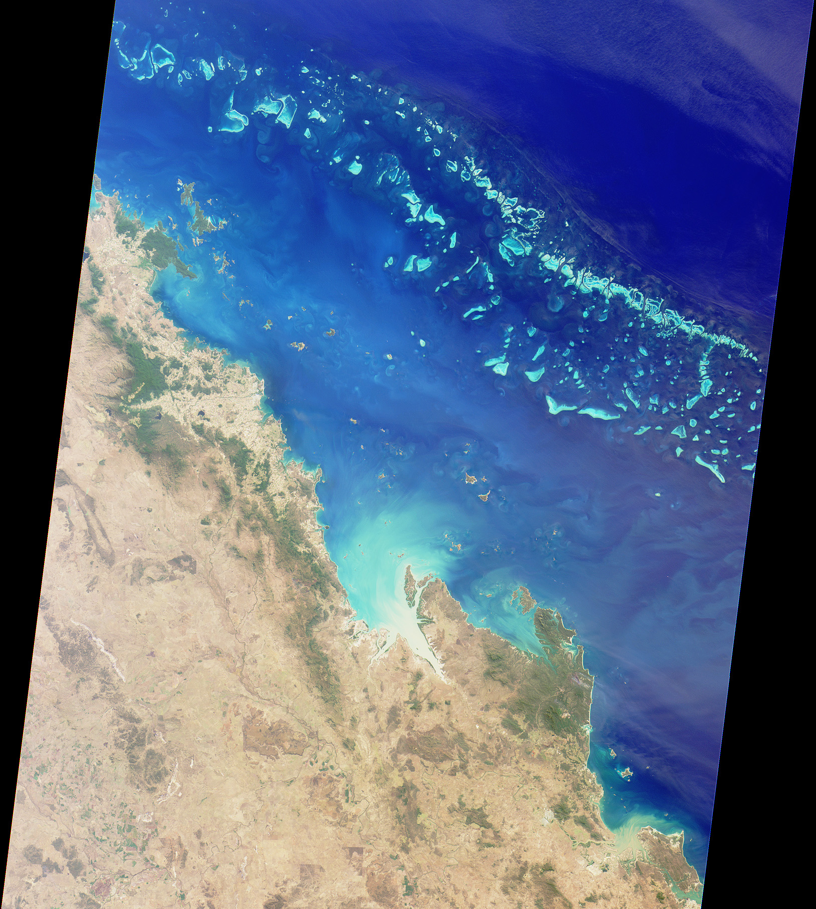
The Great Barrier Reef extends for 2,000 kilometers along thenortheastern coast of Australia. It is not a single reef, but a vastmaze of reefs, passages, and coral cays (islands that are part of thereef). This nadir true-color image was acquired by the Multi-angleImaging Spectroradiometer (MISR) instrument on August 26, 2000, and shows part of the southernportion of the reef adjacent to the central Queensland coast. The widthof the MISR swath is approximately 380 kilometers, with the reef clearlyvisible up to approximately 200 kilometers from the coast. It may bedifficult to see the myriad details in the browse image, but if youretrieve the higher resolution version,a zoomed display reveals the spectacular structure of the many reefs.
The more northerly coastal area in this image shows the vast extent ofsugar cane cultivation, this being the largest sugar producing area inAustralia, centered on the city of Mackay. Other industries in the areainclude coal, cattle, dairying, timber, grain, seafood, and fruit. Thelarge island off the most northerly part of the coast visible in thisimage is Whitsunday Island, with smaller islands and reefs extendingsoutheast, parallel to the coast. These include some of the better knownresort islands such as Hayman, Lindeman, Hamilton, and Brampton Islands.
Further south (in the high-resolutionversion), just inland of the small semicircular bay near the rightof the image, is Rockhampton, the largest city along the centralQueensland coast, and the regional center for much of centralQueensland. Rockhampton is just north of the Tropic of Capricorn. Itshinterland is a rich pastoral, agricultural, and mining region.
References & Resources
Image courtesy NASA/GSFC/LaRC/JPL, MISR Team.


