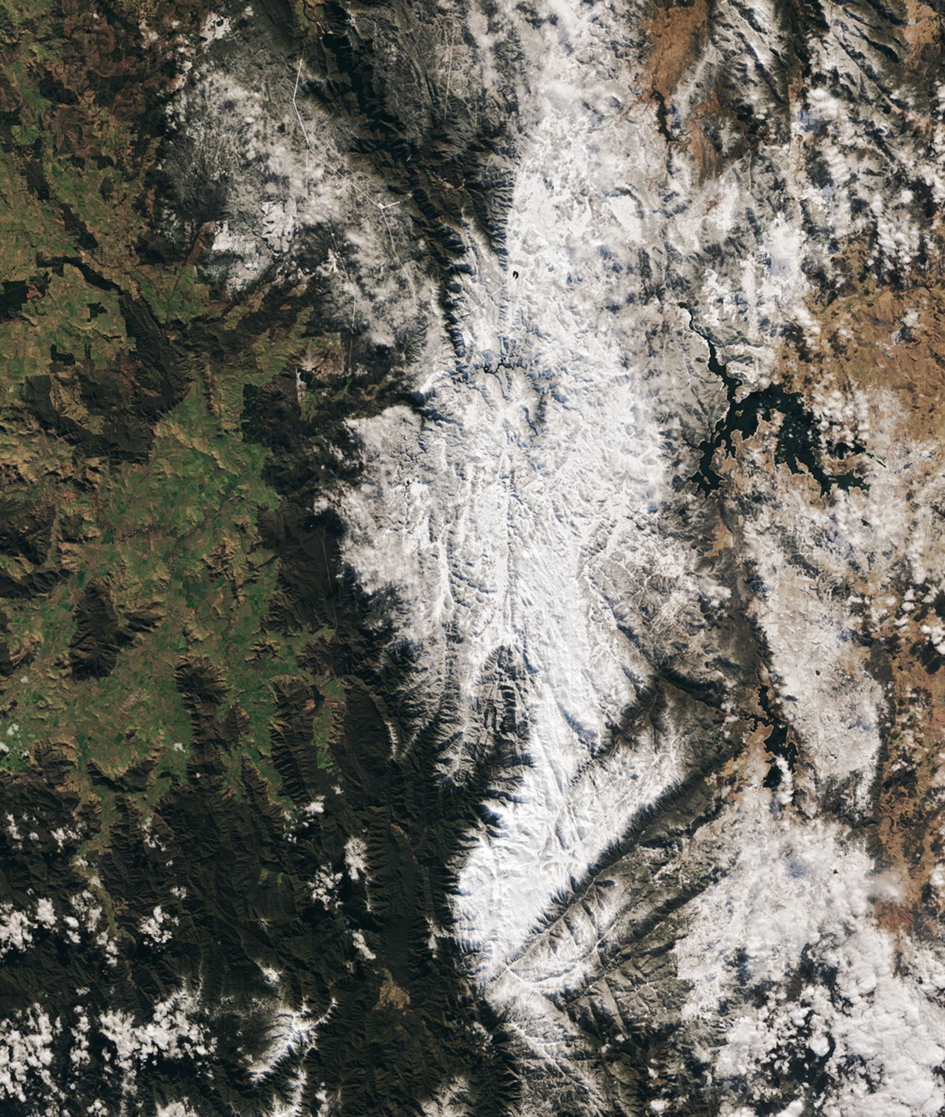

Winter made a bold—if late—entrance to the mountains in southeastern Australia. Much to the delight of skiers Down Under, a period of seasonal weather in July 2024 brought significant accumulations to the Snowy Mountains in New South Wales.
The OLI (Operational Land Imager) on Landsat 8 captured this wintry image of Australia’s Snowy Mountains on July 28. Part of the Australian Alps, the range is home to the country’s tallest peaks, including Mount Kosciuszko at 2,228 meters (7,310 feet), as well as several popular ski resorts. Peak snow season in this region usually lasts from June to August, although snow commonly falls at higher elevations in May and can linger through October.
Winter got off to a slow start in the Snowy Mountains in 2024, however. Slopes were mostly bare for the traditional opening of the ski season in early June, according to news reports. Meteorologists attributed the lack of snow to blocking highs, or strong high pressure systems, that persisted over the Great Australian Bight.
Weather patterns changed on July 19, and heavy snow reached the mountains. On July 21, the Thredbo ski resort reported that 59 centimeters (23 inches) of snow had fallen during the storm. Smaller accumulations came in subsequent days. Starting July 28, a strong cold front delivered “unusually low” temperatures to parts of New South Wales and yet more snow to the mountains. According to news reports, some of Australia’s extreme winter weather in 2024 was influenced by a rare sudden stratospheric warming event over the Antarctic.
Variable snow years are the norm in the Australian Alps, according to the Australian Bureau of Meteorology. Climate patterns such as El Niño, La Niña, and the Indian Ocean Dipole modulate each winter’s snowpack. Despite the significant year-to-year variability, long-term observations point to a thinning alpine snowpack. Maximum snow depth has trended down since the late 1950s, the agency reported, adding that the declines are linked with warming trends. The annual average temperature has risen about 1.4 degrees Celsius (2.5 degrees Fahrenheit) in the region since 1950.
References & Resources
- ABC News (2024, July 26) Record 50C temperature increase over Antarctica to shift Australia’s weather patterns. Accessed August 1, 2024.
- Australian Bureau of Meteorology (2023, June 2) How climate drivers affect Australia’s snow season. Accessed August 1, 2024.
- Australian Bureau of Meteorology (2022) State of the Climate 2022. Accessed August 1, 2024.
- CSIRO (2024, June 11) Climate concerns: Trends in Australian snow. Accessed August 1, 2024.
- The Guardian (2024, July 20) ‘Magical wintry scenes’: snow ‘just keeps coming’ at Australian ski resorts. Accessed August 1, 2024.
- The Guardian (2024, May 23) Snow worries: Australia’s ski resorts turn to snowmakers with slopes bare ahead of winter. Accessed August 1, 2024.
- The Watchers (2024, July 29) Cold wave alert as Australians face record-low temperatures, widespread frost outbreak. Accessed August 1, 2024.
- Weatherzone (2024, July 29) Cold snap sending shivers across southeastern Australia. Accessed August 1, 2024.
NASA Earth Observatory image by Michala Garrison, using Landsat data from the U.S. Geological Survey . Story by Lindsey Doermann .