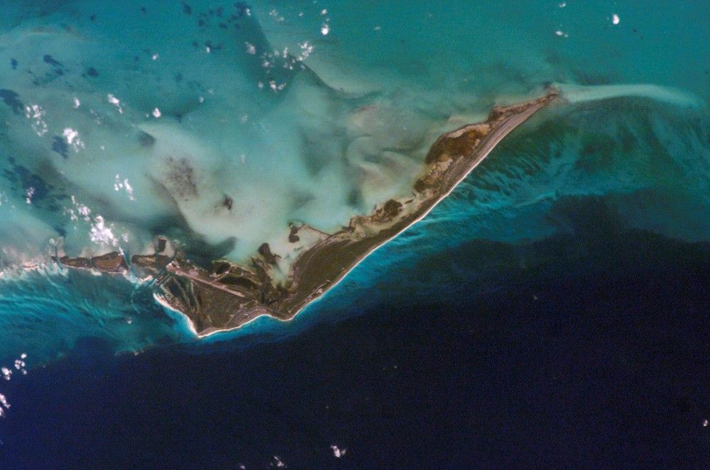

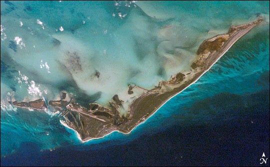
Cayo Largo del Sur, also known simply as Cayo Largo, is alittle island no more than 25 kilometers (15.5 miles) long and 3kilometers (1.9 miles) wide. It is the second-biggest island inCuba’s Canarreos Archipelago. Christopher Columbus is said to havevisited the island on his second expedition in 1494, and Sir Francis Drakemay have also stopped on the island during his circumnavigation of theglobe. Pirates also likely used the island as a base. Today, pristinebeaches, scuba diving, and wildlife draw tourists to the island, but nopeople live there permanently; locals who work in the hotels stay forabout 20 days, then return to their families on nearby islands.
Shallow water surrounds Cayo Largo, evidenced by the lighter shade ofblue around the island’s perimeter. While the water south of theisland appears clear enough to reveal the underlying ocean floor,the water on the north side of the island is cloudy. This cloudy waterindicates that sediment is washing off the land surface and into thewater or is being stirred up from the shallow sea floor.
Cayo Largo is a limestone island, formed over millions of years fromthe remains of marine organisms, such as the ones that build coral reefs.Living coral reefs form one more attraction for tourists on this island,although coralbleaching has stressed some reef communities in the Caribbean. Thenorthern coast of Cayo Largo consists largely of mangroves and saltpans.
References & Resources
Astronaut photograph ISS012-E-8962 was acquired November 24, 2005, with a Kodak 760C digital camera using an 180 mm lens, and is provided by the ISS Crew Earth Observations experiment and the Image Science & Analysis Group, Johnson Space Center. The International Space Station Program supports the laboratory to help astronauts take pictures of Earth that will be of the greatest value to scientists and the public, and to make those images freely available on the Internet. Additional images taken by astronauts and cosmonauts can be viewed at the NASA/JSC Gateway to Astronaut Photography of Earth.