For more than 10 years, students from around the world have been participating with NASA in a science project called Students Cloud Observations Online, or S’COOL, for short. January 13, 2009, marks the twelfth anniversary of the launch of the educational collaboration, in which students record cloud type, cover, height, and thickness at times that coincide with satellite overpasses. They submit their observations to NASA via the Web, providing scientists with information they can use to spot check the accuracy of some kinds of cloud data from satellites.
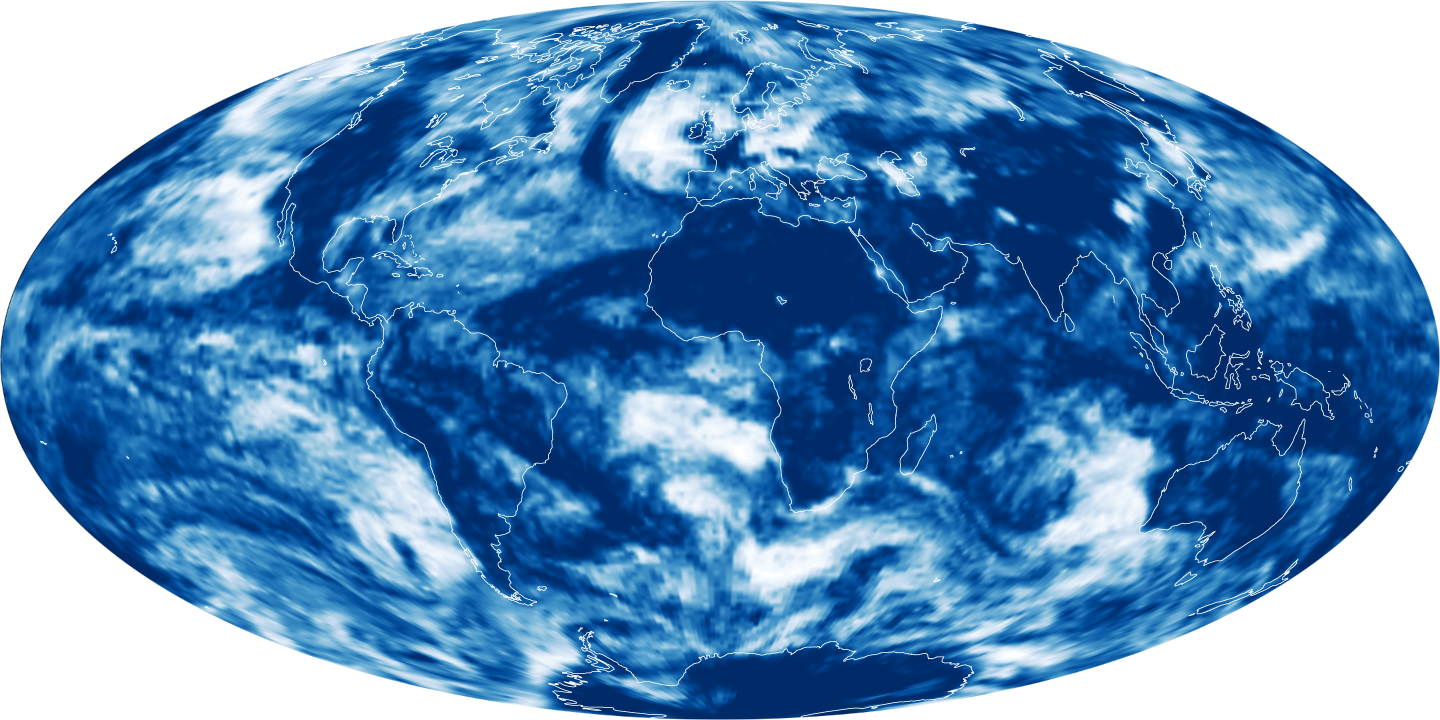
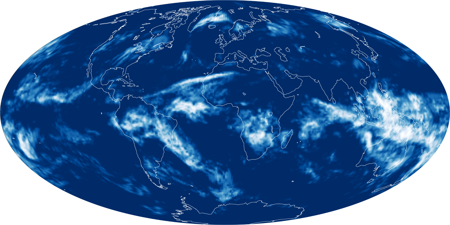
Cloud fraction, the percent of the sky within a set area that is cloud covered, is one type of satellite cloud data for which students are making matching observations. The top map shows low-altitude cloud fraction, while the bottom image shows high-altitude cloud fraction. Areas of clear skies are blue, while areas that were 100 percent cloudy are white. Each map combines observations from the CERES sensors on NASA's Terra and Aqua satellites collected on December 27, 2008. (Terra crosses southward over the equator in the morning. Aqua crosses northward over the equator in the afternoon. Together, they provide a global picture of Earth’s cloudiness each day.)
Low clouds were more common over the ocean than over land, with the cloud-free skies over Earth’s driest areas standing out most prominently: the Sahara, southwest Asia and the Tibetan Plateau, Australia, and Antarctica. High-altitude cloud cover was patchier. A streak of high clouds penetrated the western Sahara from the Atlantic Ocean, and a river of high clouds meandered southeast from the heart of South America into the southern Atlantic. Only over the western Pacific was there widespread high-altitude cloud cover.
Clouds are important to map because they have a major influence on how much sunlight the Earth absorbs and reflects as well as how freely heat radiated from the surface of the Earth can escape to space. Clouds that reflect sunlight cool the Earth, while clouds that trap outgoing heat warm the Earth. Which influence is stronger depends on the kind of cloud (water or ice), the cloud height (low altitude or high altitude), the time of day when the cloud forms, and numerous other variables. Being able to map the amount and height of clouds from satellites is a key part of scientists’ efforts to understand and predict climate change.
Further Reading
- S’COOL Project Website
- Arctic Reflection: Clouds Replace Snow and Ice as Solar Reflector
- Arbiters of Energy
- Global Maps: Cloud Fraction
References & Resources
NASA images created by Jesse Allen, using CERES FLASHFlux data provided courtesy of FLASHFlux team at NASA’s Langley Research Center. Caption by Rebecca Lindsey.