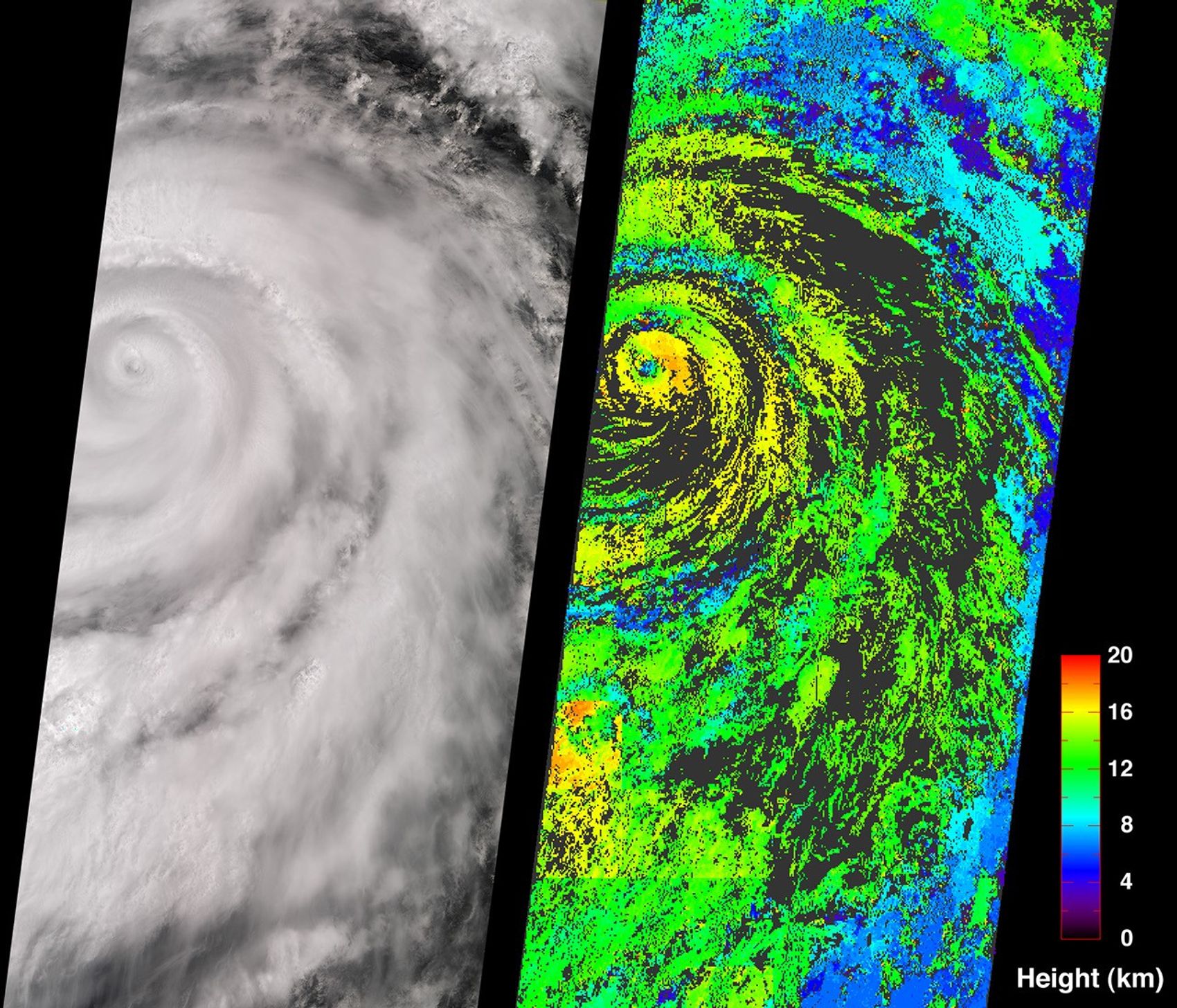
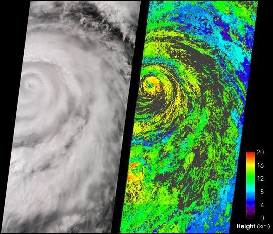
A classical intense hurricane is shown in this view of Juliette,captured by the Multi-angle Imaging SpectroRadiometer (MISR) on September 26,2001.
On the left is a true-color image produced by MISR’s nadir(vertical-viewing) camera. Impressive spiral arms wrapped around the eyeare apparent. Several areas of convective cloud can be discerned alongthe arms. The eye of the storm is centered at 18.8N latitude and 109.8Wlongitude (about 480 kilometers south of Cabo San Lucas, Mexico). On theright is the cloud-top height field derived using automated computerprocessing of the data from multiple MISR cameras. Relative heightvariations are well represented, such as the clearing within the storm’seye. The stereoscopic data processing algorithm used to generate theseresults is still being refined. Future versions of this product may showmodest changes in the height values compared to the preliminary valuesdisplayed here. Areas where heights could not be retrieved are shown indark gray. The observations cover a 380-kilometer swath width.
On September 25, Air Force reconnaissance aircraft recorded minimumsea level pressures of 923 millibars—the lowest measurement for aneastern North Pacific hurricane since 1973. According to the NationalHurricane Center, deep convection surrounding Juliette’s eye began toweaken on the morning of September 26. The strength of this potentiallydangerous hurricane continued to diminish over the next few days as thestorm approached cooler waters. It travelled in a north-northwestdirection over the Pacific Ocean until reaching the tip of BajaPeninsula, where the heaviest rainfall and winds were confined. Juliettewas downgraded to a tropical storm on September 29, and to a tropicaldepression on September 30. The National Hurricane Center predictedJuliette’s cyclonic circulation to be mostly dissipated by October4.
References & Resources
Image courtesy NASA/GSFC/LaRC/JPL, MISR Team.