


Full image (412 K)
Anaglyph [3 dimensional image (476 K)]
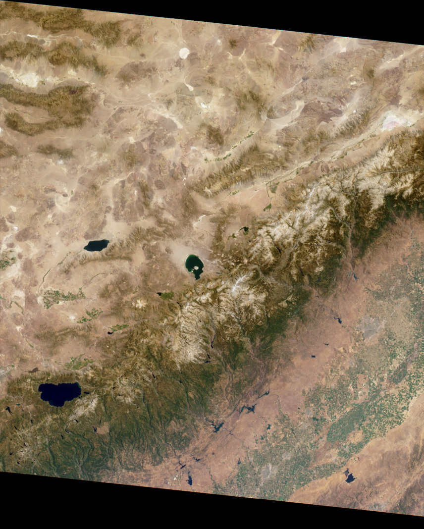
This Multi-angle Imaging Spectroradiometer (MISR) image of theSierra Nevada mountains near the California-Nevada border was acquiredon August 12, 2000. MISR's vertical-viewing (nadir) camera producedthe image.
A stereo "anaglyph" created using the nadir and45.6-degree forward-viewing cameras provides a three-dimensional viewof the scene when viewed with red/blue glasses. The red filter should beplaced over your left eye.
To facilitate the stereo viewing, the imageshave been oriented with north toward the left.Some prominent features are Mono Lake, in the center of the image;Walker Lake, to its left; and Lake Tahoe, near the lower left. This viewof the Sierra Nevadas includes Yosemite, Kings Canyon, and SequoiaNational Parks. Mount Whitney, the highest peak in the contiguous 48states (elev. 14,495 feet), is visible near the righthand edge. Above it(to the east), the Owens Valley shows up prominently between the SierraNevada and Inyo ranges.
Precipitation falling as rain or snow on the Sierras feeds numerousrivers flowing southwestward into the San Joaquin Valley. The abundantfields of this productive agricultural area can be seen along the lowerright; a large number of reservoirs that supply water for cropirrigation are apparent in the western foothills of the Sierras. Urbanareas in the valley appear as gray patches; among the California citiesthat are visible are Fresno, Merced, and Modesto.
References & Resources
Image courtesy NASA/GSFC/JPL, MISR Science Team.
None


