


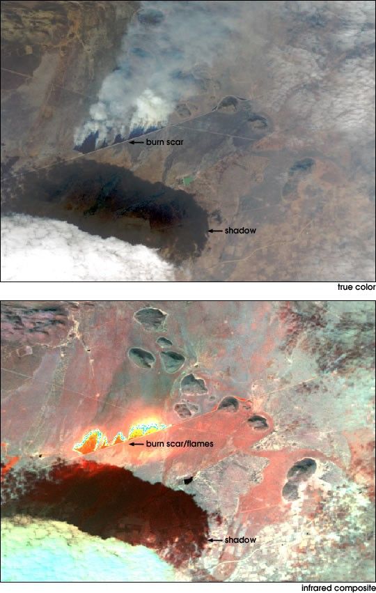
The MODIS Airborne Simulator [MAS (MODIS stands for Moderate Resolution Imaging Spectroradiometer, an instrument aboard the Terra satellite)] took this image of a controlled burn in the Madikwe Game Reserve,South Africa on August 20, 2000. The true color image (top) shows plumes of smoke blown in front of the advancing flames, and a developing burn scar. The infrared composite image (bottom) sees through the smoke to reveal the hot flames(yellow) and the still-warm ground of the burn scar (orange).
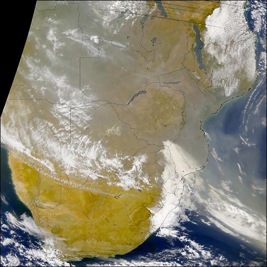
Scientists will use this and other data collected during the SAFARI 2000 field campaign, combined with data from the Terra satellite, to learn more about the ecosystems of Southern Africa,and the seasonal changes that occur there.
Related images from SAFARI 2000: the ER-2 aircraft that carries the MAS, another MAS image, setting a controlled burn, and Smoke in Southern Africa.
References & Resources
Images courtesy NASA/SAFARI 2000
None


