
























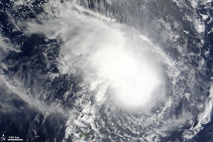
Tropical Cyclone Gael in the southern Indian Ocean was captured in this natural-color image from the Moderate Resolution Imaging Spectroradiometer (MODIS) on NASA’s Terra satellite on February 4, 2009. The storm has the appearance of a nautilus: a tight ball of clouds (lower right) with “ridges” of clouds streaking out in rays from the core of the storm. The clockwise spiral of winds flowing into the storm (the typical pattern for Southern Hemisphere cyclones) is not dramatic, suggesting the system is not particularly well organized. The small island of Mauritius is located at bottom of the image, left of center. The storm was headed west-southwest toward Madagascar when this image was captured at 6:35 a.m. local time in Mauritius.
The high-resolution image provided above is at MODIS’ full spatial resolution (level of detail) of 250 meters per pixel. The MODIS Rapid Response System provides this image at additional resolutions.
References & Resources
NASA image by Jeff Schmaltz, MODIS Rapid Response Team, Goddard Space Flight Center. Caption by Rebecca Lindsey.







