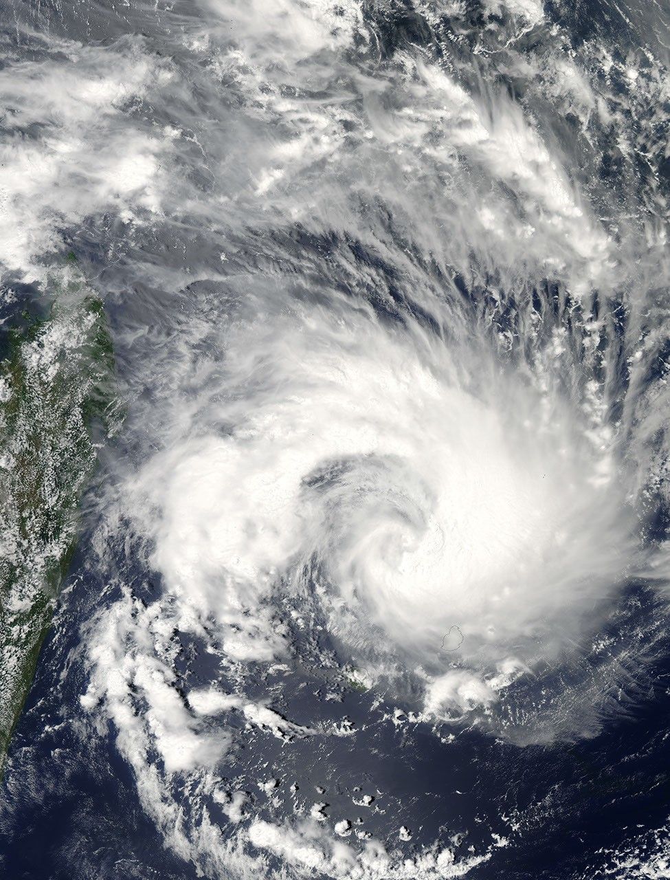
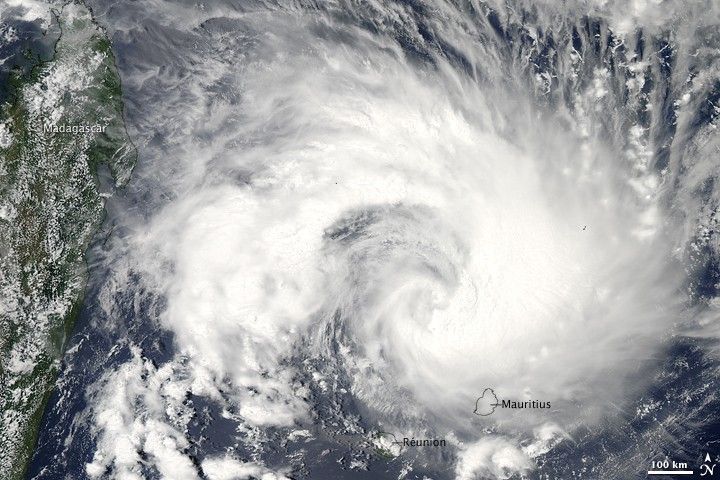
Tropical Cyclone Gael tracked westward across the southern Indian Ocean in early February 2009. The storm grazed the small island of Mauritius, and had approached the central coast of Madagascar on February 5, when this image was captured by the Moderate Resolution Imaging Spectroradiometer (MODIS) on NASA’ Aqua satellite. A wide gap had opened up in the storm west of the eye, but the inward, clockwise spiral of the cloud bands was still apparent. Thunderstorms are embedded in the cloud bands; their high tops seem to boil up from the surrounding clouds. The image was acquired at 2:10 p.m. local time on Reunion Island.
The high-resolution image provided above is at MODIS’ full spatial resolution (level of detail) of 250 meters per pixel. The MODIS Rapid Response System provides this image at additional resolutions.
References & Resources
NASA image by Jeff Schmaltz, MODIS Rapid Response Team, Goddard Space Flight Center.