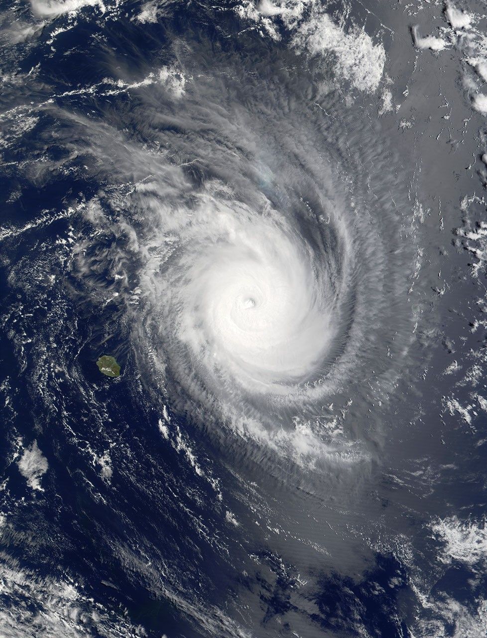
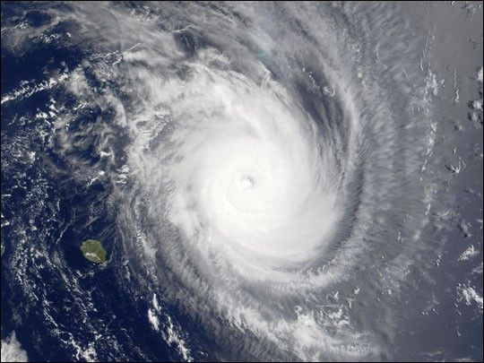
Projected to weaken over the coming day, Tropical Storm Guillaume wasstill going strong in the Indian Ocean in this Moderate-resolutionImaging Spectroradiometer (MODIS) image made fromdata acquired at 10:20 a.m. local time on Tuesday, February 19, 2002.Shown here to the northeast of the French island of Réunion in thesouthwestern Indian Ocean off the coast of Madagascar, the outer bandsof the storm clouds are obscuring the island of Mauritius, northeast ofRéunion.
The storm has been tracking slowly south-southeast, and should weakenas it moves farther south. As of Wednesday morning, February 20, maximumsustained winds were around 140 miles per hour (mph), with gusts of upto 167 mph. Waves in the region were as high 24 feet. January and February are the peakcyclone months in the region, and Mauritius experiences on average aboutten each season.
References & Resources
Image courtesy Jacques Descloitres, MODIS Land Rapid Response Team at NASA GSFC