Suggested Searches

1 min read

Cyclone Ivy

Instruments:
2004-02-25 00:00:00
February 25, 2004

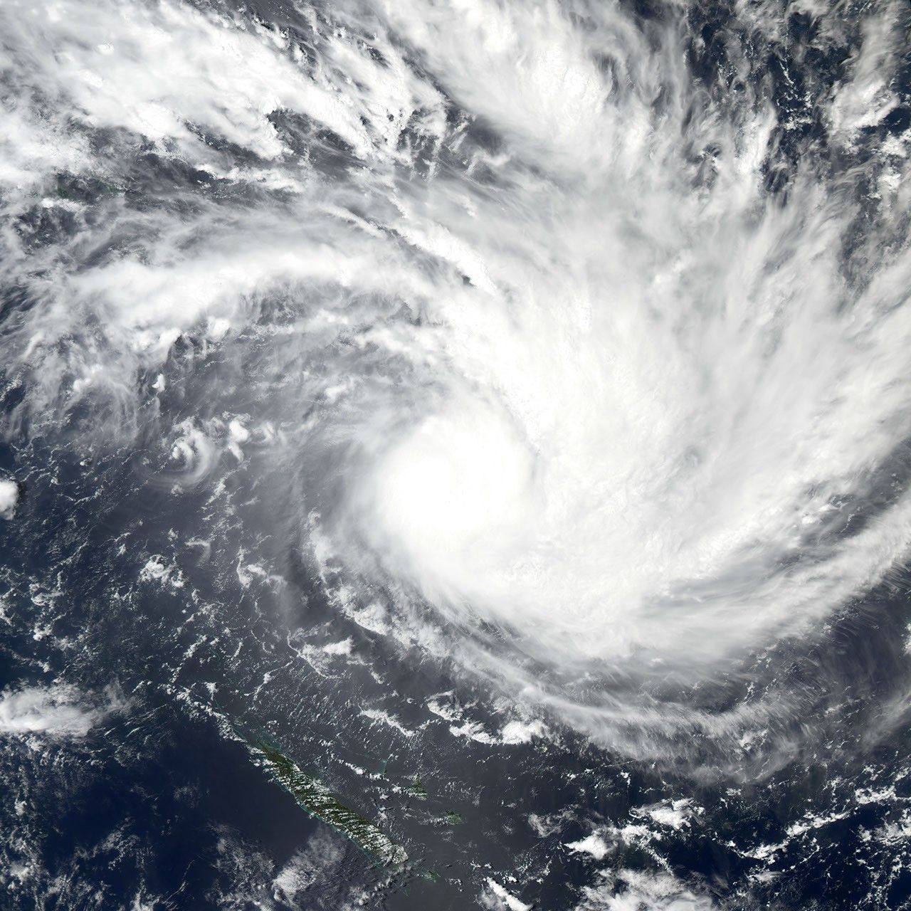
On February 25, Tropical Cyclone Ivy was continuing to gather strength and generate rough seas. In this image Ivy was located about 450 kilometers north of Port Vila, the capital of Vanuatu, and was moving west-southwest at six knots. The cyclone had maximum sustained winds of 75 knots and gusts to 90 knots and was intensifying.

References & Resources

Image courtesy of Jesse Allen, NASA Earth Observatory at NASA Goddard Space Flight Center.

You may also be interested in:

Stay up-to-date with the latest content from NASA as we explore the universe and discover more about our home planet.

A Northwest Night Awash in Light
3 min read

The glow of city lights, the aurora, and a rising Moon illuminate the night along the northwest coast of North…

Article
The Potomac Island Where History Took Flight
4 min read

Samuel Pierpont Langley conducted the first successful flight of an unpiloted, engine-driven, heavier-than-air craft from a houseboat near Chopawamsic Island…

Article
Rings of Rock in the Sahara 
3 min read

In southeastern Libya, Jabal Arkanū’s concentric rock rings stand as relics of past geologic forces that churned beneath the desert.

Article