![Request for Information – Potential [Placeholder for Prize]](https://assets.science.nasa.gov/dynamicimage/assets/science/psd/solar/2023/09/s/solarsystem_0.jpg?w=1024)


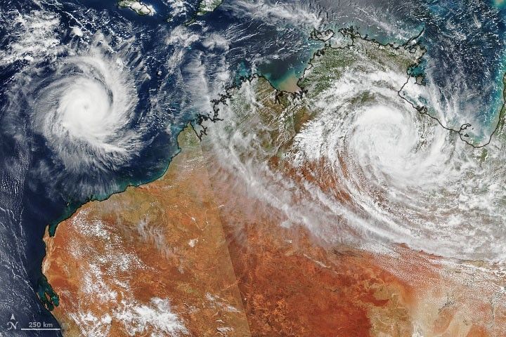
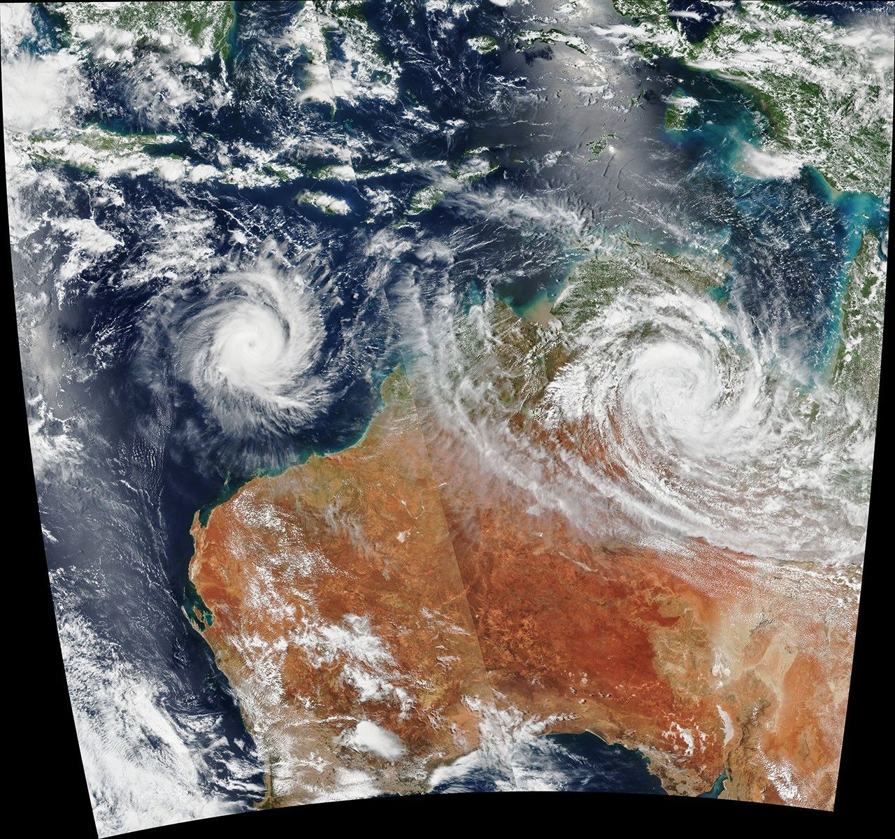
On February 25, 2020, the Visible Infrared Imaging Radiometer Suite (VIIRS) on the NOAA-NASA Suomi NPP satellite acquired the data for this natural-color image of tropical cyclones Ferdinand and Esther as they passed over and near Australia. (Note that the line across the left side of the image marks the edge of the swath between two satellite passes that occurred about 90 minutes apart.)
Esther made landfall on February 24 along the Carpentaria Coast between Queensland and Northern Territory. Though downgraded to a tropical depression, the storm system is expected to continue dumping heavy rain on Northern Territory and Western Australia. Cyclone Ferdinand formed on February 23 between Australia and Indonesia and has intensified to a category 2 storm. However, it is expected to continue tracking westward over the Indian Ocean and is not likely to make landfall.
References & Resources
NASA Earth Observatory image by Joshua Stevens, using VIIRS data from NASA EOSDIS/LANCE and GIBS/Worldview and the Suomi National Polar-orbiting Partnership. Text by Michael Carlowicz.