

August 5, 2014
Dam Breach at Mount Polley Mine in British Columbia
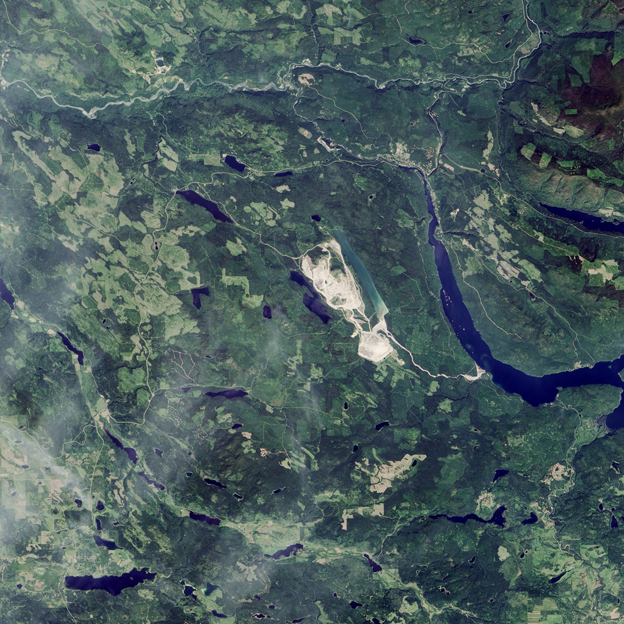
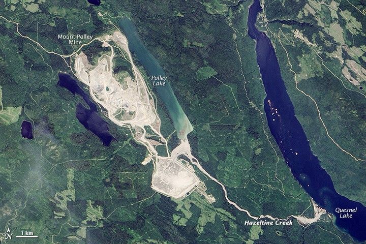
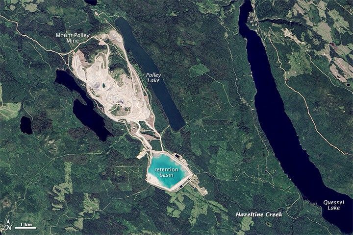
An earthen dam at Mount Polley Mine in British Columbia breached on August 4, 2014, sending contaminated water surging into nearby lakes. Wastewater and metal-laden sand spilled from a retention basin and triggered a water-use ban in Likely, British Columbia, and other nearby towns. Local authorities had lifted the ban as of August 12.
The Operational Land Imager (OLI) on Landsat 8 captured a view of the aftermath (top) on August 5, 2014. For comparison, the lower image shows the mine and the surrounding landscape on July 29, 2014, before the dam failed. Turn on the comparison tool to slide between the two images.
On August 5, nearly all of the wastewater in the retention basin had drained, exposing the silty bottom. Hazeltine Creek, normally about 1 meter (3 feet) wide, swelled to a width of 150 meters (490 feet) as a result of the spill. In the aftermath of the flood, a layer of brown sediment coated forests and stream valleys affected by the spill. Notice how much forest immediately north of the retention basin was leveled. Debris, mainly downed trees, are visible floating on Quesnel Lake. (Note that some of the variations in colors between the two images are caused by different lighting conditions and viewing angles.)
The breach released more than 10 million cubic meters (350 million cubic feet) of water and 4.5 million cubic meters (150 million cubic feet) of sand into Polley and Quesnel Lake, according to estimates from British Columbia’s Ministry of Environment. That is enough water to fill 4,000 Olympic-sized pools.
References & Resources
- CBC (2014, August) Mount Polley mine spill, an aerial view. Accessed August 15, 2014.
- British Columbia Ministry of Environment (2014, August) Mt. Polley Mine Tailings Pond Breach. Accessed August 15, 2014.
- British Columbia Ministry of Environment (2014, August) Mt. Polley Mine Incident. Accessed August 15, 2014.
- The Globe and Mail (2014, August 5) What part of B.C. is affected by the Mount Polley mine waste water spill? Accessed August 15, 2014.
- Mining.com (2014, August 12) Satellite photo shows impact of Mount Polley breach. Accessed August 15, 2014.
- Imperial Metals (2014, August 12) Mount Polley Mine. Accessed August 15, 2014.
NASA Earth Observatory images by Jesse Allen, using Landsat data from the U.S. Geological Survey. Caption by Adam Voiland.