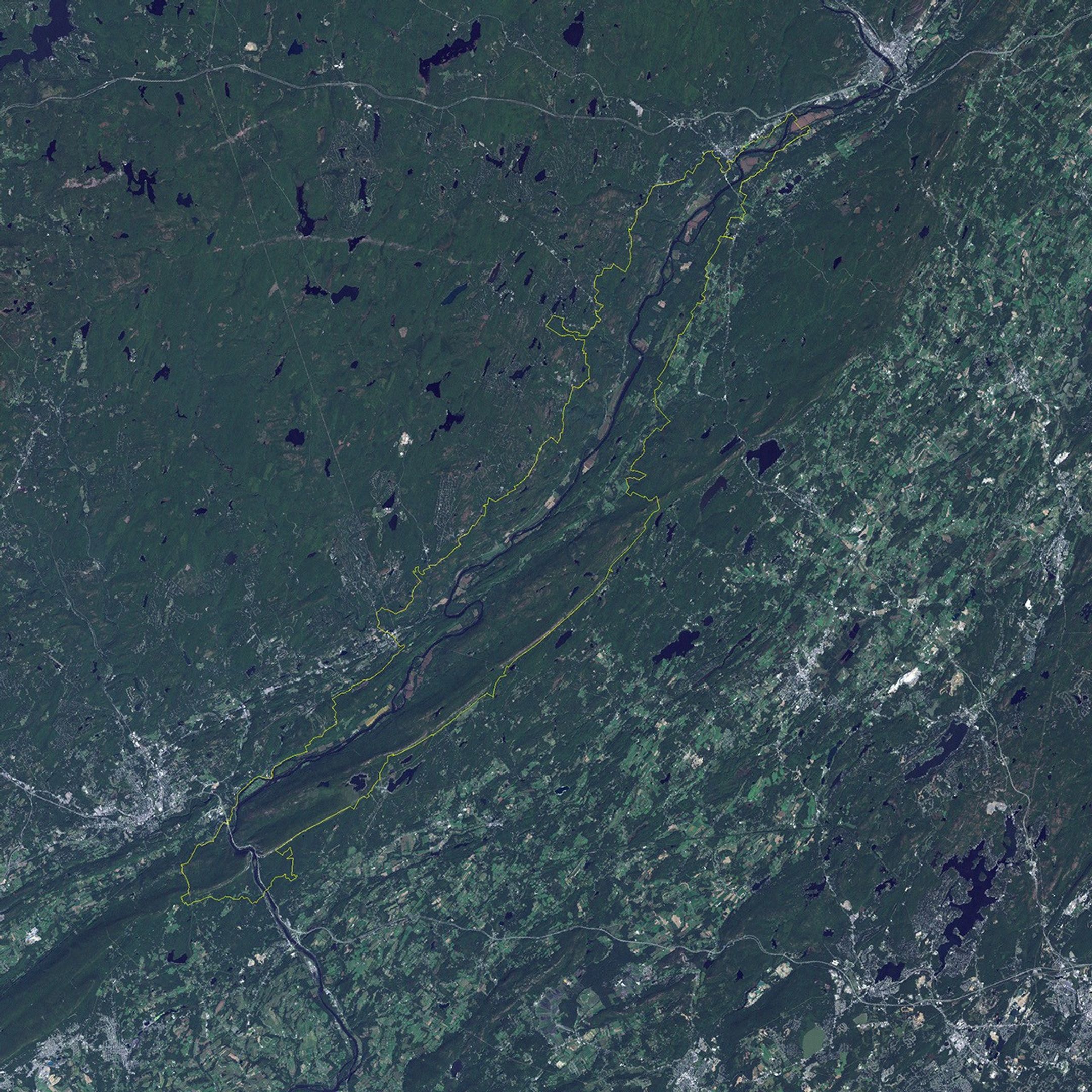
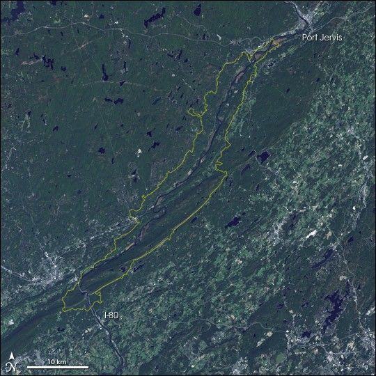
Delaware Water Gap National Recreation Area lies on the border of New Jersey and Pennsylvania. The park runs roughly 40 miles along the Delaware Riverand the Appalachian Mountains, which are immediately adjacent to the river. At its southern end,the river cuts through the Appalachian Range to continue south and east to Philadelphia.This natural water gap cut by the river now also serves as a passage through the mountains forInterstate 80, which runs from New York City just 90 miles away, across the U.S. toSan Francisco.
This image shows the Delaware River running diagonally from northeast (top right) to southwest across the image, taking a sharp turn to form theactual water gap at the park’s southern end. The town of Port Jervis lies just abovethe northern end of the park. The southern end of the park is just beyond the gap through the Appalachians, where Interstate 80 runs immediately beside the river.
The park was created in 1965, under the original name of Tocks Island National Recreation Area, to support recreational use of area. The Army Corp of Engineers was to place a dam across the river to create a 37-mile-long lake holdingnearly 250 billion gallons of water. However, the dam and many of the additional water-management contruction projects wereultimately abandoned in the face of public opposition and cost overruns. Congressde-authorized the project in 1992, though the National Recreation Area around the originalreservoir site has been retained.
The park provides natural shelter for a wide variety of plant and animal life in theshade of its forested hills, and in the waters of its glacial lakes. This includesmany beautiful song birds, eagles, and turkey vultures. The heavily cracked rocksprovide shelter and wintering quarters for a variety of snakes. Other wildlife well-known in the area includes black bears and less welcome guests, such as the hemlock woolyadelgid (a pest which is destroying the park's hemlock tree stands) and gypsy moths(a foreign pest with no native biological controls that denudes forests of their leaf cover).
The park also includes a number of cultural resourcessuch as archaeological remains of Native American settlements in the area fromprehistorical and colonial times, fortifications in the area from the French and IndianWar (1753-1760), as well as evidence of the area’s use as farming and mining land in the 19th century. The Appalachian Trail threads through the length of the park, andthe park’s proximity to such major cities of New York and Philadelphia makes it a populargetaway nature experience.
This natural-colour image wascollected by the Landsat 7 satellite's Enhanced Thematic Mapper Plus (ETM+) instrumenton September 23, 1999.
References & Resources
NASA image created by Jesse Allen, Earth Observatory, using data obtained from the University of Maryland’s Global Land Cover Facility . GIS overlay data was provided by Eric Brown de Colstoun, Landsat Project Science Office.