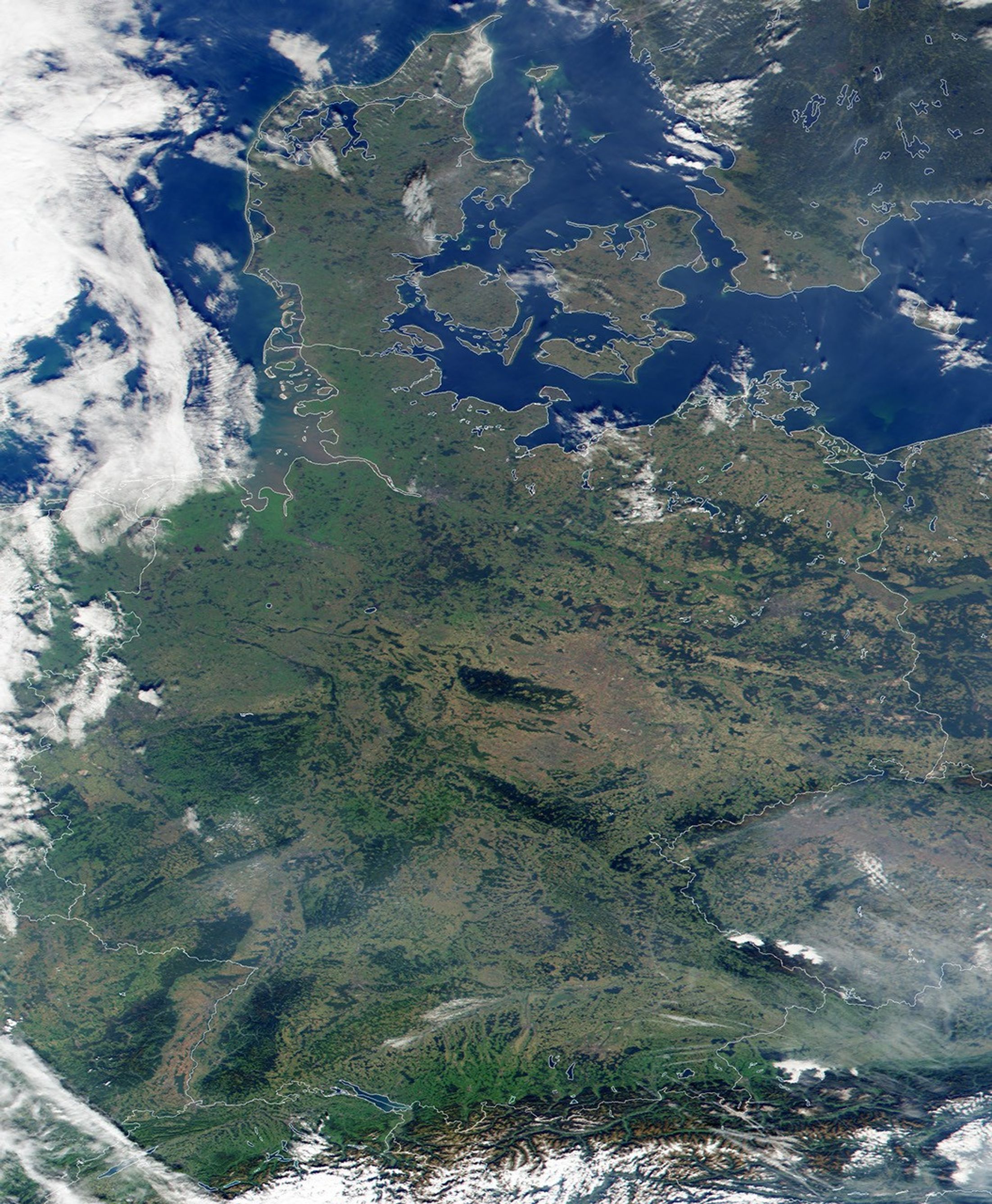


Over the past few hundred years probably no area of the world has seenits borders change as frequently as Central and Eastern Europe. Theregion's latest political boundaries have been superimposed in whiteupon this true-color image of Europe acquired by the Moderate-resolutionImaging Spectroradiometer (MODIS) on September 29, 2000, flying aboard NASA's Terraspacecraft. At the top of the image, one can see the Danish islands ofSjaelland and Fyn, and the Danish mainland. Copenhagen, the capital ofDenmark, is located on Sjaelland, the larger of the islands.
Moving towards the bottom of the image, the Rhine River is snaking itsway north along the border of Germany and France. At Germany's southernedge, the dark brown Alps can be discerned through an uneven layer ofclouds.
References & Resources
Brian Montgomery, Robert Simmon, and Reto Stockli, based on data from the MODIS Science Team