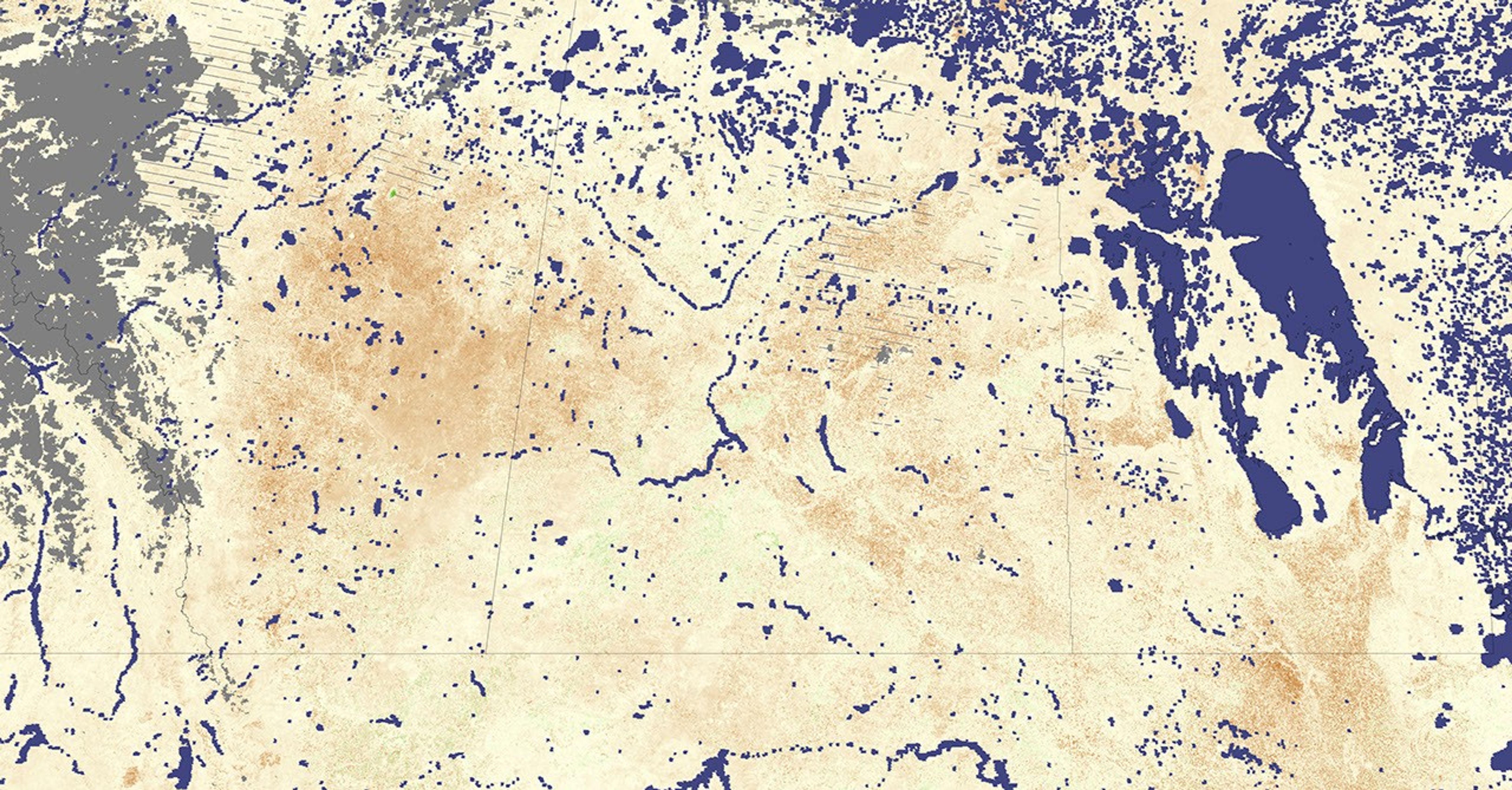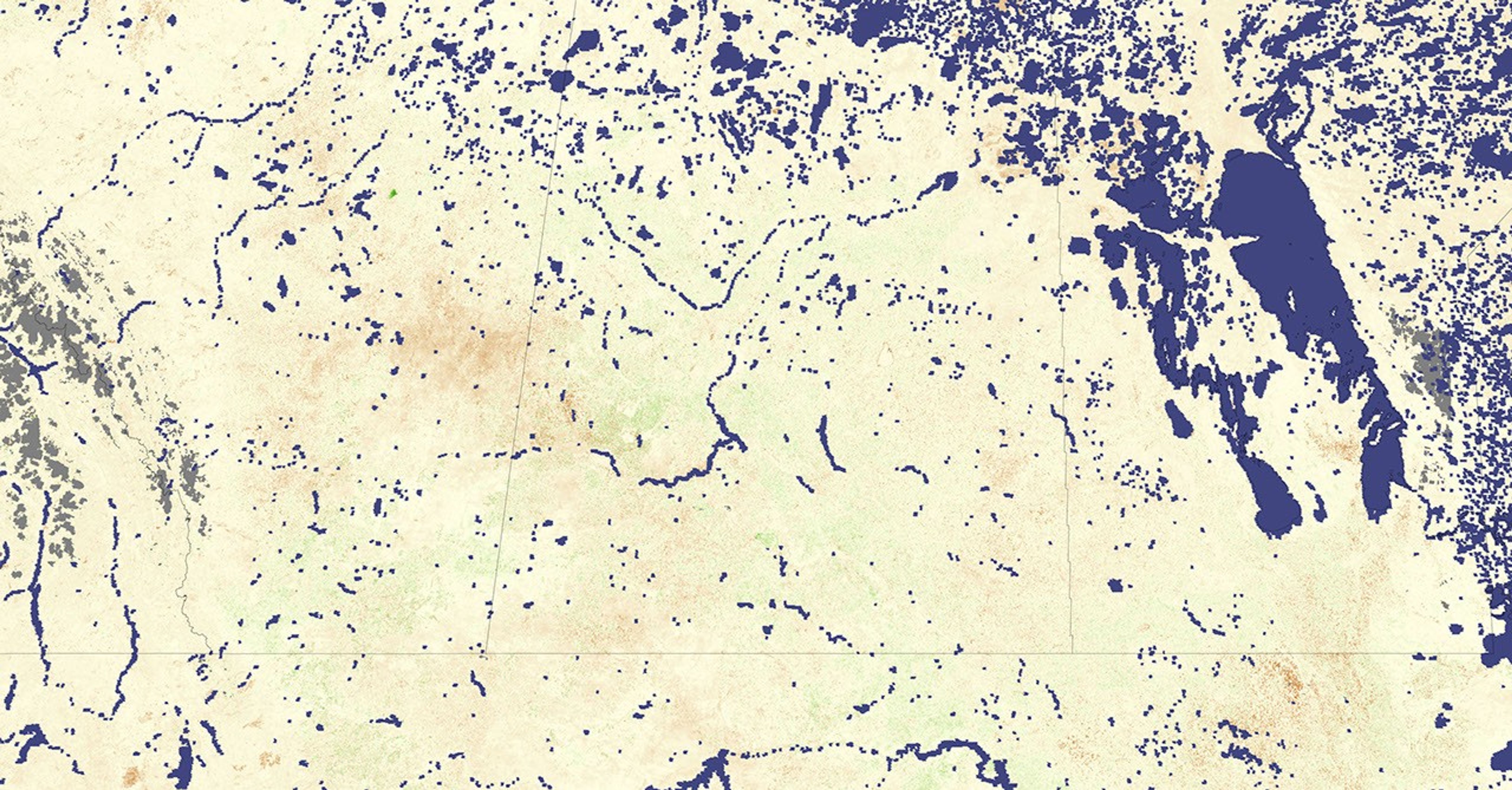
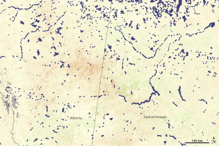
Regional drought hit farmers on the Canadian prairie during the critical period in which grains are planted and begin to develop in the spring and early summer of 2009. These images show the impact of the drought on Alberta and western Saskatchewan between June 26 and July 11 (top) and July 12 and July 27 (bottom). The images are a vegetation index that reflects how much photosynthesis is happening. When plants are growing more than average (based on data from 2000 through 2008), the index is green. Regions in which plants are growing at an average pace are cream colored, and brown areas reflect poor growth. Gray masks out areas where the sensor did not collect data, largely because of persistent clouds.
According to the U.S. Department of Agriculture’s Foreign Agricultural Service, no significant rain had fallen over the Canadian prairie since the harvest of 2008 as of July 10, and June temperatures had been unusually cool. The region produces a quarter of all Canadian wheat and 85 percent of its barley. Production of both crops was expected to drop as a result of the drought, said the Foreign Agricultural Service.
The images reflect the drop in agricultural production. All vegetation—crops and natural vegetation—was growing less than average, as indicated by the predominant shade of brown in the images. Vegetation seemed to be recovering slightly in the second half of July.
References & Resources
- Trent, A. (2009, July 10). Canadian Wheat Production Down. In World Agricultural Production. U.S. Department of Agriculture, Foreign Agricultural Service. Accessed August 14, 2009.
- Trent, A. (2009, July 10). Canadian Barley Production Down. In World Agricultural Production. U.S. Department of Agriculture, Foreign Agricultural Service. Accessed August 14, 2009.
NASA image created by Jesse Allen, Earth Observatory, using data provided by Inbal Reshef, Global Agricultural Monitoring Project . Caption by Holli Riebeek.