


![Request for Information – Potential [Placeholder for Prize]](https://assets.science.nasa.gov/dynamicimage/assets/science/missions/a-step/FFR_Earth_Background_20251120%20.png?w=1024)


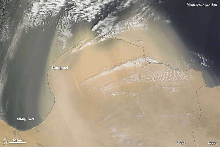
Dust blew off the Libya coast for the second consecutive day on April 17, 2012, as the Moderate Resolution Imaging Spectroradiometer (MODIS) on NASA’s Terra satellite passed overhead and took this picture.
Unlike the previous day, when the dust was thin enough to allow the satellite sensor a glimpse of the land below, the dust on April 17 obscured the coastline east of Banghazi (Benghazi). In this image, the coast is outlined in black.
A little larger than Alaska, Libya has no surface water, and instead taps underground reservoirs for irrigation. Sand seas stretch over the country’s arid interior, and dust storms rank among Libya’s most common natural hazards.
References & Resources
- References
- CIA World Factbook. (2012, April 11) Libya. Accessed April 17, 2012.
NASA image by Jeff Schmaltz, LANCE/EOSDIS MODIS Rapid Response. Caption by Michon Scott.


