Atmosphere
The astonishing thing about the Earth… is that it is alive…. Aloft, floating free beneath the moist, gleaming membrane of bright blue sky, is the rising Earth, the only exuberant thing in this part of the cosmos…. It has the organized, self-contained look of a live creature, full of information, marvelously skilled in handling the Sun.
— Lewis Thomas, The Lives of a Cell
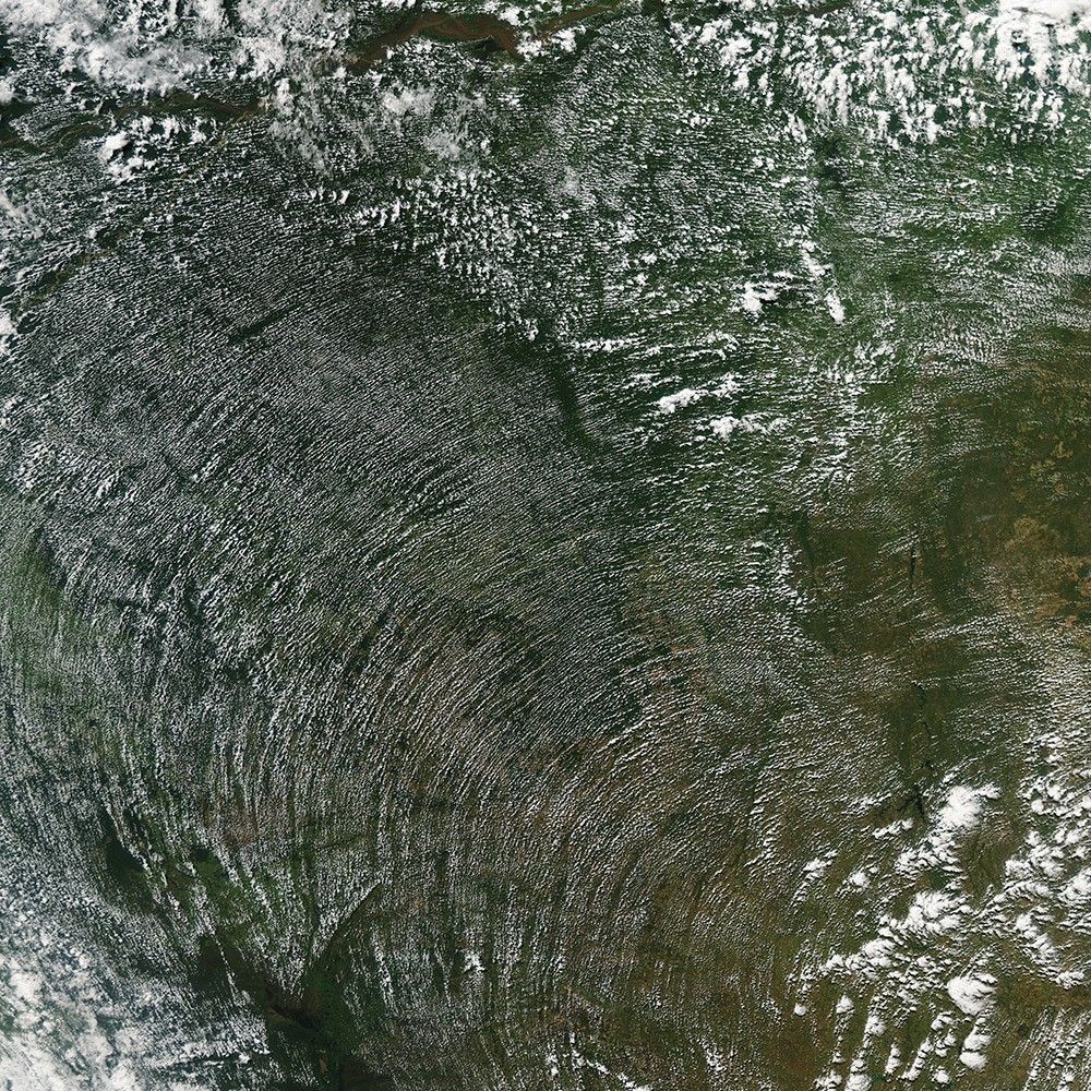
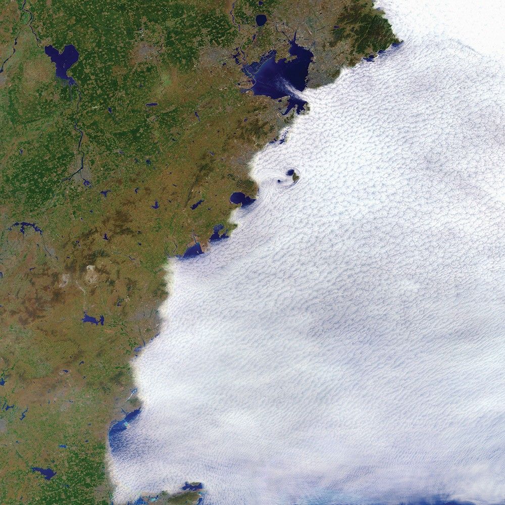
Curving Cloud Streets
-
Brazil and Bolivia
To the human eye, the wind is invisible. It can only be visualized by proxy, by its expressions in other phenomena like blowing leaves, airborne dust, white-capped waters—or the patterns of clouds.
Acquired in June 2014 by the Aqua satellite, this image shows a broad swath of the Amazon rainforest in Brazil and Bolivia as it appeared in the early afternoon. As sunlight warms the forest in the morning, water vapor rises on columns of heated air. When that humid air runs into a cooler, more stable air mass above, it condenses into fluffy cumulus clouds.
Cumulus cloud streets often trace the direction, and sometimes the intensity, of winds—lining up parallel to the direction of the wind. Usually this means a straight line, but clouds can also line up along the concentric, curved lines of high-pressure weather systems, as they did here.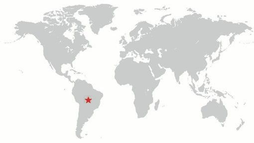

A Trio of Plumes
-
South Atlantic Ocean
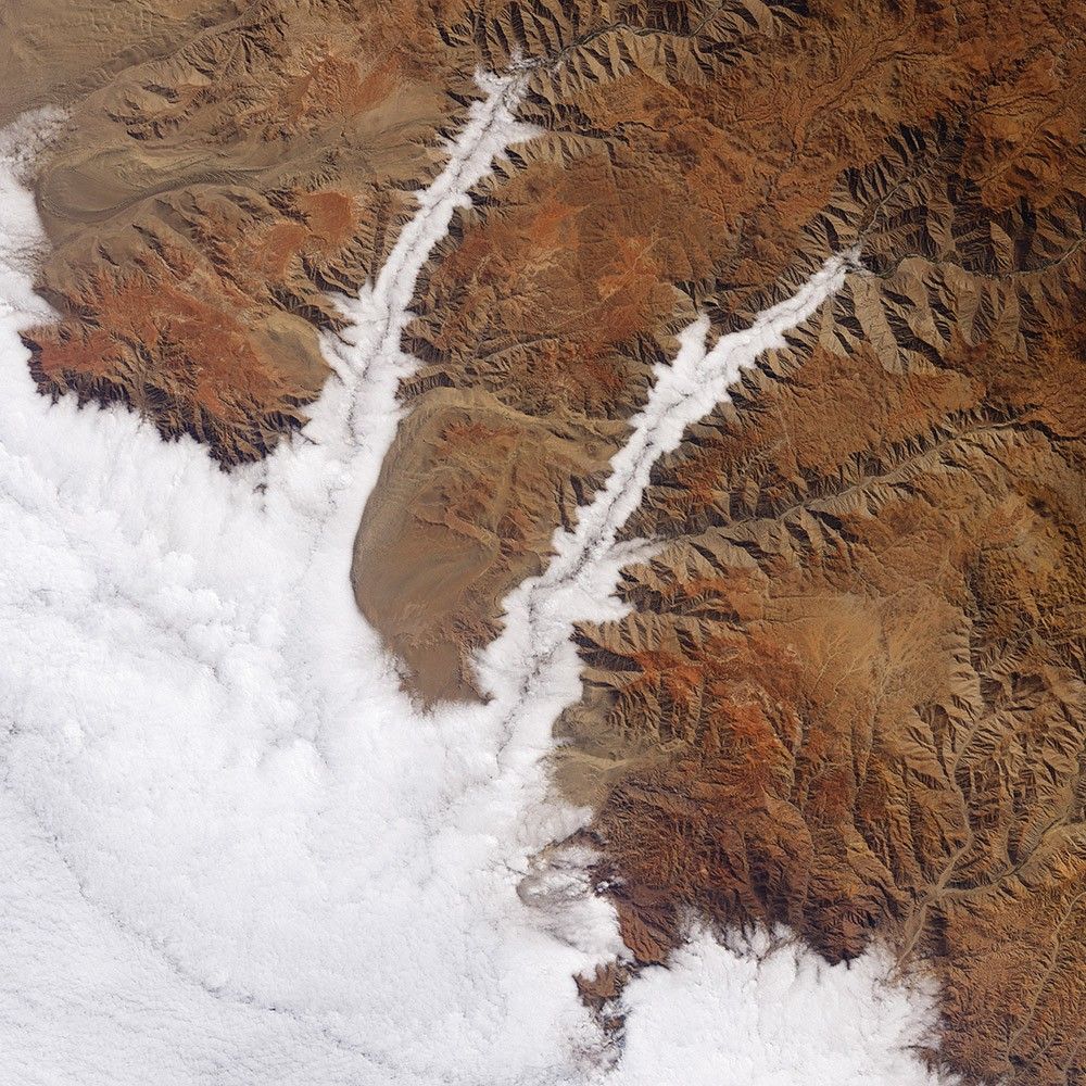
The uninhabited South Sandwich Islands include several active stratovolcanoes. Due to their remote location, these volcanoes are some of the least studied in the world, though satellites often catch them erupting.
The combination of clouds and ice at these latitudes can make it difficult to see plumes of volcanic ash in natural-color imagery. But using portions of the electromagnetic spectrum that are typically invisible to the naked eye (such as infrared) enables satellites to distinguish ice from ash and clouds. The Aqua satellite captured this false-color image in September 2016. Note the three bright white plumes running down the middle third of the page; they are warmer and brighter in infrared than the cooler ice clouds (teal) around them.
Researchers have learned that even small eruptions like this can affect cloud cover and weather. The tiny solid and liquid particles in the plume (aerosols) act as seeds for the formation of cloud droplets.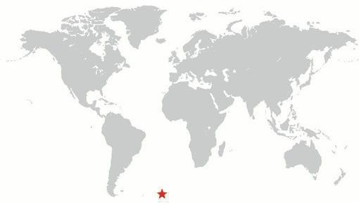
Filling the Valleys
-
Peru
The valleys along Peru’s southern coast are among the deepest on Earth. They are also frequently filled with clouds. In July 2015, Landsat 8 captured this view of the cloud-filled canyons through which the Yauca and Acarí rivers empty into the Pacific Ocean.
You can’t see it, but the Pacific lies below the clouds on the lower left. The clouds are marine stratocumulus—a type of low-level cloud so close to the surface that it is essentially fog. Such clouds are a persistent feature off the coast of Peru and Chile, developing most often during the winter and early spring. On some occasions, prevailing winds can push the clouds inland. Because the marine clouds are low, they are easily blocked by coastal mountains and hills, such as the Andes. But in areas where low valleys open to the ocean, the clouds move inland.
A Glorious View
-
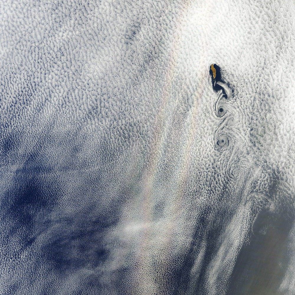
Pacific Ocean
A layer of stratocumulus clouds over the Pacific Ocean serves as the backdrop for this rainbow-like phenomenon known as a glory. Glories form when water droplets within clouds scatter sunlight back toward a source of illumination (in this case, the Sun).
Although glories may look similar to rainbows, the way light is scattered to produce them is different. Rainbows are formed by refraction and reflection; glories are formed by backward diffraction. From the ground or from an airplane, glories appear as circular rings of color. In this image, however, the glory is stretched vertically because of how the imager scans the surface in swaths.
Note, too, the swirling von Kármán vortices visible to the right of the glory. The alternating rows of vortices form as air masses run into an obstacle—the island of Guadalupe—and form a wake behind it.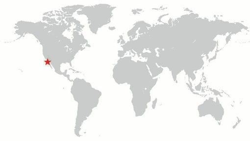

Punching Holes in the Sky
-
United States
In December 2009, the Landsat 5 satellite observed this extraordinary example of “hole-punch clouds” over West Virginia. This strange phenomenon results from a combination of cold temperatures, air traffic, and atmospheric instability.
If you were to look from below, it would appear as if part of the cloud were falling out of the sky. As it turns out, that is actually what is happening. The clouds are initially composed of liquid drops at a super-cooled temperature below 0° Celsius. As an airplane passes through a cloud, particles in the exhaust can create a disturbance that triggers freezing. Ice particles then quickly grow at the expense of water droplets. Eventually, the ice crystals in these patches of clouds grow large enough that they literally fall out of the sky, earning hole-punch clouds their alternate name: “fallstreak holes.”
In this false-color image, pink and faint blue areas are typical water-rich clouds, and bright cyan areas are ice clouds. The hole-punch areas appear dark around the ice clouds.
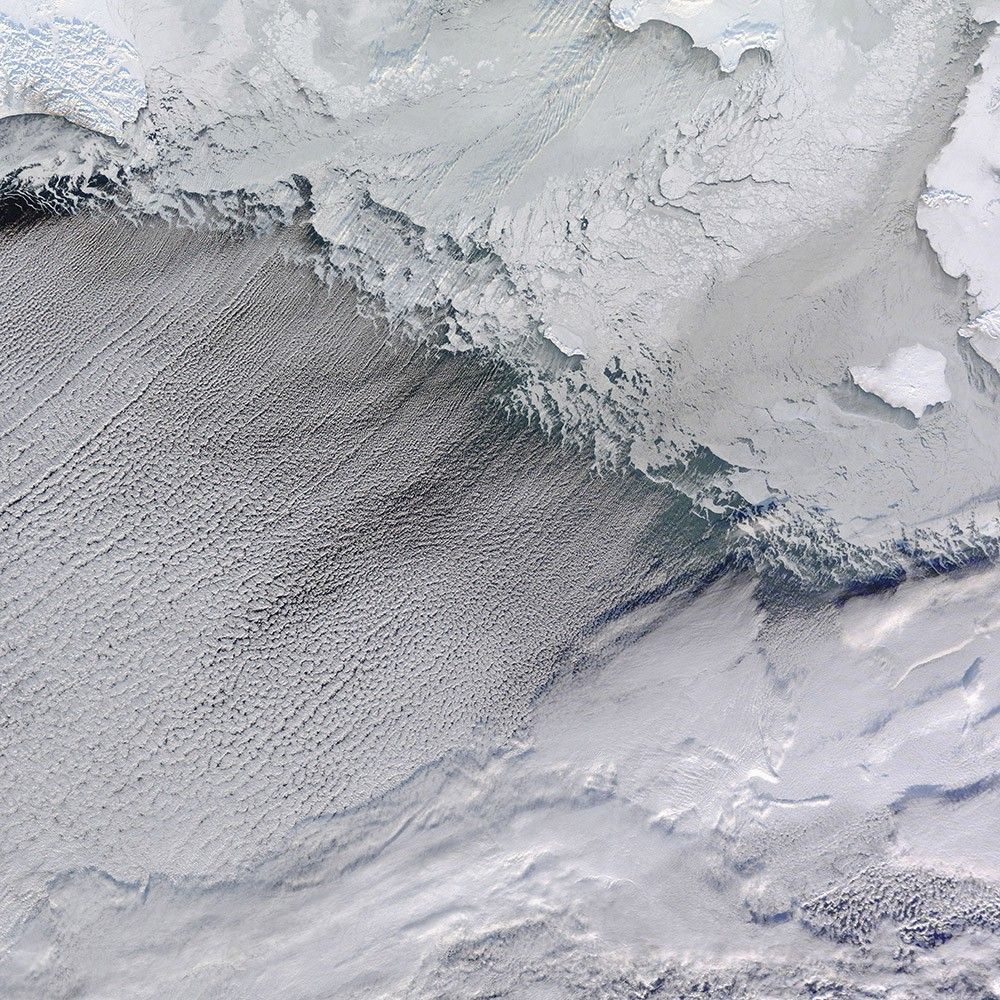
Bering Streets
-
Arctic Ocean
Winds from the northeast pushed sea ice southward and formed cloud streets—parallel rows of clouds—over the Bering Strait in January 2010. The easternmost reaches of Russia, blanketed in snow and ice, appear in the upper left. To the east, sea ice spans the Bering Strait. Along the southern edge of the ice, wavy tendrils of newly formed, thin sea ice predominate.
The cloud streets run in the direction of the northerly wind that helps form them. When wind blows out from a cold surface like sea ice over the warmer, moister air near the open ocean, cylinders of spinning air may develop. Clouds form along the upward cycle in the cylinders, where air is rising, and skies remain clear along the downward cycle, where air is falling. The cloud streets run toward the southwest in this image from the Terra satellite.
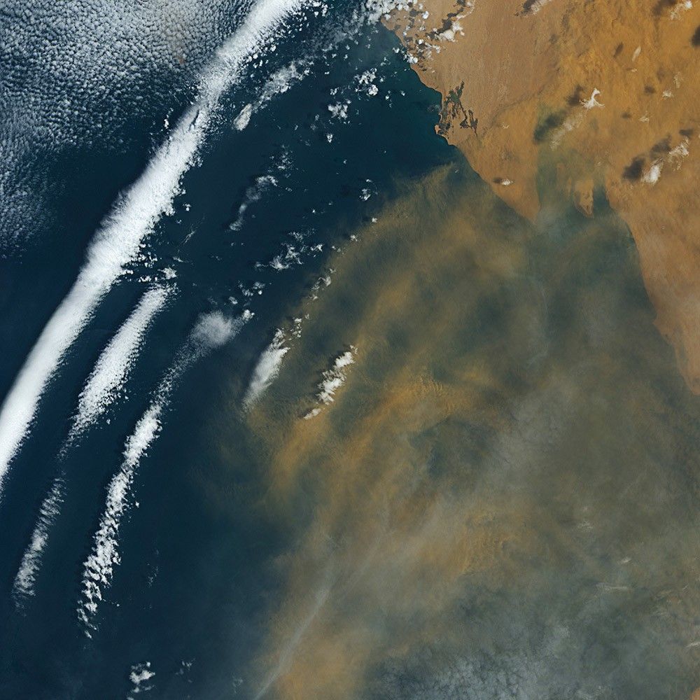
Riding the Waves
-
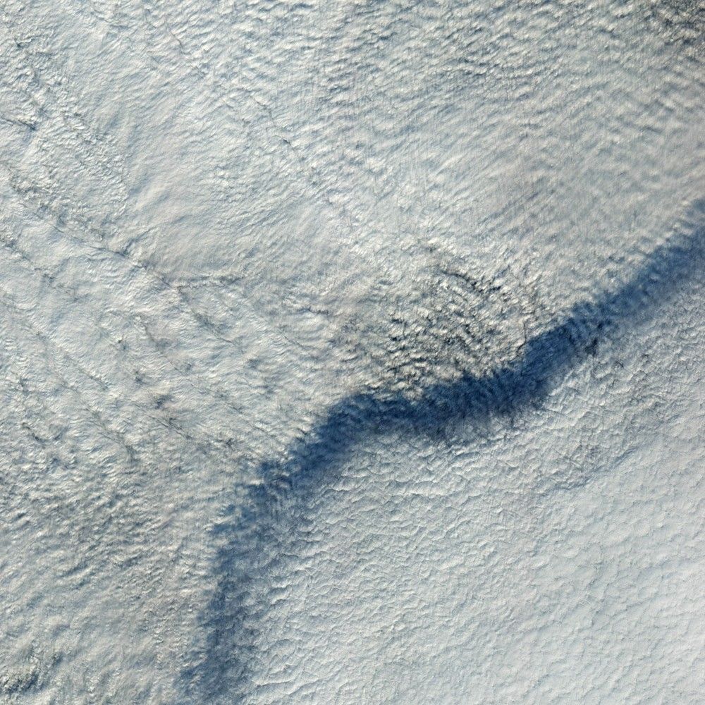
Mauritania
You cannot see it directly, but air masses from Africa and the Atlantic Ocean are colliding in this Landsat 8 image from August 2016. The collision off the coast of Mauritania produces a wave structure in the atmosphere.
Called an undular bore or solitary wave, this cloud formation was created by the interaction between cool, dry air coming off the continent and running into warm, moist air over the ocean. The winds blowing out from the land push a wave of air ahead like a bow wave moving ahead of a boat.
Parts of these waves are favorable for cloud formation, while other parts are not. The dust blowing out from Africa appears to be riding these waves. Dust has been known to affect cloud growth, but it probably has little to do with the cloud pattern observed here.
Cloud Shadow
-
Germany
In November 2012, the Earth Observing-1 satellite acquired this image of a layer of clouds casting a distinctive shadow on another, lower cloud layer. The upper deck was more than 1 kilometer (0.6 miles) above the ground. Both layers were composed of stratus clouds, a low-lying type that tends to be uniform and flat. When the satellite’s Advanced Land Imager acquired the image, the clouds were over northeastern Germany near Harz National Park.
While local meteorological conditions affect cloud height, the latitude at which clouds form is also important. Almost all clouds exist in the lowest level of the atmosphere, the troposphere. However, the depth of the troposphere varies by latitude—thinner near the poles than the Equator, so clouds can occur at higher levels in the tropics than they do at high- and mid-latitudes.

Double Trouble
-
Pacific Ocean
The island of Hawaii rarely takes a direct hit from a hurricane. In August 2016, two Pacific storms almost changed that.
The Suomi NPP satellite observed Hurricanes Madeline and Lester stirring up the central Pacific Ocean as category 3 and 4 storms while moving northwest toward the Hawaiian Islands. The tight, deep eye of category 3 Hurricane Madeline (right) appears almost three-dimensional even in a two-dimensional satellite view. Lester showed off an equally menacing eye. The bright streaks across the ocean surface are areas of sunglint, where sunlight reflected directly back at the image.
Ultimately, the storms blew just south and north of the islands without making landfall. In fact, no hurricane has made landfall on the Big Island since recordkeeping started in 1949. Only 15 hurricanes have passed within 200 nautical miles of the island in that time.

Making Tracks
-
Pacific Ocean
Ships steaming across the Pacific Ocean left this cluster of bright cloud trails lingering in the atmosphere in February 2012. The narrow clouds, known as ship tracks, form when water vapor condenses around tiny particles of pollution from ship exhaust. The crisscrossing clouds off the coast of California stretched for many hundreds of kilometers from end to end. The narrow ends of the clouds are youngest, while the broader, wavier ends are older.
Some of the pollution particles generated by ships (especially sulfates) are soluble in water and can serve as the seeds around which cloud droplets form. Clouds infused with ship exhaust have more and smaller droplets than unpolluted clouds. As a result, light hitting the ship tracks scatters in many directions, often making them appear brighter than other types of marine clouds, which are usually seeded by larger, naturally occurring particles like sea salt.
Tracing the Coast
-
China
The ocean does not heat up as much throughout a day as landmasses do. For this reason, cool, moist marine air commonly gives rise to dense clouds over the ocean.
In this example from the coast of China, an onshore wind carries the clouds from the ocean toward the land. But the land is warmer, drier, and unfavorable for cloud growth. As a result, the marine clouds that move onshore tend to evaporate, leaving a cloud layer that traces the coastline.
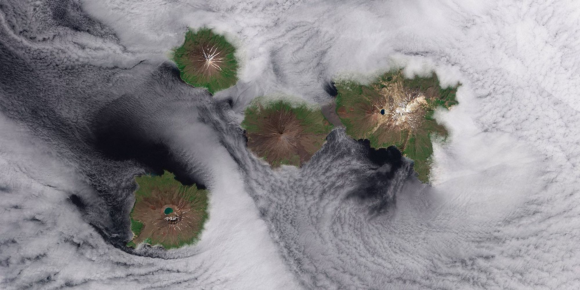
Four Mountains Stand Out
-
Pacific Ocean
They are called the Islands of the Four Mountains. Part of the Aleutian Island chain, these peaks are actually the upper slopes of volcanoes rising from the seafloor: Carlisle, Cleveland, Herbert, and Tana. Standing in one of the most remote reaches of the world, these volcanoes have scarcely been studied. Satellite sensing makes that easier, as this Landsat 8 image from June 2013 shows.
Herbert Island is dominated by a symmetrical stratovolcano that stands in its center. The remote island has scarcely been studied, and there are no records of eruptions there. The 2-kilometer-wide summit caldera include a lake of meltwater, remnants of the snow that covers the peak for most of the year. The straight-down (nadir) satellite view can make it difficult to determine which part of the landscape stands taller than the other, a phenomenon known as relief inversion.
You can see how a layer of low clouds and fog obscures the lower elevations of the islands and the sea surface. But these clouds also hint at the complicated airflow patterns around and through the islands.

Framing an Iceberg
-
South Atlantic Ocean
In June 2016, the Suomi NPP satellite captured this image of various cloud formations in the South Atlantic Ocean. Note how low stratus clouds framed a hole over iceberg A-56 as it drifted across the sea.
The exact reason for the hole in the clouds is somewhat of a mystery. It could have formed by chance, although imagery from the days before and after this date suggest something else was at work. It could be that the relatively unobstructed path of the clouds over the ocean surface was interrupted by thermal instability created by the iceberg. In other words, if an obstacle is big enough, it can divert the low-level atmospheric flow of air around it, a phenomenon often caused by islands.
Valley Fog
-
Canada
Fog is essentially a cloud lying on the ground. Like all clouds, it forms when the air reaches its dew point—the temperature at which an air mass is cool enough for its water vapor to condense into liquid droplets.
This false-color image shows valley fog, which is common in the Pacific Northwest of North America. On clear winter nights, the ground and overlying air cool off rapidly, especially at high elevations. Cold air is denser than warm air, and it sinks down into the valleys. The moist air in the valleys gets chilled to its dew point, and fog forms. If undisturbed by winds, such fog may persist for days. The Terra satellite captured this image of foggy valleys northeast of Vancouver in February 2010.

Holuhraun Lava Field
-
Iceland
As an island in the moist, turbulent North Atlantic, Iceland is often shrouded in clouds and difficult to observe from space. In 2014, the island started making some of its own cloud cover, as the Earth split open between the Bárðarbunga and Askja volcanoes and spewed lava and hot gas.
Landsat 8 captured this view of the eruption in September 2014. The false-color image combines shortwave infrared, near-infrared, and green light. Ice and the plume of steam and sulfur dioxide appear cyan and bright blue, while liquid water is navy blue. Bare or rocky ground around the Holuhraun lava field appears in shades of green or brown, and fresh lava is bright orange. Offshore clouds appear in bright cyan.
Infrared imagery can help scientists estimate the rate at which lava is pouring out of Earth, as well as the sulfur dioxide content of the plume. It also helps them pinpoint lava flows and model how the eruption evolved.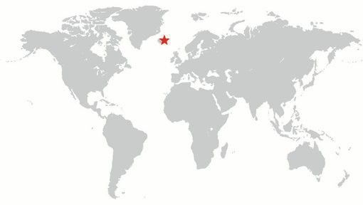

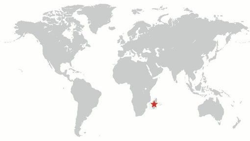
Lofted Over Land
-
Madagascar
As an island in the moist, turbulent North Atlantic, Iceland is often shrouded in clouds and difficult to observe from space. In 2014, the island started making some of its own cloud cover, as the Earth split open between the Bárðarbunga and Askja volcanoes and spewed lava and hot gas.
Landsat 8 captured this view of the eruption in September 2014. The false-color image combines shortwave infrared, near-infrared, and green light. Ice and the plume of steam and sulfur dioxide appear cyan and bright blue, while liquid water is navy blue. Bare or rocky ground around the Holuhraun lava field appears in shades of green or brown, and fresh lava is bright orange. Offshore clouds appear in bright cyan.
Infrared imagery can help scientists estimate the rate at which lava is pouring out of Earth, as well as the sulfur dioxide content of the plume. It also helps them pinpoint lava flows and model how the eruption evolved.