


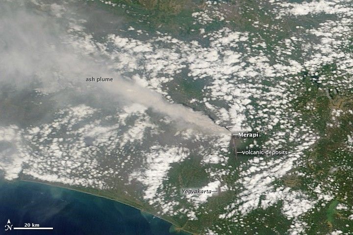
A thick plume of ash rose from the Merapi Volcano on November 10, 2010, when the Moderate Resolution Imaging Spectroradiometer (MODIS) on NASA’s Terra satellite captured this photo-like image. The image provides the most cloud-free satellite view of the eruption to date. A dark brown streak down the southern face of the volcano is ash and other volcanic material deposited by a pyroclastic flow or lahar.
Though still erupting and dangerous on November 10, the eruption was quieter than it had been the previous week. The ash plume caused flight cancellations in both Jakarta and Yogyakarta, reported CNN. As of November 10, the eruption had killed at least 156 and displaced about 200,000.
References & Resources
- CNN. (2010, November 10). Volcano ash forces flight cancellations in Indonesia. Accessed November 11, 2010.
- Klemetti, E. (2010, November 10). Wednesday (11/10/10) update: A respite for Indonesia and upswing for the Philippines. Eruptions. Accessed November 11, 2010.
- Reuters. (2010, November 10). Indonesia volcano wanes but some flights cancelled. Accessed November 11, 2010.
NASA image courtesy Jeff Schmaltz, MODIS Rapid Response Team at NASA GSFC. Caption by Holli Riebeek.


