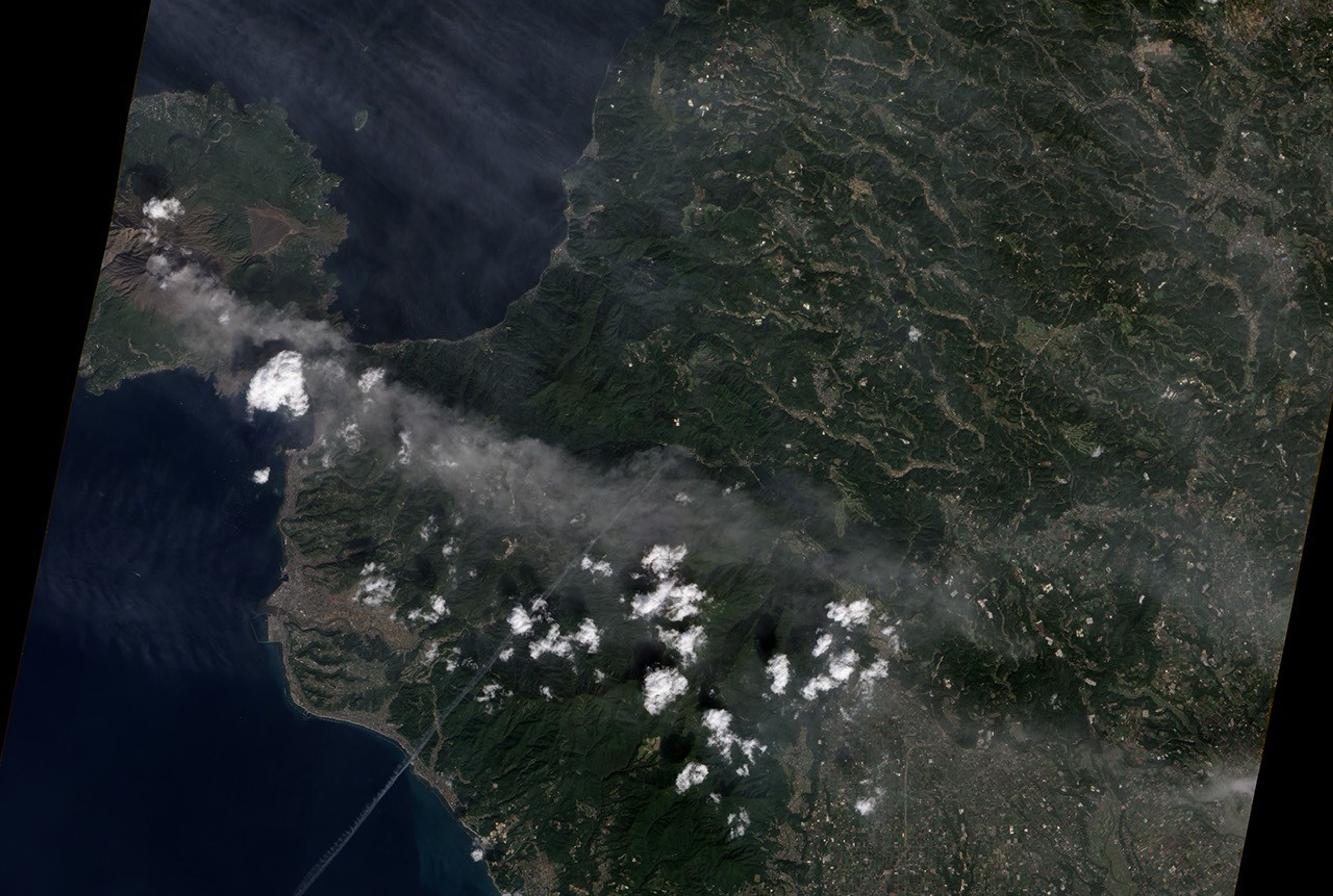
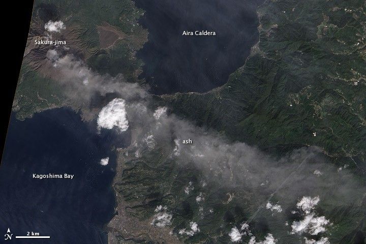
One of Japan’s most active volcanoes, Sakurajima released a plume of ash on November 2, 2010. A pilot reported that the plume reached an altitude of 1.5 kilometers (6,000 feet). This photo-like image of the erupting volcano was taken by the Advanced Land Imager (ALI) on NASA’s Earth Observing-1 (EO-1) satellite. Such plumes are common at the volcano, where frequent eruptions have been recorded since the 8th century.
Sakura-jima is on the southern end of the island of Kyushu. The volcano sits on the southern edge of the Aira caldera, the circular water-filled hole that formed on the north side of Kagoshima Bay in an eruption 22,000 years ago. Sakura-jima formed an island until 1914, when an explosive eruption produced enough material to join the island to the peninsula on the east.
References & Resources
- Global Volcanism Program. (2010, November 2). Sakura-jima. Smithsonian National Museum of Natural History. Accessed November 11, 2010.
NASA image by Rob Simmon, using data ALI data from the EO-1 team. Caption by Holli Riebeek.