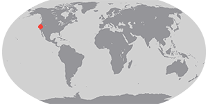
A strong extratropical cyclone hit the Pacific Northwest on November 19, 2024, bringing damaging winds and rain to the region. The storm knocked over trees and left nearly 600,000 people without power in Washington state on November 20, according to news reports.
This image shows the storm system at 1:50 p.m. Pacific Time (21:50 p.m. Universal Time) on November 19. Extra-tropical cyclones are large rotating weather systems that occur in the midlatitudes (generally more than 30° latitude away from the equator). Mature extratropical cyclones like this often feature comma-shaped cloud patterns that are the product of “conveyor belt” circulation. Heavy precipitation is often present near the low-pressure head of the comma. This image was captured by the VIIRS (Visible Infrared Imaging Radiometer Suite) on the NOAA-20 satellite.
On the evening of November 19, the storm’s central pressure dropped to levels on par with a storm in October 2021, which saw the lowest pressure in about 50 years of records for that region, according to Chris Dolce, a meteorologist at The Weather Channel. The pace of the storm’s intensification was more than double the criteria for bombogenesis—a popular term that describes a midlatitude cyclone that rapidly intensifies into a “bomb cyclone.”
The plunging atmospheric pressure in the center of the storm caused winds to increase quickly on November 19. The National Weather Service in Seattle reported wind gusts of up to 77 miles (124 kilometers) per hour in the mountains southeast of Seattle.
The cyclone kicked off a long-duration atmospheric river that forecasters expect will park over Northern California and southern Oregon through November 22. The National Weather Service estimates that these areas could see rainfall totals of 12 to 16 inches (30 to 41 centimeters) over the duration of the storm.
References & Resources
- Accuweather (2024, November 20) Bomb cyclone with atmospheric river blasts Oregon, Northern California and Washington. Accessed November 20, 2024.
- NASA Earth Observatory (2021, October 26) Extratropical Cyclones Drench West Coast. Accessed November 20, 2024.
- NASA Earth Observatory (2013, March 7) Storms Come in Many Forms. Accessed November 20, 2024.
- National Weather Service (2024, November 20) Public Information Statement: Highest Winds Report. Accessed November 20, 2024.
- The New York Times (2024, November 20) West Coast Braces for Heavy Rain and Snow. Accessed November 20, 2024.
- NOAA (2024, June 16) What is bombogenesis? Accessed November 20, 2024.
- The Weather Channel (2024, November 20) Atmospheric River To Pummel N. California, Northwest With Flooding Rain, Snow, Strong Winds. Accessed November 20, 2024.
NASA Earth Observatory image by Lauren Dauphin, using VIIRS data from NASA EOSDIS LANCE , GIBS/Worldview , and the Joint Polar Satellite System (JPSS). Story by Emily Cassidy .


