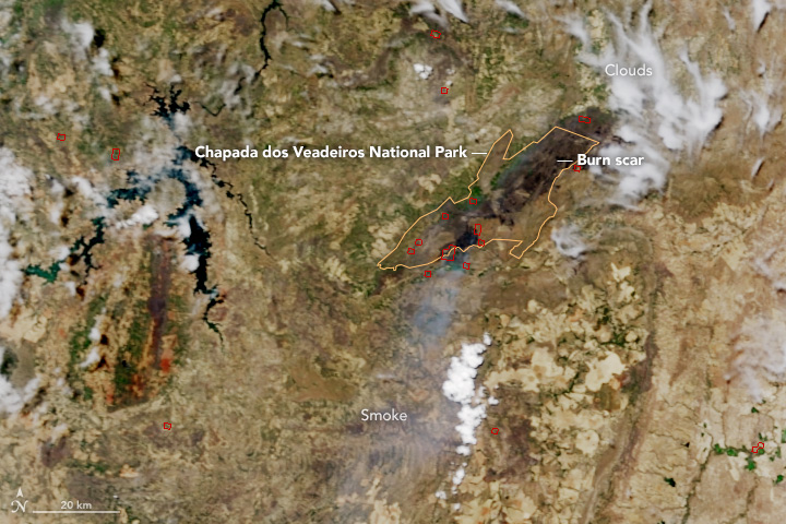
Hundreds of firefighters are battling a blaze in Brazil’s Chapada dos Veadeiros National Park. The fire started on October 17, 2017, and within six days it had charred 35,000 hectares (86,000 acres), roughly 15 percent of the park, according to the Chico Mendes Institute for Biodiversity Conservation, which manages the park.
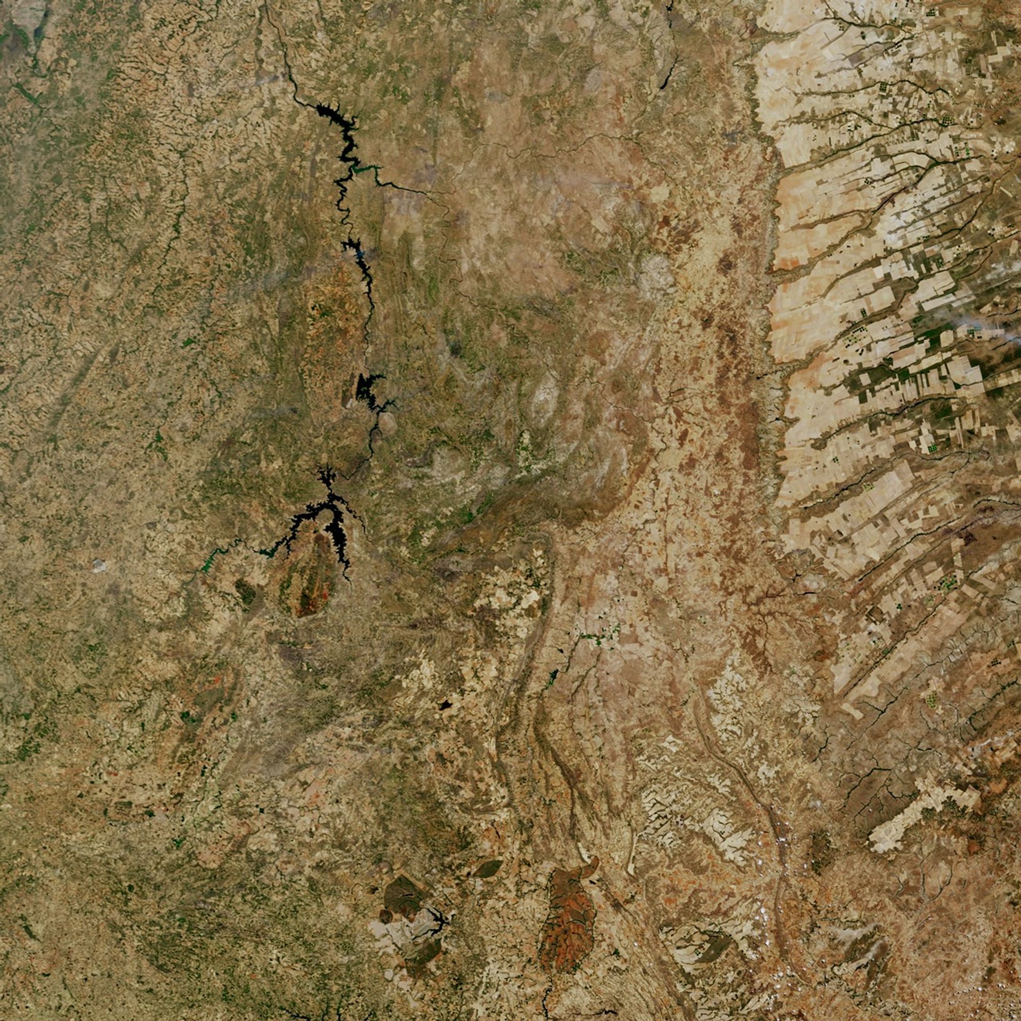
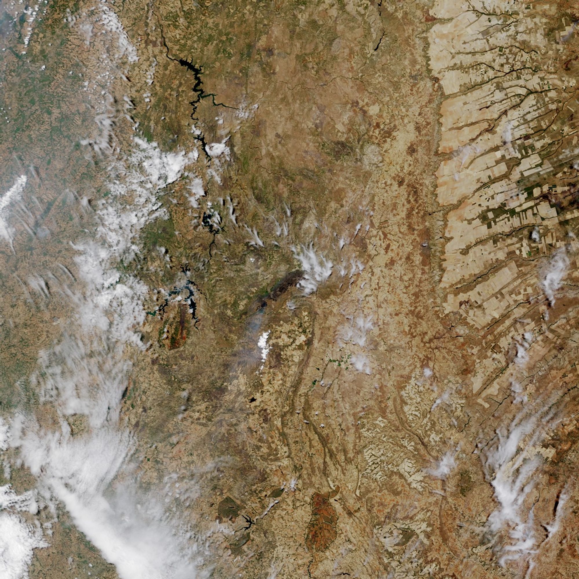
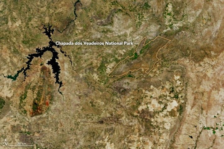
NASA’s Terra and Aqua satellites began to detect fires in the park on October 17. The natural-color image at the top was captured by the Moderate Resolution Imaging Spectroradiometer (MODIS) on the Terra satellite on October 22, 2017. The second image shows the same area on October 6, before the fire had started. Burned areas appear darker brown than the surrounding cerrado landscape. Red outlines indicate hot spots where MODIS detected unusually warm surface temperatures—a sign of actively burning fires.
Chapada dos Veadeiros, a UNESCO world heritage site, is prized for the richness of its flora and fauna. The park supports between 350 and 400 species of vascular plants per hectare. Many endangered species are found within the park’s boundaries, such as the maned wolf, capybaras (the largest rodents in the world), and rheas (the largest birds in South America). Other large mammals in the park include the giant anteater, giant armadillo, and jaguar.
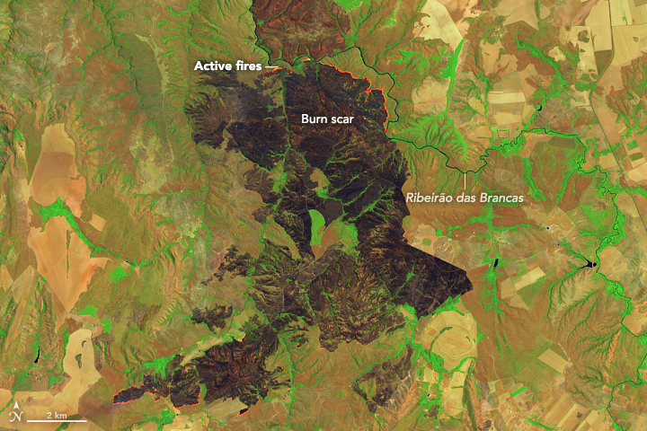
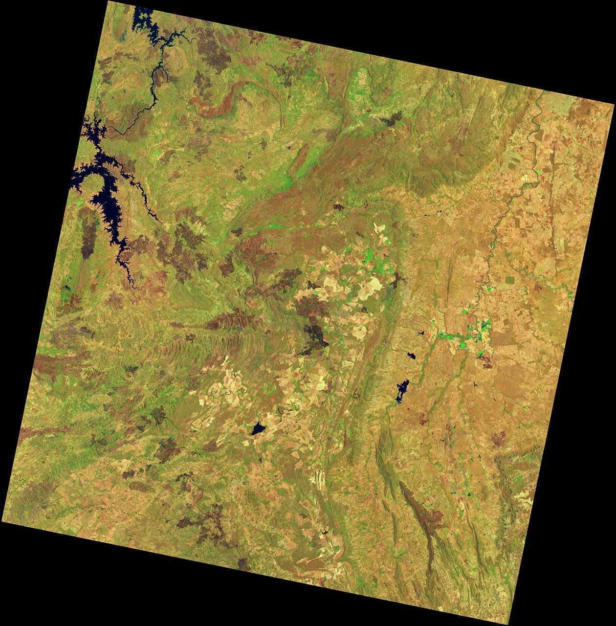
The fire is one of several that have burned in this region recently. Throughout October, satellites detected several fires burning nearby in the states of Goiás, Tocantins, and Bahia. On October 12, 2017, the Operational Land Imager (OLI) on Landsat 8 captured an actively burning fire southeast of the park, near the Ribeirão das Brancas, a river in Goiás. MODIS satellites first detected evidence of the fire on October 10; it appeared to be extinguished by October 15.
References & Resources
- Chico Mendes Institute for Biodiversity Conservation (2017, October 23) Mais de 200 pessoas combatem fogo na Chapada dos Veadeiros. Accessed October 23, 2017.
- EBC (2017, October 22) Incêndio na Chapada dos Veadeiros continua sem controle, diz diretor do parque. Accessed October 23, 2017.
- Globo (2017, October 21) Parque Nacional da Chapada dos Veadeiros tem combate ao incêndio reforçado com bombeiros e brigadistas. Accessed October 23, 2017.
- United Nations Cerrado Protected Areas: Chapada dos Veadeiros and Emas National Parks. Accessed October 23, 2017.
NASA Earth Observatory images by Jesse Allen and Joshua Stevens, using MODIS data from the Land Atmosphere Near real-time Capability for EOS (LANCE), and Landsat data from the U.S. Geological Survey . Story by Adam Voiland.