Hot, dry weather and strong winds fueled wildland fires in Baja California in late January 2025. Seasonal Santa Ana winds blew in from dry areas inland and accelerated down the Sierra Juarez mountain range, creating conditions where a few sparks and small brush fires could quickly escalate.
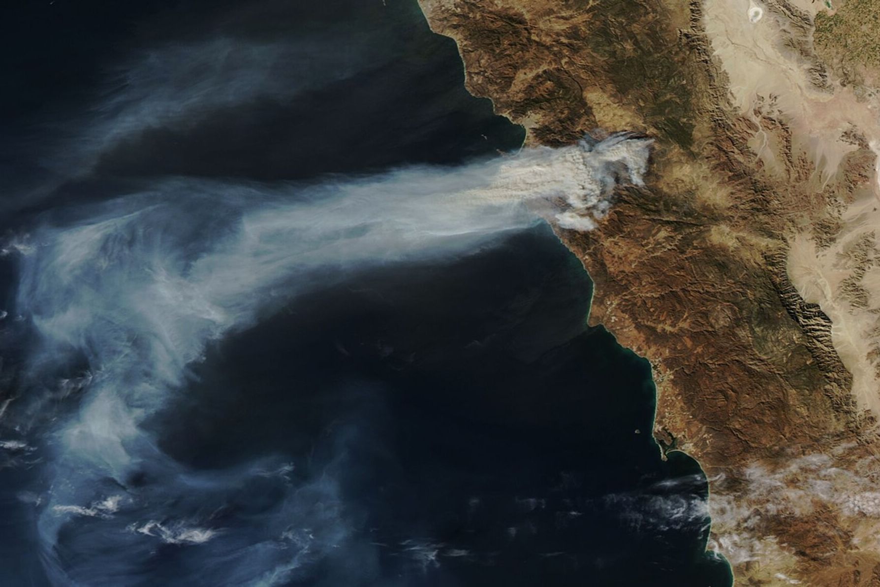
The MODIS (Moderate Resolution Imaging Spectroradiometer) on NASA’s Aqua satellite captured this image of smoke streaming from a large fire in the El Escondido area of Ensenada on January 23, 2025. The image was captured at 1:44 p.m. Pacific Time (21:44 Universal Time).
Mexico’s National Forestry Commission reported that the fire began on January 22 and had burned nearly 11,000 hectares (27,000 acres) by January 24. According to Baja California’s Civil Protection Office, winds exceeded 80 kilometers (50 miles) per hour as the fire burned. The region is also experiencing extreme drought conditions, according to the National Integrated Drought Information System.
Forecasters expect the region to get some relief soon. They predict that winds should ease in the coming days and a developing storm will likely bring rain.
References & Resources
- Comisión Nacional Forestal, via X (2025) CONAFOR. Accessed January 24, 2025.
- Ground News (2025, January 24) Fires in Tecate and Tijuana consume thousands of hectares. Accessed January 24, 2025.
- NASA (2025) Fire Information for Resource Management System. Accessed January 24, 2025.
- NASA Earthdata Wildfires. Accessed January 24, 2025.
- National Integrated Drought Information System (2025) Global Drought Conditions. Accessed January 24, 2025.
- National Weather Service, via YouTube (2025, January 23) Santa Ana winds end but still dry – weekend precipitation from cold storm – NWS San Diego. Accessed January 24, 2025.
- Protección Civil Baja California, via Facebook (2025, January 22) Advertencia por vientos fuertes. Accessed January 24, 2025.
- Servicio Meteorológico Nacional (2025) Weather Forecast by Municipality. Accessed January 24, 2025.
NASA Earth Observatory image by Lauren Dauphin, using MODIS data from NASA EOSDIS LANCE and GIBS/Worldview . Story by Adam Voiland.