


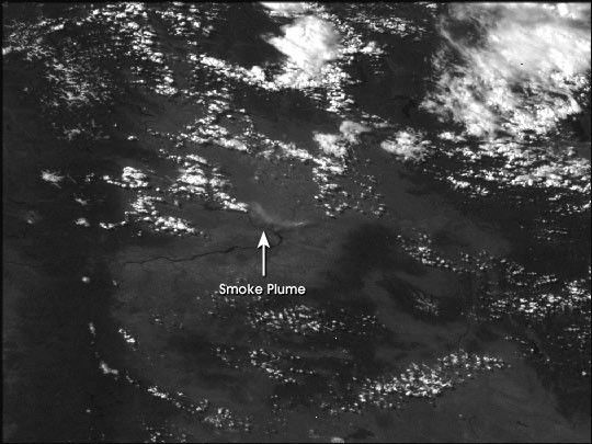
A large brush fire in southern Washington state burned over150,000 acres on June 28th and 29th, 2000. Ignited by a carcrash, the fire was burning near the Hanford nuclearreservation, although it had not released any radioactivityby afternoon on the 29th.
The image above was aquired by a NOAA GeostationaryOperational Environmental Satellite (GOES) at 4:30 PDTJune 28, 2000. The smoke plume was relatively small andthin compared to a forest fire of the same size.
For current GOES images of the Pacific, see thePublic Use of Remote Sensing Data GOES Archive.
References & Resources
(Image by the GOES Projedct Science Office based on data from NOAA.)


