![Request for Information – Potential [Placeholder for Prize]](https://assets.science.nasa.gov/dynamicimage/assets/science/psd/solar/2023/09/s/solarsystem_0.jpg?w=1024)


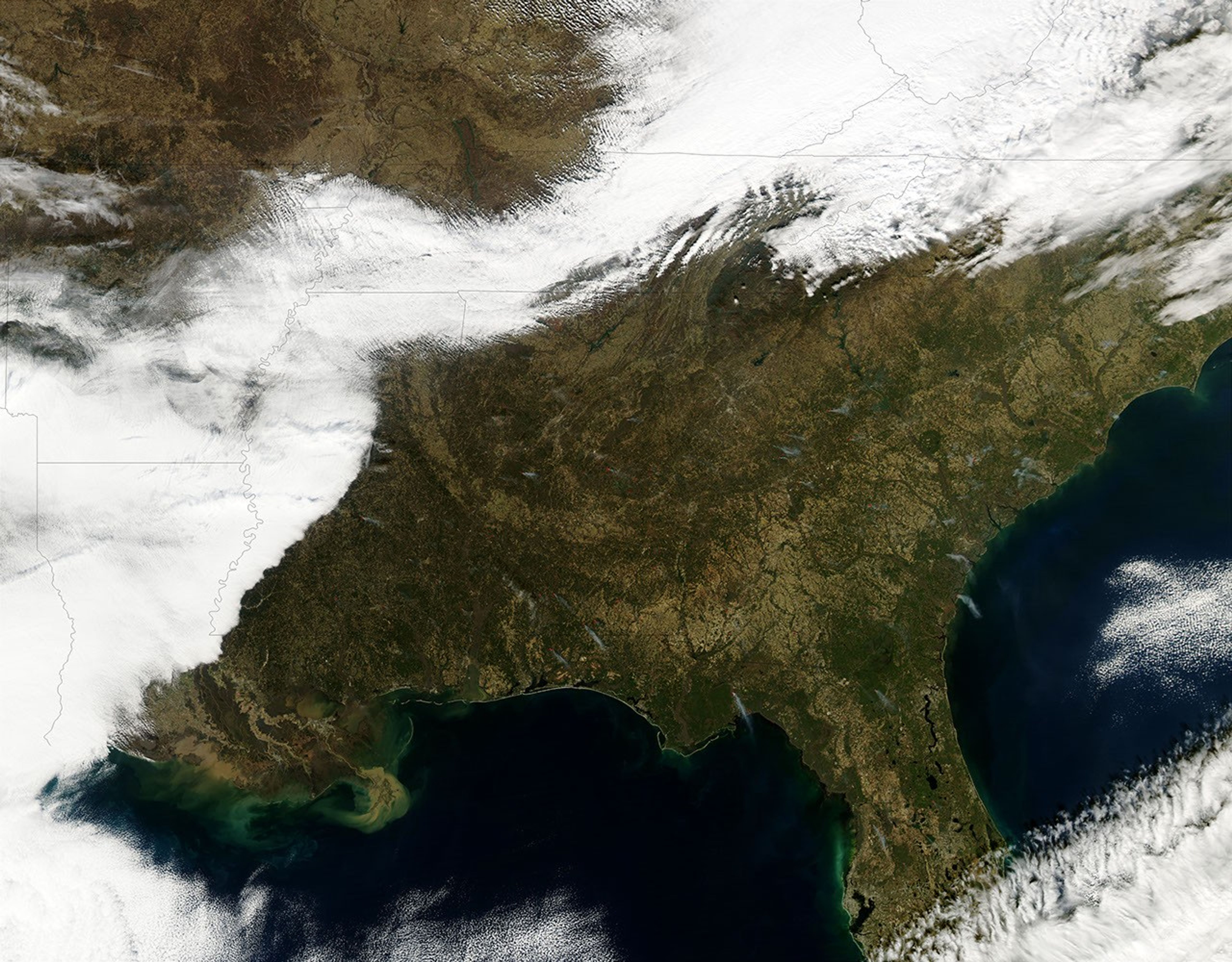
A mixture of prescribed fires and wildfires was burning throughout the southern United States on January 14, 2003. This image was captured by the Moderate Resolution Imaging Spectroradiometer (MODIS) on the Aqua satellite, and shows active fire detection by MODIS marked with red dots. States with fires include (bottom left to right) Louisiana, Mississippi, Alabama, Georgia, South and North Carolina, with Florida in the bottom right corner. According to the January 15 morning report from the Southern Fire Coordination Center of the National Interagency Fire Center, 17 prescribed burns were underway on more than 11,500 acres in Arkansas (visible, but cloud-covered in the high-resolution image), Georgia, Florida, Mississippi, and South Carolina. Dozens of additional small fires were reported on state lands throughout the south as well.
References & Resources
Image courtesy Jeff Schmaltz, MODIS Rapid Response Team, NASA GSFC