![Request for Information – Potential [Placeholder for Prize]](https://assets.science.nasa.gov/dynamicimage/assets/science/psd/solar/2023/09/s/solarsystem_0.jpg?w=1024)


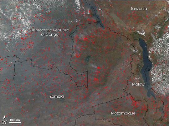
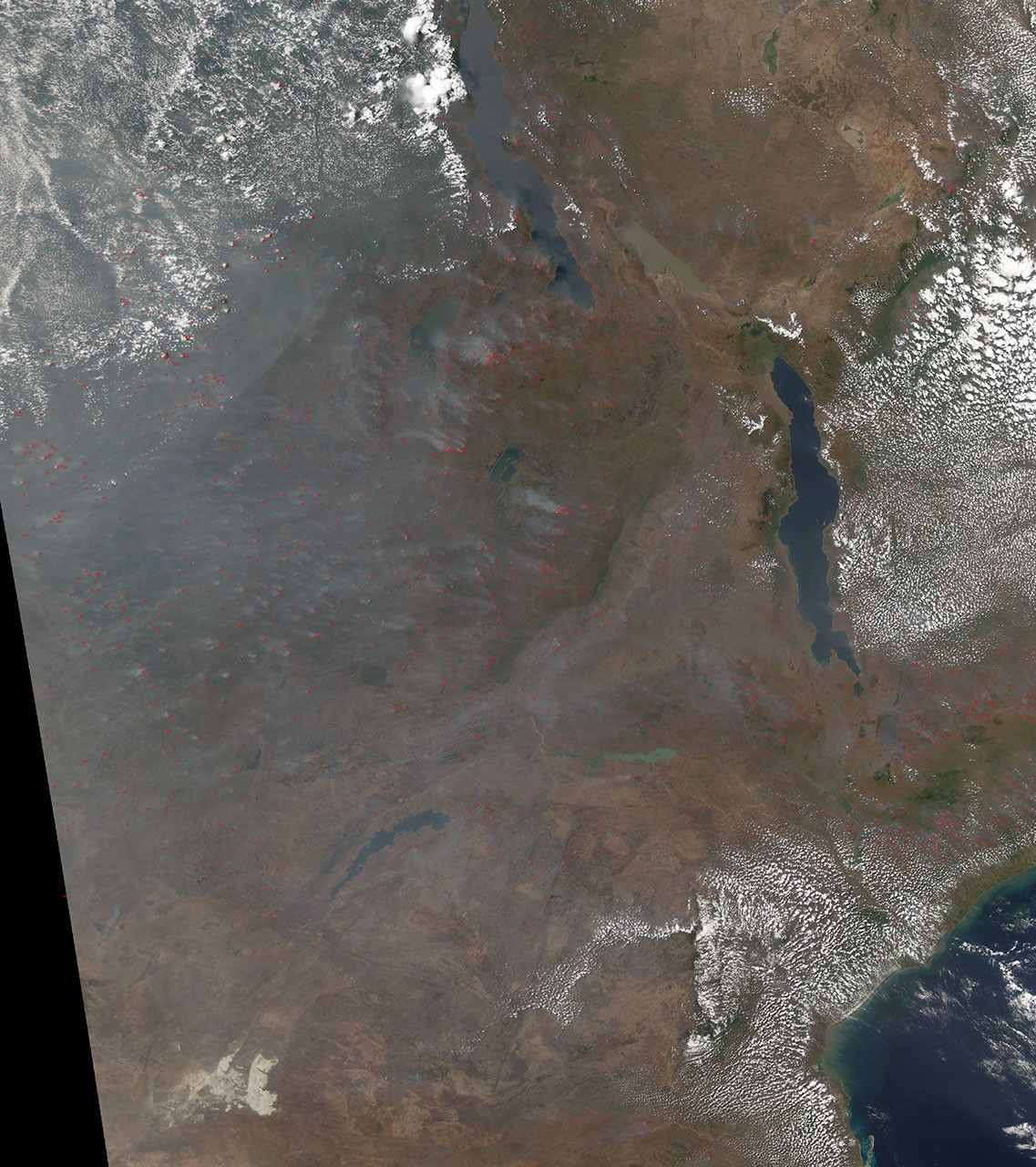
Widespread agricultural fires are a common occurrence in Africa. People have been using fire to manage farm and rangeland there for hundreds, probably thousands, of years. Even though this kind of burning is common, that doesn’t mean it is benign. This image from the Moderate Resolution Imaging Spectroradiometer (MODIS) on NASA’s Aqua satellite shows why: the fires (locations marked with red dots) produce a great deal of smoke, which degrades the air quality. As the burning continues for several months, air pollution is a serious problem, even in these predominantly rural areas. This image was captured on August 29, 2007. To learn more about biomass burning in Africa, please see the feature story Savanna Smog.
You can download a 250-meter-resolution KMZ file of Central Africa suitable for use with Google Earth.
References & Resources
NASA image created by Jesse Allen, using data obtained from the Goddard Land Processes data archives (LAADS).