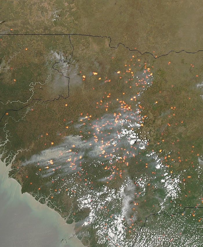
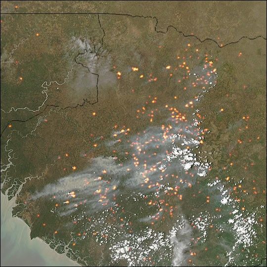
Dozens of smoky fires were burning in the western Africa country of Guinea (center) on April 20, 2004. This image of the fires was captured by the Moderate Resolution Imaging Spectroradiometer (MODIS) on the Aqua satellite. Yellow dots with red outlines mark the location of active fires detected by MODIS. Guinea is approaching the end of its dry season (December-May), when dry, dusty winds blow across the country from the Sahara Desert out toward the Atlantic. These winds are known as harmattan winds, and they can fan the flames of brush and agricultural fires, creating natural hazards.
The high-resolution image provided above is 500 meters per pixel. The MODIS Rapid Response System provides this image at
References & Resources
Image courtesy Jeff Schmaltz, MODIS Rapid Response Team, NASA-GSFC