


![Request for Information – Potential [Placeholder for Prize]](https://assets.science.nasa.gov/dynamicimage/assets/science/psd/solar/2023/09/s/solarsystem_0.jpg?w=1024)


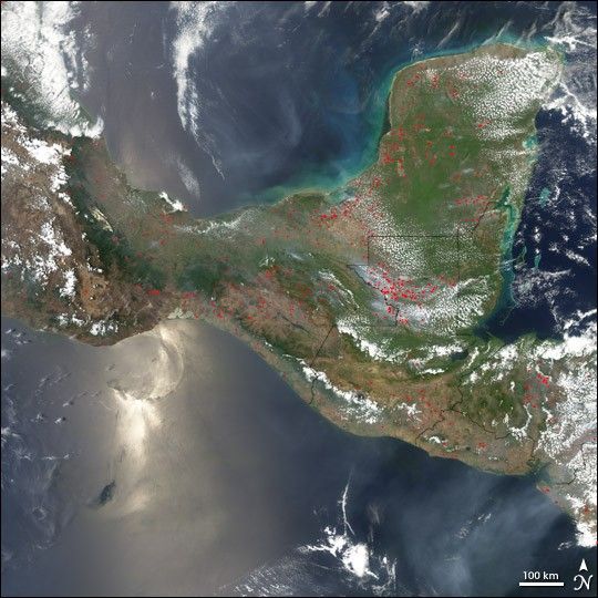
Fires continued to burn across southern Mexico, the Yucatan Peninsula, and northern Central America on April 19, 2005. The smoke extends out over the water in both directions: north into the Gulf of Mexico (top), and south over the Pacific Ocean (bottom right). Actively burning fires detected by the Moderate Resolution Imaging Spectroradiometer (MODIS) on NASA’s Aqua satellite have been marked in red. An especially intense cluster of fires is burning in northwestern Guatemala, right of image center. The country is suffering from a severe drought that makes normal agricultural burning practices dangerous. In addition, people who are fighting over land in the country set fire to forests as a form of protest or to degrade land in protected forest reserves so that the government will permit salvage logging. This combination of accidental and intentional fire is taking a huge toll on the country's remaining rainforest.
References & Resources
NASA image created by Jesse Allen, Earth Observatory, using data obtained from the MODIS Rapid Response team.


