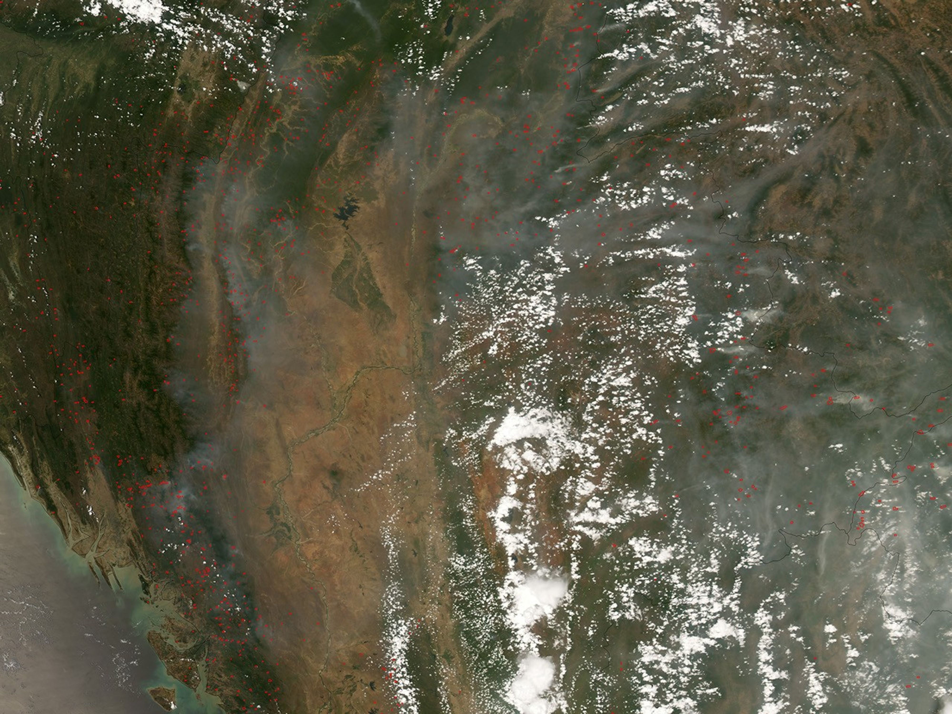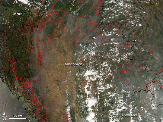
Widespread fires (marked in red) burned across eastern India and northern Myanmar on April 21, 2008, when the Moderate Resolution Imaging Spectroradiometer (MODIS) on NASA’s Aqua satellite passed over the region and captured this image. Smoke concentrated over the hilly terrain, particularly in western Myanmar, China, Laos, and Thailand. The dry season in the area typically lasts from mid-February to mid-May, and people often use the dry period to set agricultural fires. Although many of the fires pictured in the image could be intentional, it is not uncommon for planned fires to get out of control and spread into natural areas.
References & Resources
NASA image created by Jesse Allen, using data provided courtesy of the MODIS Rapid Response team. Caption by Rebecca Lindsey.