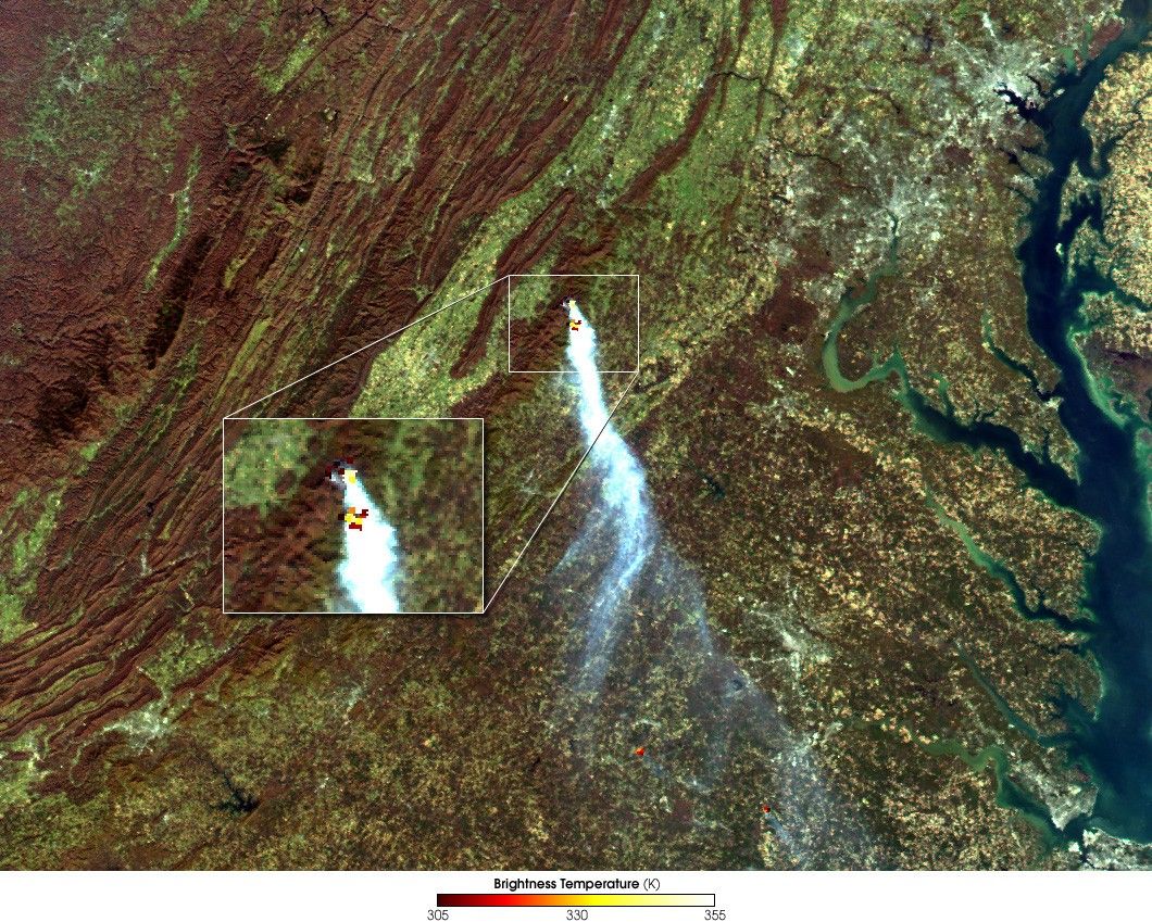
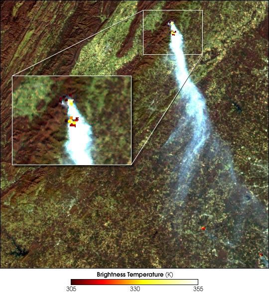
A large smoke plume has been streaming eastward from Virginia’sShenandoah National Park near Old Rag Mountain. Based on satelliteimages, it appears the blaze started sometime between October 30 and 31.This true-color image of the fire was obtained on November 1, 2000 by theModerate-resolution Imaging Spectroradiometer (MODIS), flying aboardNASA’s Terra spacecraft.Thermal Infrared data, overlaid on the color image,reveals the presence of two active fires underneath the smoke plume. The northernfire (upper) is burning near the Pinnacles Picnic Area along Skyline Drive. The southernfire (lower) is on Old Rag Mountain. Old Rag is one of the most popular hikesin the Washington, DC area, and features extremely rugged terrain, withgranite cliffs up to 90 feet high.
This scene was produced using MODIS direct broadcast data received andprocessed at the Space Science and Engineering Center,University of Wisconsin-Madison. The smoke plumeappears blue-grey while the red and yellow pixels show the locations ofthe smoldering and flaming portions of the fire, respectively.
References & Resources
Image by Liam Gumley, Cooperative Institute for Meteorological Satellite Studies, and Robert Simmon, NASA GSFC