


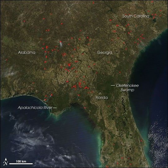
Dozens of fires were burning in the Southeast on March 15, 2006, when the Moderate Resolution Imaging Spectroradiometer (MODIS) on NASA’s Aqua satellite passed over the region. Places where the sensor detected actively burning fires are marked in red. According to reports from the National Interagency Fire Center from March 16, numerous types of fires were burning in the Southeast, including prescribed fires (planned fires that land managers use to manage natural resources), lightning-caused fires, and human-caused fires. The high-resolution image provided above has a spatial resolution of 500 meters per pixel. The MODIS Rapid Response System provides this image at additional resolutions.
References & Resources
NASA image courtesy the MODIS Rapid Response Team, Goddard Space Flight Center


