![Request for Information – Potential [Placeholder for Prize]](https://assets.science.nasa.gov/dynamicimage/assets/science/psd/solar/2023/09/s/solarsystem_0.jpg?w=1024)


April 25, 2017
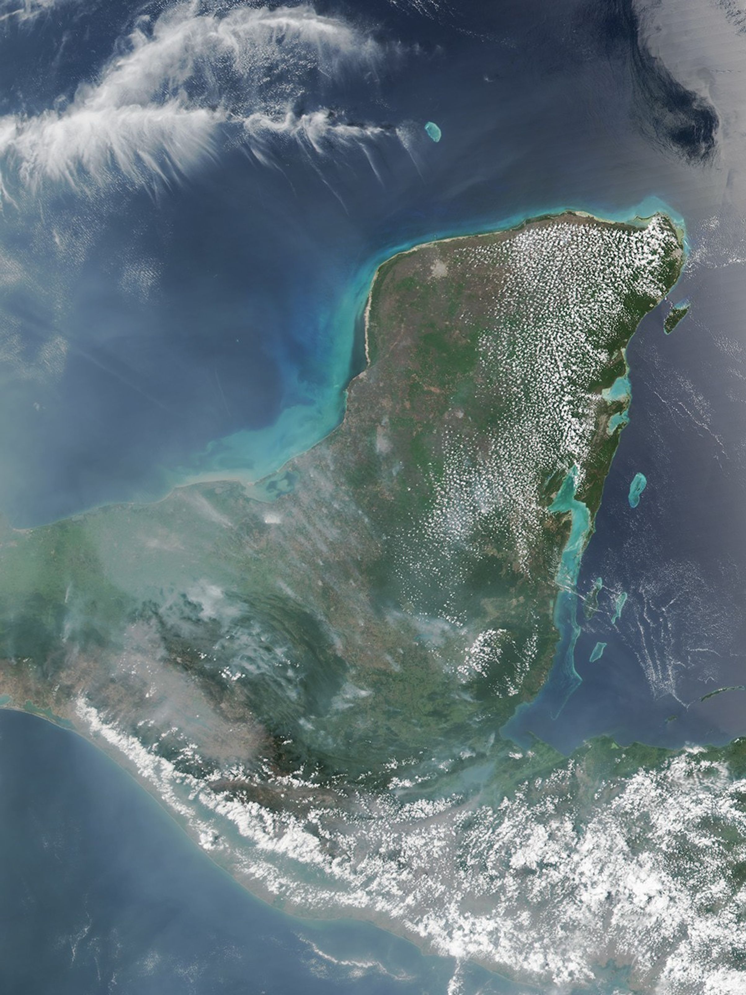
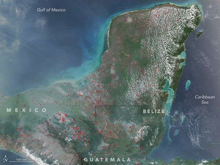
On April 25, 2017, the Visible Infrared Imaging Radiometer Suite (VIIRS) on the Suomi NPP satellite acquired this natural-color image of widespread fire activity across the Yucatán Peninsula. Each red hot spot is an area where the thermal bands on the instrument detected temperatures higher than normal. For a false-color image of these fires, visit NOAA’s Environmental Visualization Laboratory.
Further Reading
- Mongabay (2017, April 17) Guatemala declares state of emergency as rainforest goes up in flames. Accessed May 1, 2017.
- NASA (2017, May 1) Fires in Yucatan. Accessed May 1, 2017.
References & Resources
NASA image by Jeff Schmaltz, LANCE/EOSDIS Rapid Response. Caption by Adam Voiland.